RC15B - Puente Yamomachay
Site Code: RC15B. GPS: S12°075708, W75°771023. Elevation: 4025m asl.
Water Quality Data
The following river and water quality data was collected from this site:
| RC15B | July 2022 |
|---|---|
| Season: | Austral Winter |
| Date: | 3.7.22 |
| Time: | 11.30 |
| Width (m) | 5.10 |
| Depth (Av.) (m) | 0.376 |
| CSA (Av.) (m²) | 1.916 |
| Velocity (Av.) (m/s) | 0.24 |
| Discharge (Av.) (m³/s) | 0.46 |
| Riverbed sediment | Mainly Pebbles |
| Temp. (Atmospheric) (°C) | 6.6 |
| Temp. (Water) (°C) | 11.53 |
| Atmospheric pressure (mbar) | <600 |
| Dissolved oxygen (mg/l) | 1.99 |
| Dissolved oxygen (%) | 31.58 |
| pH | 7.58 |
| Conductivity (µS/cm) | 448 |
| Total Dissolved Solids (ppm) | 224 |
| ORP (mV) | 146.75 |
| Turbidity | Clear: |
| Alkalinity (mg/l CaCO₃) | 159 (1.6N) |
| Alkalinity Field Tester (ppm CaCO₃) | 142 |
Data Analysis
Discharge at this point along the Rio Cañete is very variable due to the specific geology close to this site. In the dry season all the water in the main river channel infiltrates underground several kilometres upstream of the site and there is no flow for several weeks in the main river channel above the site. At the site the subterranean flow reemerges from underground at several adjacent points and the river in the main channel reforms just below the site.
At just over 4,000m asl the DO readings at RC15B are low but as expected.
The average pH reading of almost 8.0 is as expected for a clean river and appropriate for most forms of aquatic life.
Site Descriptions
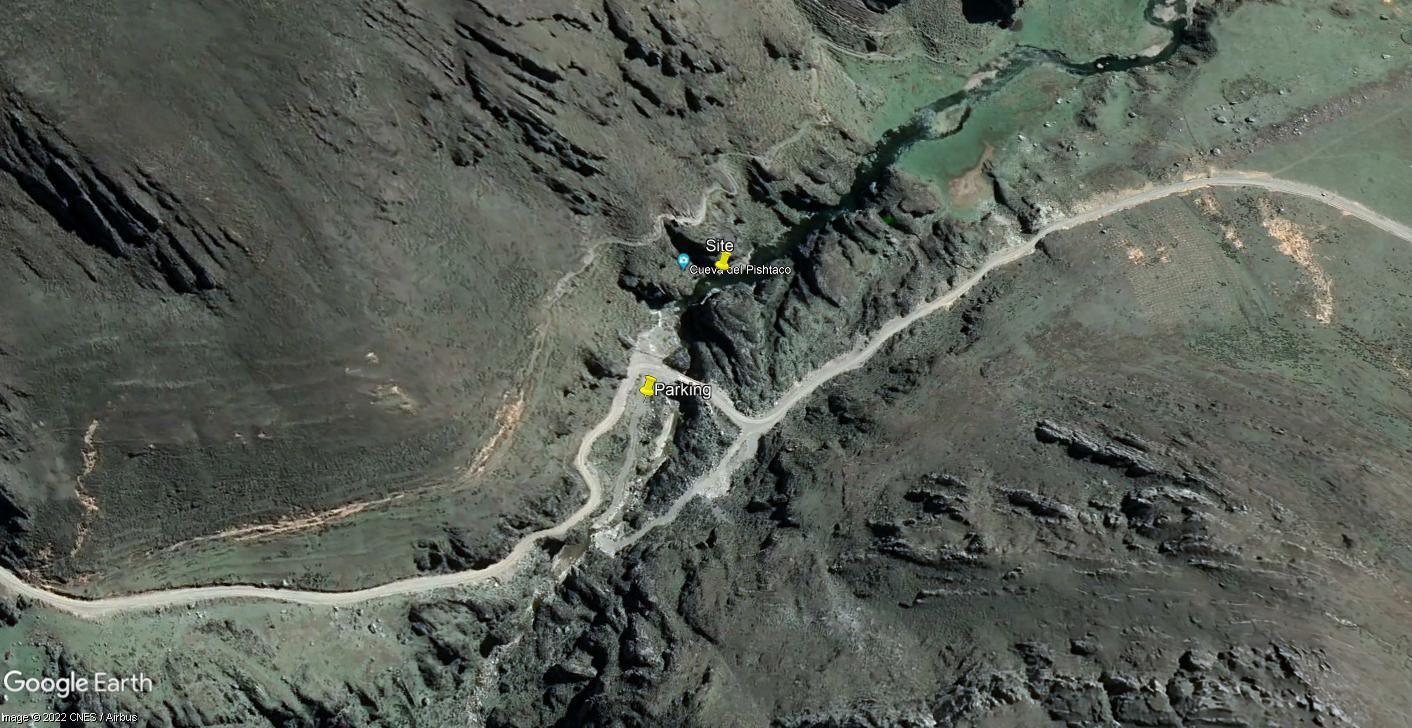
Site RC15B lies at 4025m asl below a series of caves and is accessed though them. At this point the valley consists of a narrow steep sided gorge for about one kilometre.
The bed load in the river channel is comprised of gravels, pebbles and smaller boulders.
The river flow in the Rio Cañete at this point is reduced year round by significant infiltration resulting in a high percentage of the discharge passing underground (subterranean flow). This fluctuates significantly between the seasons with no flow in the main channel during the dry season due to the extent of the infiltration higher up the valley.
As the population density above Puente Vilca is very low, the impact of anthropic activity is minimal. There is no agricultural activity in the valley or valley sides - extensive pastoralism dominates throughout the headwater areas.
At these elevations the fauna and flora are now more typical of the high Andes. Andean Goose, Yellow-billed Teal, Yellow-billed Pintail, Puna Teal, Andean Coot, Spot-winged Pigeon, Black-winged Ground Dove and Mountain Caracara are now commonly observed.
 Site RC15B - Study site location: subterranean outflow from below the cave of the Pishtaco. (John Forrest)
Site RC15B - the study site: subterrenean outflow pool. (June 2022) (John Forrest)
Site RC15B - the study site and view of the main river channel in the background. (June 2022) (John Forrest)
