RC05 - Tambo
Site Code: RC05. GPS: S12°80400, W75°896007. Elevation: 1135m asl.
Water Quality Data
The following river and water quality data was collected from this site:
| RC05 | July 2019 | November 2019 | November 2021 | June 2022 | October 2022* |
|---|---|---|---|---|---|
| Season: | Austral Winter | Austral Summer | Austral Summer | Austral Winter | |
| Date: | 10.07.19 | 18.11.19 | 10.11.21 | 26.6.22 | 21.10.22 |
| Time: | 13.20 | 16.00 | 15.00 | 11.30 | 18.15 |
| Width (m) | 38.0 | 18.0 | 11.0 | 13.4 | 16.0 |
| Depth (Av.) (m) | 0.23 | 0.62 | 0.82 | 0.2 | |
| CSA (Av.) (m²) | 4.21 | 6.30 | 10.99 | 3.20 | |
| Velocity (Av.) (m/s) | 0.68 | 0.27 | 0.81 | 0.75 | |
| Discharge (Av.) (m³/s) | 7.50 | 2.87 | 1.67 | 8.79 | 2.40 |
| Riverbed sediment | Cobbles & boulders | Cobbles & boulders | Mainly boulders | Mainly boulders | Pebbles & Cobbles |
| Temp. (Atmospheric) (°C) | 28 | 29 | 25 | 22 | 20 |
| Temp. (Water) (°C) | 20.58 | 23.39 | 23.80 | 19.33 | 20.19 |
| Atmospheric pressure (mbar) | 885 | 852 | 869 | 850 | |
| Dissolved oxygen (mg/l) | 6.42 | 5.47 | 6.60 | 8.82 | 4.48 |
| Dissolved oxygen (%) | 81.6 | 76.7 | 87.9 | 111.0 | 58.9 |
| pH | 8.75 | 8.39 | 8.71 | 7.89 | |
| Conductivity (µS/cm) | 352 | 418 | 538 | 430 | 476 |
| Total Dissolved Solids (ppm) | 176 | 209 | 263 | 215 | 238 |
| ORP (mV) | 356.7 | 137.7 | 73.7 | 152.0 | 105.7 |
| Turbidity | Clear: | Clear: | Clear: | Clear: slightly greenish/blueish | Clear: |
| Alkalinity (mg/l CaCO₃) | 135 (1.6N) | - | 113 (1.6N) | 135 (1.6N) | 135 (1.6N) |
| Alkalinity Tester (ppm CaCO₃) | - | - | 107 | 125 | 86 |
*Data recorded just upriver from RC05, above confluence with rio Tupe.
Data Analysis
Discharge at this site is significantly impacted by the El Platanal HEP water abstraction and limited seasonal abstraction for agricultural irrigation in the valley above Catahuasi. The El Platanal HEP abstracts water below site RC06 at the Capillucas reservoir and dam, and the water only re-enters the main channel below site RC03. Input from the only significant tributary below the dam - the rio Tupe - is low but water abstracted for irrigation is high as the Catahuasi district is the last major agricultural district in the main valley producing fruit and vegetables.
At just over 1100m asl the DO readings at RC05 are as expected for both July and November data sets. The raised elevation and great fluctuations in daily temperature in such narrow and sheltered valleys will produce fluctuations in maximum absolute oxygen capacity and, in consequence, percentage saturation that therefore fluctuates with that rhythm. At DO levels ranging from 4.5-8.8 mg/l and 77-111% oxygen saturation aquatic vertebrates survive and invertebrates will thrive.
The conductivity readings at this site 352-538 µS/cm are as expected at this altitude.
pH readings averaging around 8.5 are as expected. At these levels the alkalinity of the river is suitable for aquatic life and not approaching the tolerances of most aquatic vertebrates and invertebrates.
Site Description
Site RC05 is located just below the town of Catahuasi in the arid upper tropics. The Rio Cañete, at this point is downriver of the last major intensively farmed lands in the main valley above Catahuasi. The use of pesticides and fertilizers is probably only higher in the various sub-catchments in the temperate zone, including Yauyos, Huantan, Laraos, Alis etc. The valley still has a narrow steeply v-shaped profile with a high river cliff on the south bank, indicating previous periods of flooding. As elsewhere in the drainage basin discharge is highly seasonal with measurements in February-March considerably greater than at other times in the year. The channel itself is choked with large boulders and rocks from landslides and previous flooding events.
The banks are lined with scattered willow and some acacia scrub. The cultivation of crops is exclusively for subsistence farming in the marginal small groups forced onto the poorer soils. The production of maize, bananas dominate with smaller areas of avocado production. As with elsewhere in the catchment, there is little or no natural vegetation remaining. The fauna and flora in the valley are depauperate with relictual west flanks endemics. The impact of water quality on the health of the environment and populations of wildlife occupying these lands is the subject of some aspects of our study here.
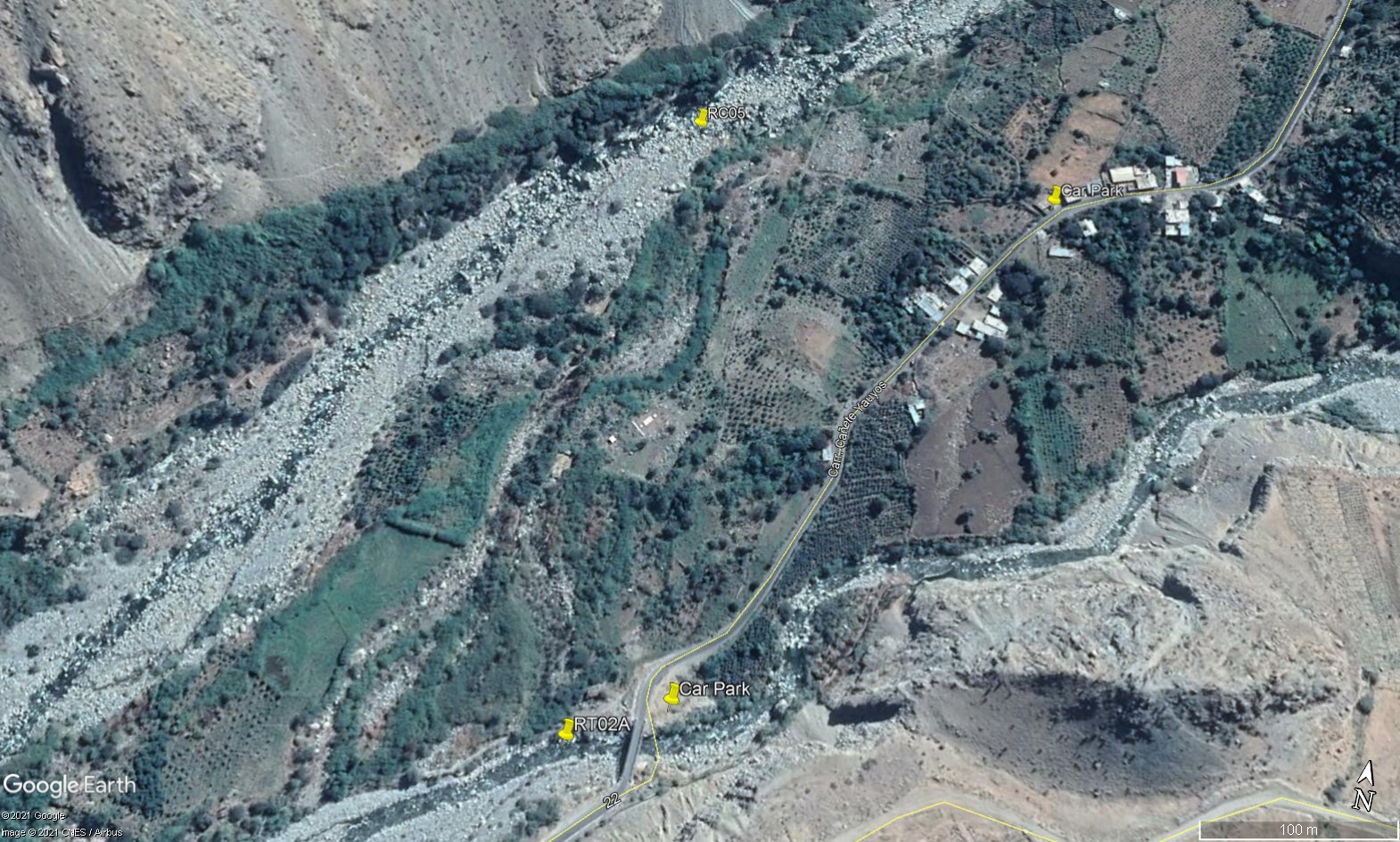 Site RC05 - Study site location: due west of the small settlement of Tambo.
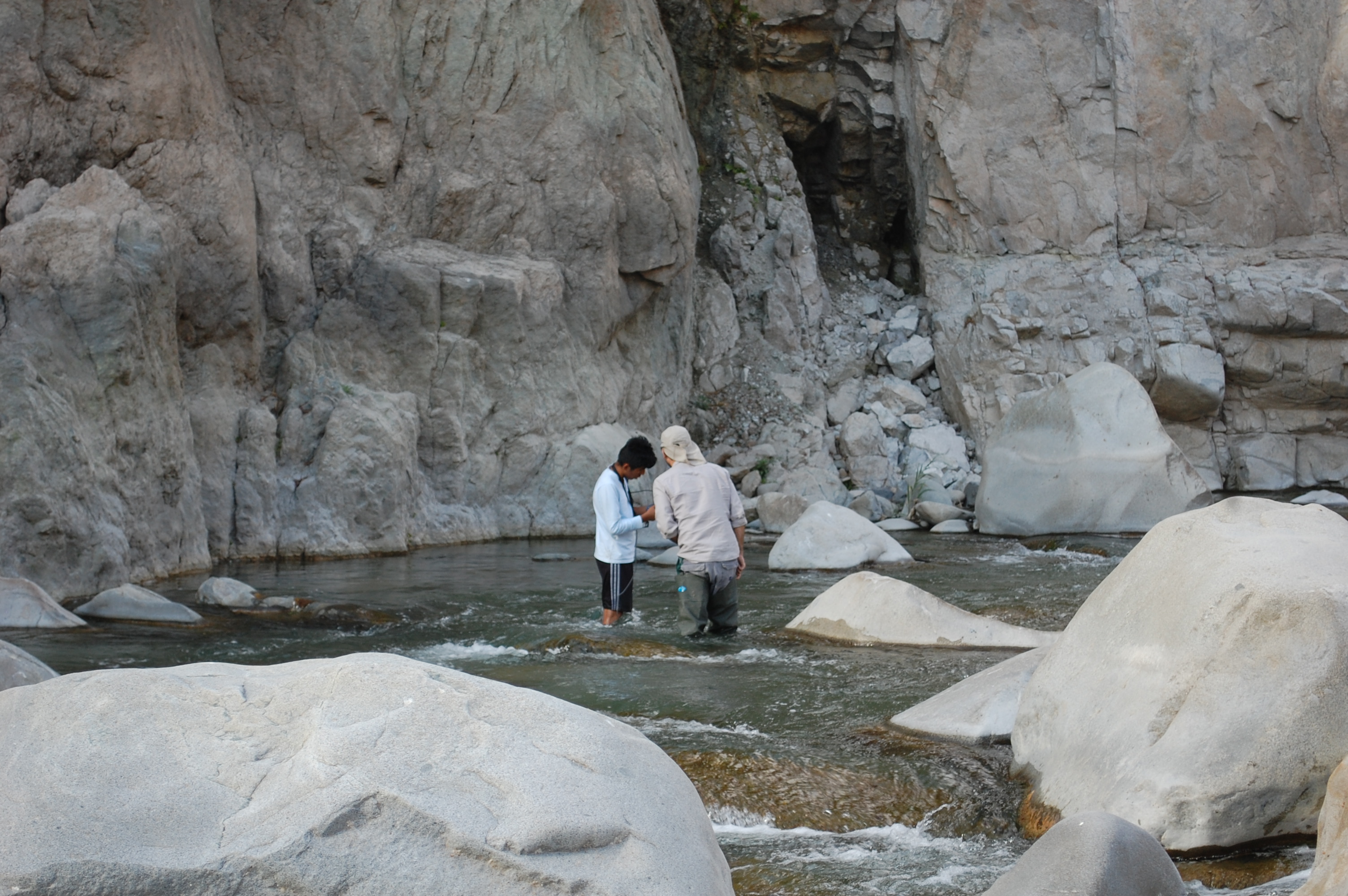 Site RC05 - the study site. (November 2019) (John Forrest)
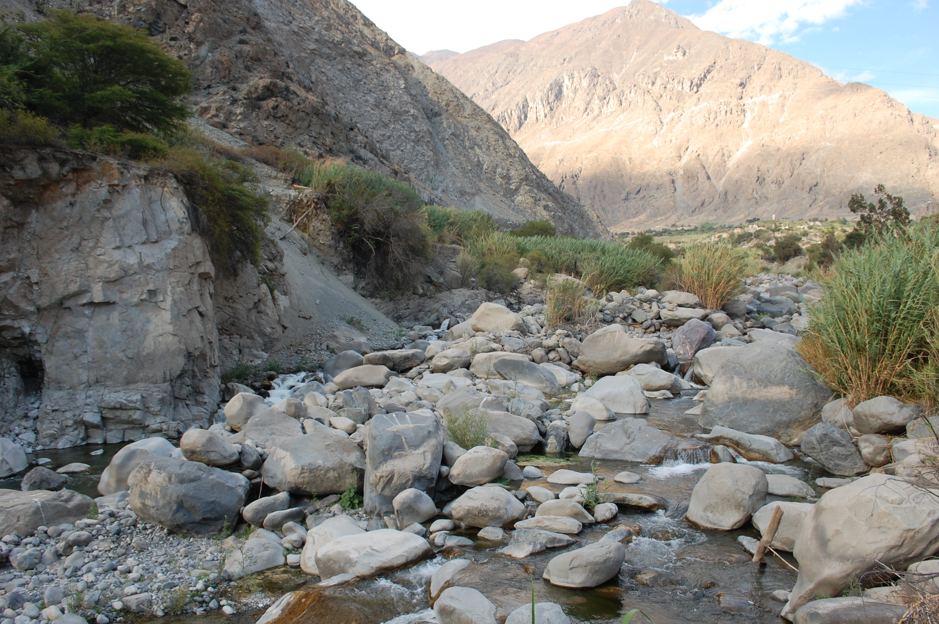 Site RC05 - View upstream. (November 2019) (John Forrest)
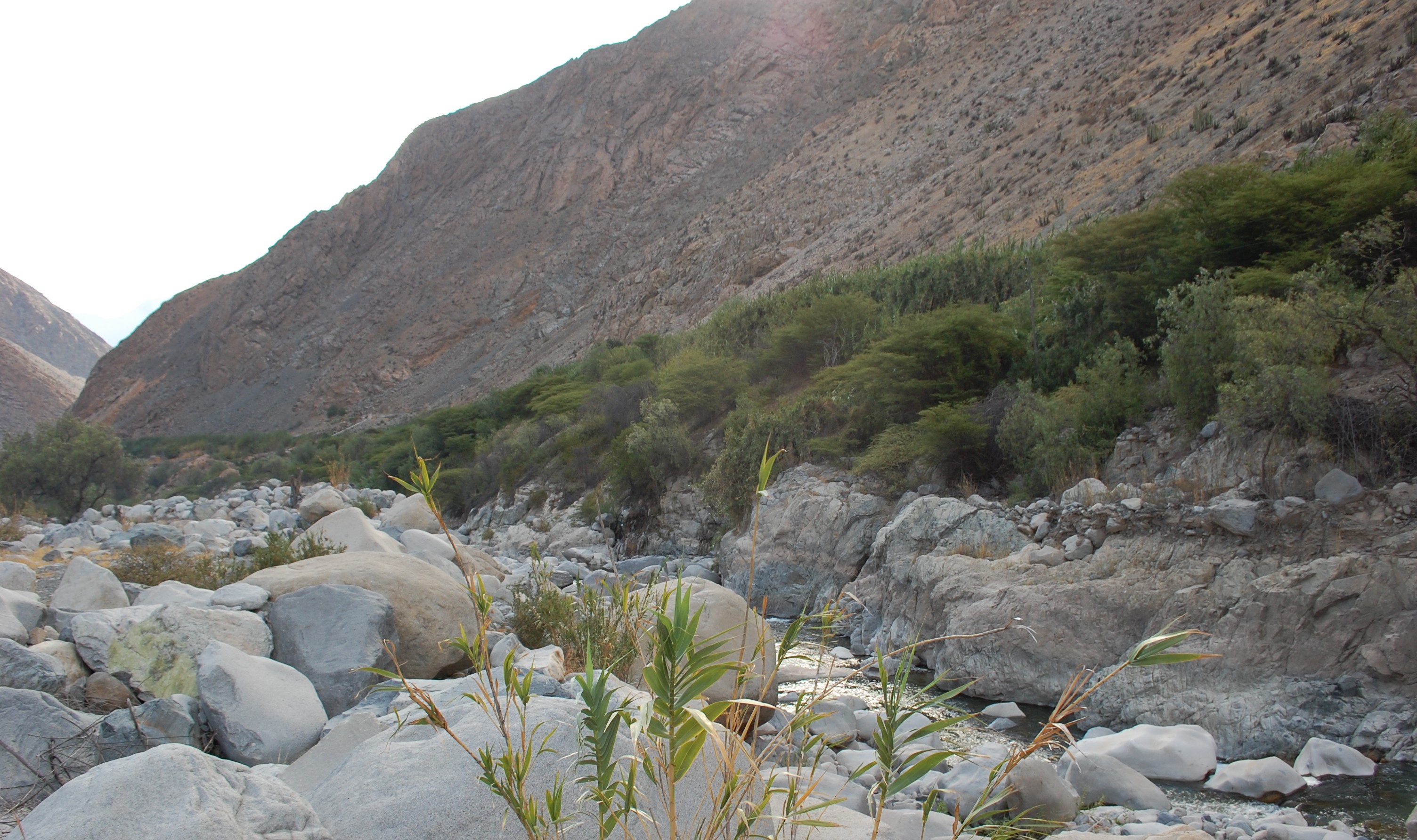 Site RC05 - View downstream. (November 2019) (John Forrest)