RT10A - Lower Miraflores
Site Code: RT10A. GPS: S12°27948, W75°816499. Elevation: 3262m asl.
Water Quality Data
The following river and water quality data was collected from this site:
| T10a | November 2019 | November 2021 | June 2022 |
|---|---|---|---|
| Season: | Austral Summer | Austral Summer | Austral Winter |
| Date: | 21.11.2019 | 17.11.2021 | 1.7.22 |
| Time: | 13.00 | 9.30 | 12.00 |
| Width (m) | 8.0 | 5.5 | 8.6 |
| Depth (Av.) (m) | 0.48 | 0.36 | 0.20 |
| CSA (Av.) (m²) | 3.80 | 1.96 | 1.74 |
| Velocity (Av.) (m/s) | 0.16 | 0.46 | 0.41 |
| Discharge (Av.) (m³/s) | 0.600 | 0.894 | 0.712 |
| Riverbed sediment | Cobbles & Boulders | Mainly Boulders | Mainly pebbles & cobbles |
| Temp. (Atmospheric) (°C) | 26 | 14 | 22 |
| Temp. (Water) (°C) | 13.4 | 12.36 | 11.95 |
| Atmospheric pressure (mbar) | 689 | <600 | |
| Dissolved oxygen (mg/l) | 3.97 | 6.07 | 6.35 |
| Dissolved oxygen (%) | 65.4 | 82.90 | 99.63 |
| pH | 8.89 | 8.52 | 8.44 |
| Conductivity (µS/cm) | 230 | 398 | 345 |
| Total Dissolved Solids (ppm) | 115 | 199 | 172 |
| ORP (mV) | 144.3 | 116.8 | 84.08 |
| Turbidity | Clear: | Clear: | Clear: |
| Alkalinity (mg/l CaCO₃) | - | 83 | 97 (1.6N) |
| Alkalinity Field Tester (ppm CaCO₃) | - | - | 83 |
Data Analysis
Discharge in the Rio Miraflores is year-round. It appears to be fairly constant but low as this is one of the smaller sub-catchments in the drainage basin. However, the sub-catchment drains the three highest peaks with permanent snow cover in the area, including both Llongote and Ticlla so, at times, the discharge may increase.
At just above 3300m asl the DO readings at RT10A are within the expected range.
Conductivity and total solids measurements are lower, reflecting the scale of the sub-catchment and reduced input from weathering processes, consequently, water quality is good.
Average pH values are above 8.5 but suited to the aquatic life species likely to be found at this altitude.
Site Description
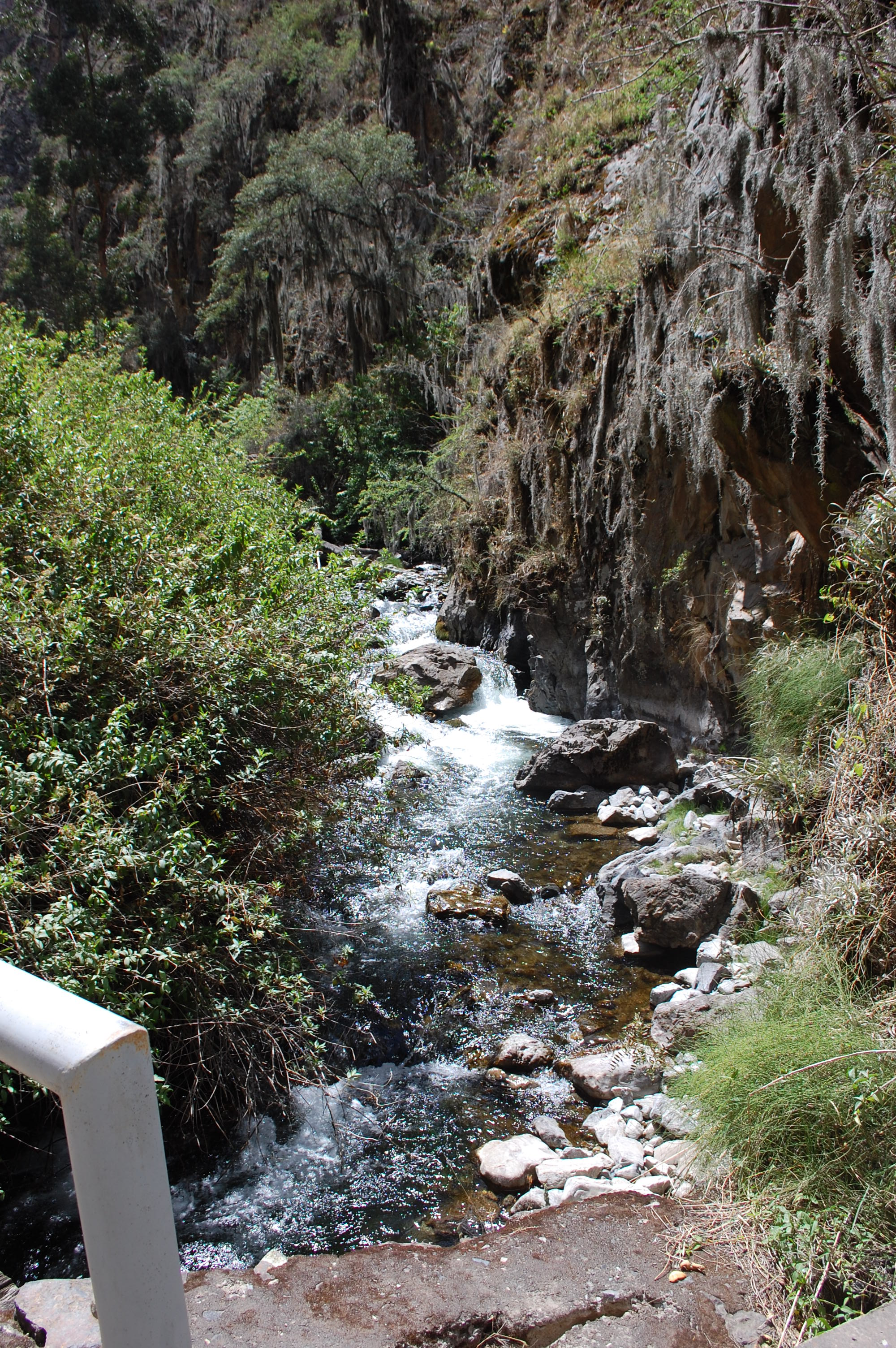
Sites RT10A lies in the arid temperate zone below the small village of Miraflores at 3330m asl. At this point the valley has a sharply v-shaped profile and is more of a canyon in places with steep sides.
There is significant agricultural cultivation on the lower slopes higher up the valley, while pastoralism dominates land use on the upper slopes. The valley lies within the Reserva Paisajistica Nor Yauyos-Cochas and the more inaccessible valley sides also have areas of pacific relictual woodlands. There is a large trout farm upstream of the site and there is evidence that rubbish has been tipped in to the river from the bridge adjacent to the site both of which might affect some results.
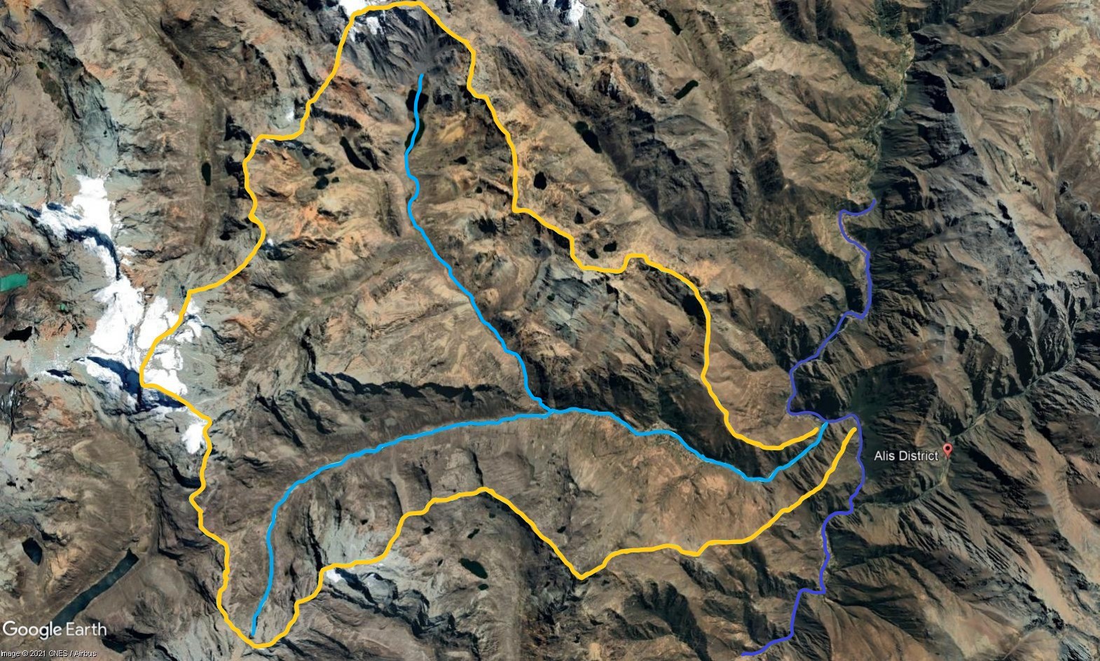 Tributary 10 - the Miraflores subcatchment. (Eustace Barnes)
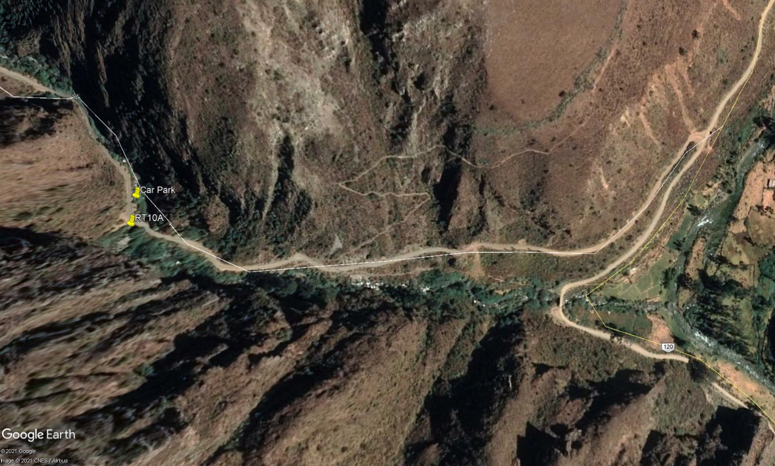 Site RT10A - the study site location just below Puente Chunque. (John Forrest)
 Site RT10A - the study site. (November 2019) (John Forrest)
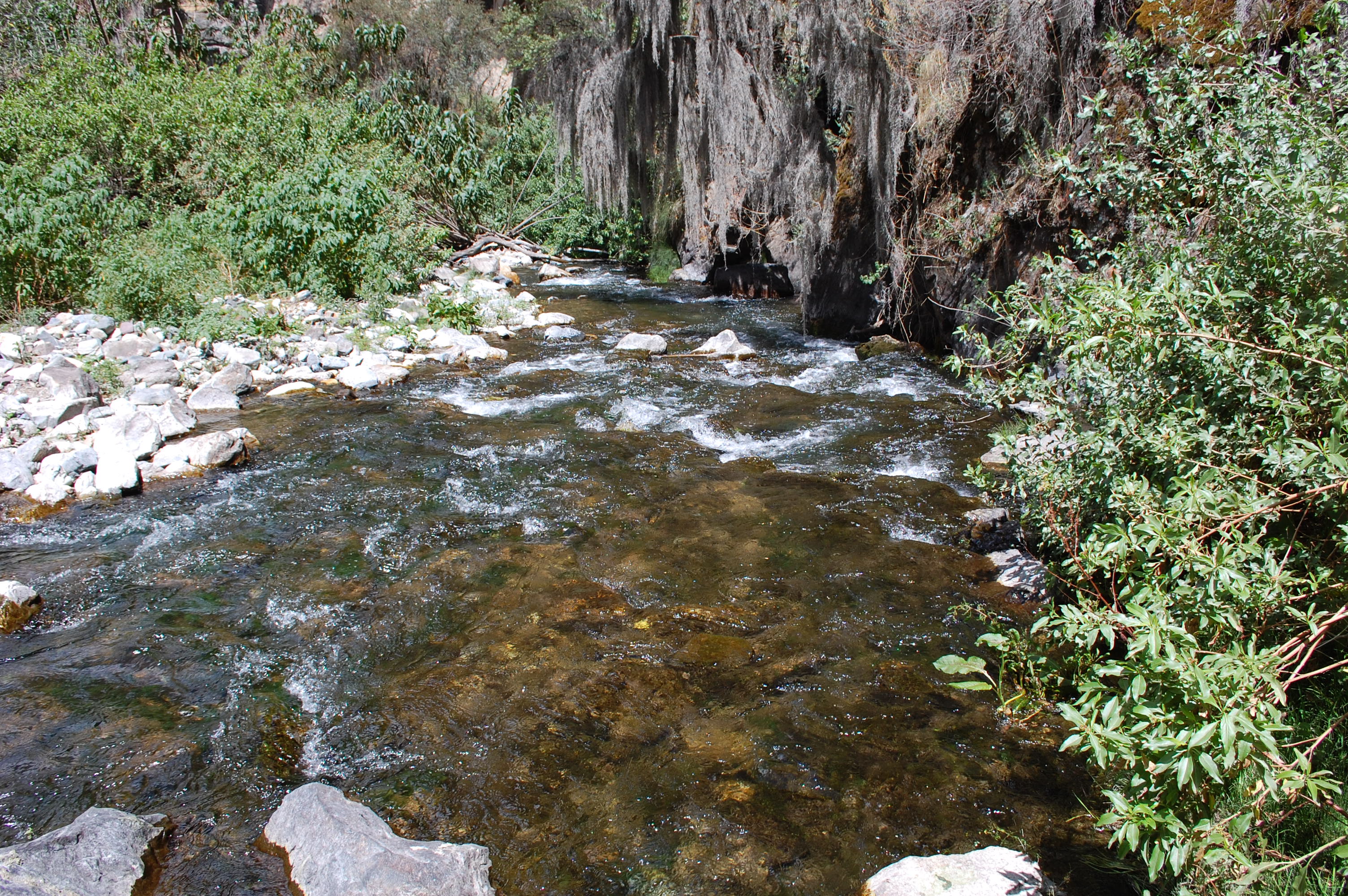 Site RT10A - View downstream from the study site. (November 2019) (John Forrest)
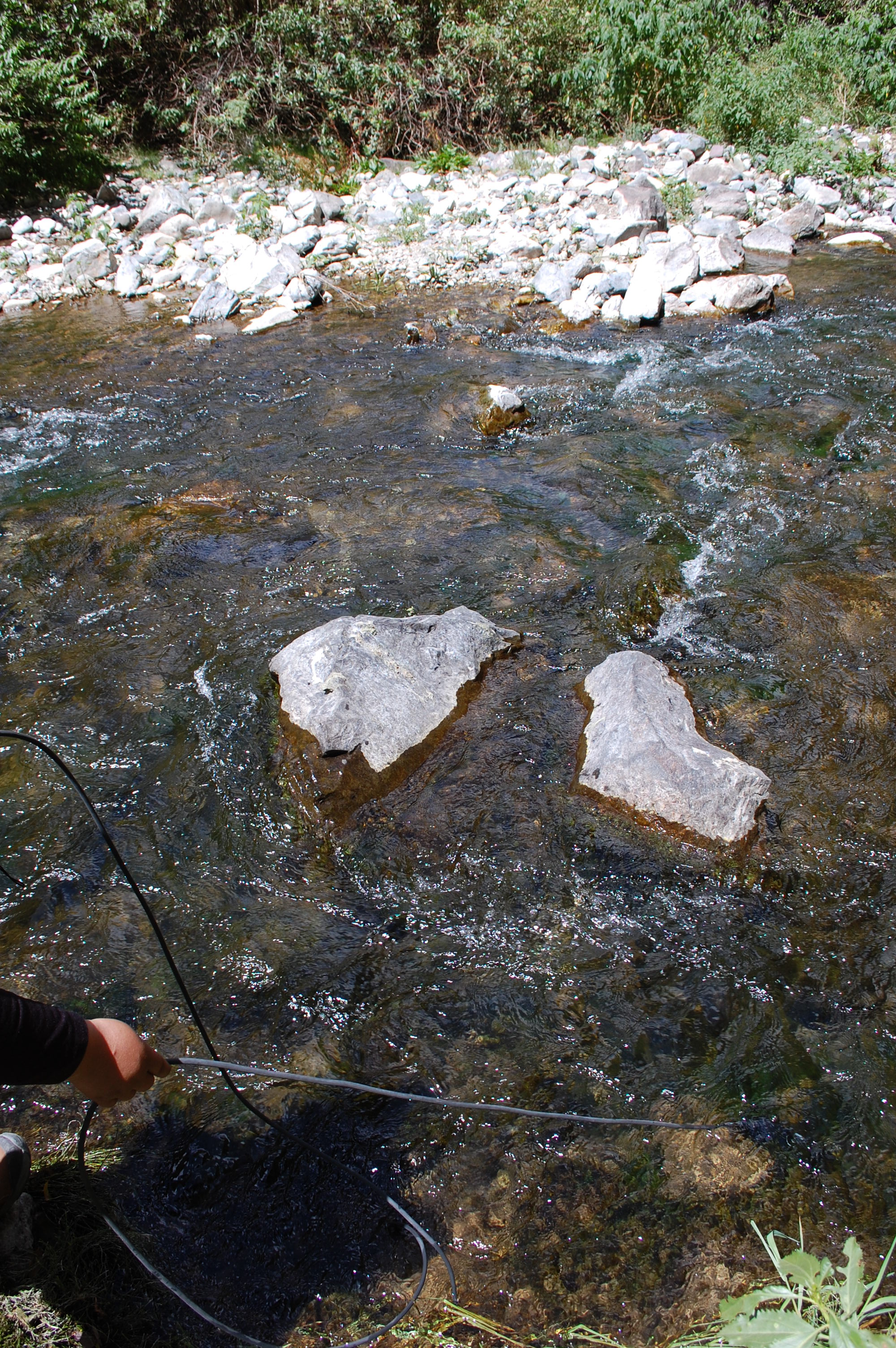
 Site RT10A - View upstream from the study site. (November 2019) (John Forrest)