RC00 - Rio Cañete Estuary
This site has been sampled at three points: RC00, RC00A and RC00B. These sites are very different in character. Sample point RC00 was only used when catching shrimp but the channel is also heavily braided as per the other two sites. Sample point RC00A, indicated by a blue point on the above image principally flows from the village of Herbay Bajo and associated lands. The sample point RC00B, indicated by a red point on the above image better represents the cumulative character of the water geochemistry for the catchment as a whole at its lowest point.
It should be noted that the geochemical character of channel water is increasingly determined by local natural and anthropogenic factors as one descends to the estuary, notwithstanding the constant input of ground waters. That is, since a high proportion of water is abstracted in the upper and mid-catchment for irrigation thereby reducing the impact of those sections of the drainage basin. Thus, it is conditions within each discreet area that are more important for the analysis of water geo-chemistry. As such, even in the lower catchment from RC00 to RC03 it seems to be the case that local geological character and local anthropic activities obtain a greater significance that they might were conditions in the mid and upper catchment less disturbed.
Site RC00. Rio Cañete estuary – Puente Clarita (North side)
Site code: RC00. GPS: S13.12475, W76.36035 Elevation: 50m asl.
Site RC00A. Rio Cañete estuary – Herbay Bajo (South side)
Site Code: RC00A. GPS: S13°12835, W76°398371. Elevation: 7m asl.
Site RC00B. Rio Cañete estuary – Herbay Bajo (North side)
Site Code: RC00B. GPS: S13°12578, W76°39892. Elevation: 8m asl.
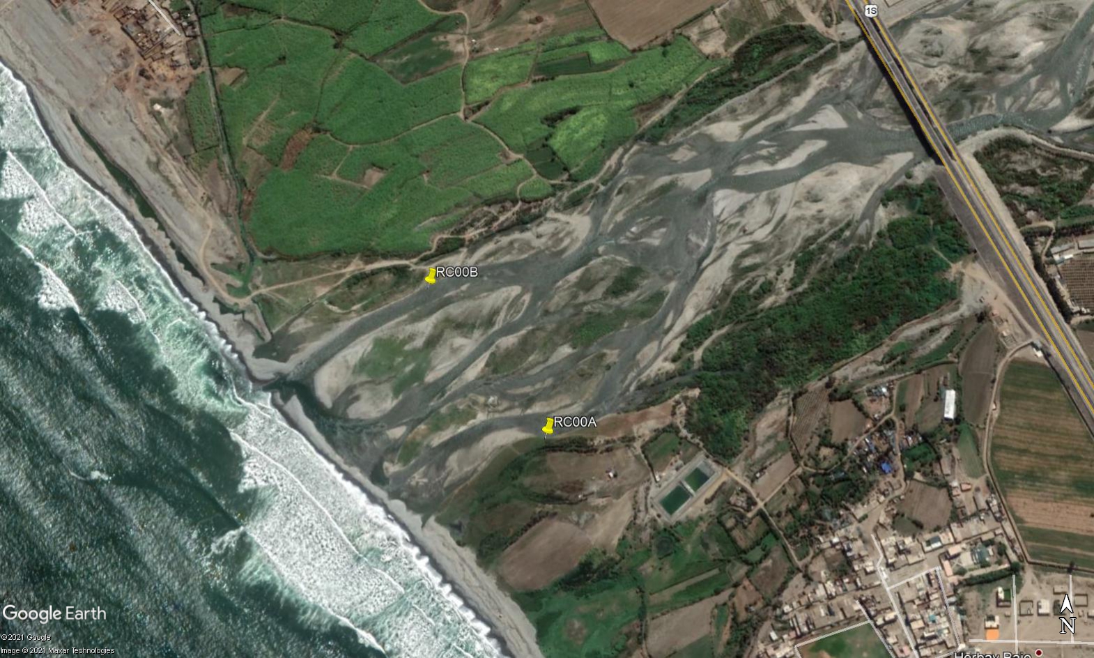 Site RC00 - Study site location: RC00B (new) on the north bank & RC00A (old) on the south bank. (John Forrest)
Water Quality Data
The following river and water quality data was collected from these sites:
| RC00 | July 2019 (RC00A) | November 2019 (RC00B) | November 2021 (RC00B) | June 2022 (RC00B) | October 2022 (RC00)+ |
|---|---|---|---|---|---|
| Season: | Austral Winter | Austral Summer | Austral Summer | Austral Winter | |
| Date: | 9.07.19 | 17.11.19 | 8.11.21 | 25.6.22 | 20.10.22 |
| Time: | 9.00 | 11.00 | 7.30 | 10.30 | 19.00 |
| Width (m) | 6.0 | 22.0 | 20.0 | 12.4 | |
| Depth (Av.) (m) | 0.10 | 0.12 | 0.18 | 0.36 | |
| CSA (Av.) (m²) | 0.57 | 2.71 | 3.60 | 4.46 | |
| Velocity (Av.) (m/s) | 0.16 | 0.44 | 0.77 | 0.49 | |
| Discharge (Av.) (m³/s) | 0.09 | 1.18 | 2.77 | 2.18* | 4.00 est. |
| Riverbed sediment | Cobbles & Boulders | Cobbles & Boulders | Cobbles & Boulders | Cobbles & Boulders | Mainly cobbles |
| Temp. (Atmospheric) (°C) | 20 | 24.5 | 16 | 16.4 | 19 |
| Temp. (Water) (°C) | 19.2 | 22.2 | 20.0 | 18.5 | 22.2 |
| Atmospheric pressure (mbar) | 1015 | 1009 | 1015 | 1024 | 1019 |
| Dissolved oxygen (mg/l) | 4.64 | 8.56 | 8.47 | 11.58 | 5.69 |
| Dissolved oxygen (%) | 50.0 | 95.4 | 92.9 | 122.7 | 65.1 |
| pH | - | 8.67 | 7.94 | 8.49 | 7.87 |
| Conductivity (µS/cm) | 696 | 496 | 651 | 534 | 575 |
| Total Dissolved Solids (ppm) | 351 | 248 | 326 | 267 | 288 |
| ORP (mV) | 354.2 | 185.8 | 143.4 | 89.8 | 95.65 |
| Turbidity | - | - | - | Clear: grey/green | Clear: slightly greyish |
| Alkalinity (mg/l CaCO₃) | 262 (1.6N) | 170 (1.6N) | 132 (1.6N) | 176 (1.6N) | 111 (1.6N) |
| Alkalinity Tester (ppm CaCO₃) | - | - | - | 126 | 105 |
*Only one of two channels - the smaller channel - measured. +Measured at Puente Clarita.
Site RC00A. Rio Cañete estuary
Data Analysis
The discharge is very variable at RC00 both in terms of the quantity and the position of the main channel within the river bed. In July 2019, the discharge was extremely low (0.09 cumecs) reflecting the abstraction of almost all water from the river upstream for agricultural purposes. Discharge figures were hardly much greater in the other sample periods.
It is the case that the amount of dissolved oxygen expected at 100% saturation at sea level and at 20°C would be around 10 mg/L. However, at 4.64 mg/l the DO reading are on the low side. As water temperature was 19°C significant factors are reducing DO levels at this site. At 4.5mg/l dissolved oxygen and 50% oxygen saturation aquatic vertebrates survive and invertebrates thrive. High concentrations of nutrients (particularly phosphorus and nitrogen) fuel algae blooms, which initially boosts dissolved oxygen levels but then rapidly reduce DO. When the algae die, bacterial decomposition spikes, using up most or all of the dissolved oxygen available. This creates an anoxic, or oxygen-depleted, environment where few organisms survive. Such nutrient levels can occur naturally but are more often caused by pollution from fertilizer runoff or poorly treated wastewaters which could apply to this site below Herbay Bajo. At these recorded levels, denitrification takes place as bacteria use nitrates to decompose organic matter. These conditions are referred to as ‘dead zones’ and are often found near larger human populations in estuaries and coastal zones.
The conductivity reading at 696 µS/cm in July 2019 indicates some contamination from waste waters and agricultural runoff, and the figures in the other sample periods were also slightly elevated. Generally, agricultural runoff and sewage will increase conductivity due to the additional chloride, phosphate and nitrate ions. The Nitrate levels recorded at RC00 were 2.2mg/l NO3. Throughout the catchment nitrate levels ranged from ‘under range’ to 6.79mg/l NO3 perhaps emphasizing the limited significance of both irrigated agriculture and sewage outfall from urban areas on the rio Cañete.
pH levels either side of 8.0 are as expected.
Site description
Site RC00 is located almost at sea level in the arid tropical zone. The rio Cañete at this point is lined with scrub and less intensively farmed areas as a consequence of the impact of both catastrophic flooding and marine ingression. In 2022 significant new activity was taking place to build up the artificial banks along both sides of the river downstream of Punete Clarita.
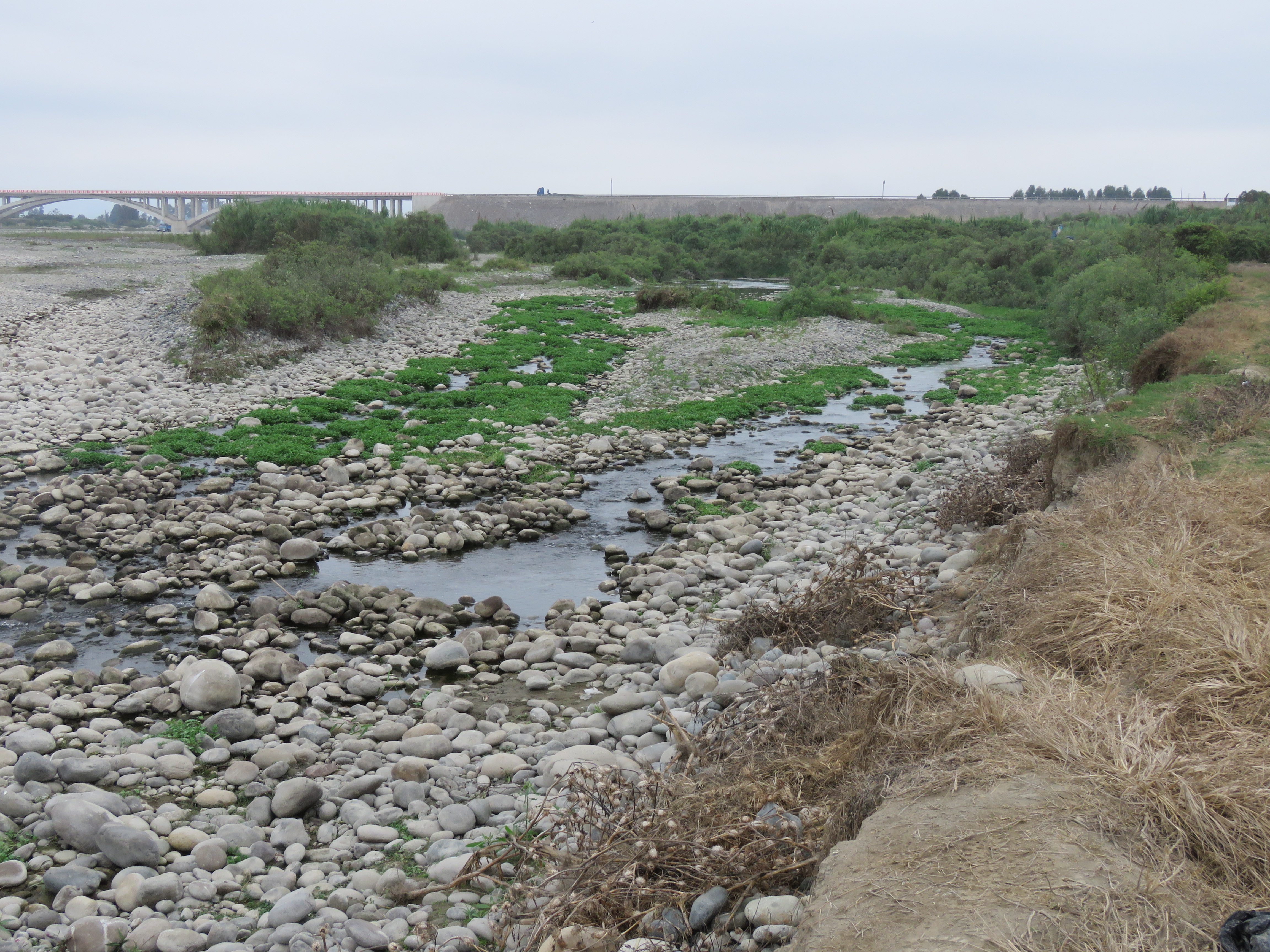
Site RC00 is located just upriver from the old Panamericana bridge over the river - Puente Clarita - on its north side. Site RC00A is located immediately below the village of Herbay Bajo, which is sited atop a river cliff on the south side of the channel. Site RC00B is located just upriver from the impoverished settlement of Boca del Rio. Within a few hundred meters the land on both sides is irrigated and agriculture is of an intensive, industrial nature.
The channel flow is highly variable from the dry season to the wet season, depending on water abstraction for agriculture and urban demand but some water flows in the channel all year round. In the wet season the river rises and may become very wide, fully occupying the width of the channel. In the dry season, the river level falls and the channel becomes highly braided with, probably, just one main channel, probably, on the south side. The bed load is made up largely of cobbles and smaller boulders, and is revealed for much of the year when the river level drops.
In 2022 a major project commenced to build up the banks along both sides of the channel in the lower valley, downstream of the new Panamerican highway bridge. This may impact upon the position of the river within the channel, in future.
The lowest sites, from RC00 towards RC02, are located within the alluvial fluvial plain – loose material that has been eroded upstream and transported downstream during major flood events over millenia. Consequently, all river bed sediments have their origins higher up the valley (See RC02, RC03 & RC10 Site descriptions).
The banks are lined with river cane and scattered areas of stunted willow. Cultivation a short distance upiver is intense and fully irrigated. The production of potatoes, maize, ajo (garlic), aji (peppers), avocado dominates land use. There are smaller areas of sugar cane, a crop which dominates land use further north in, for example, the lower Fortaleza valley. There is little or no natural vegetation remaining in the lower valley and much of what was open desert has been irrigated and no highly productive agricultural lands. The water quality in the river at lower elevations is impacted by agricultural run-off and sewage disposal. The wider environment and fauna in the valley are largely determined by agriculture with many species expanding their range and abundance to occupy newly created agricultural lands. Desert fauna and flora has decreased accordingly.
Site photos
| 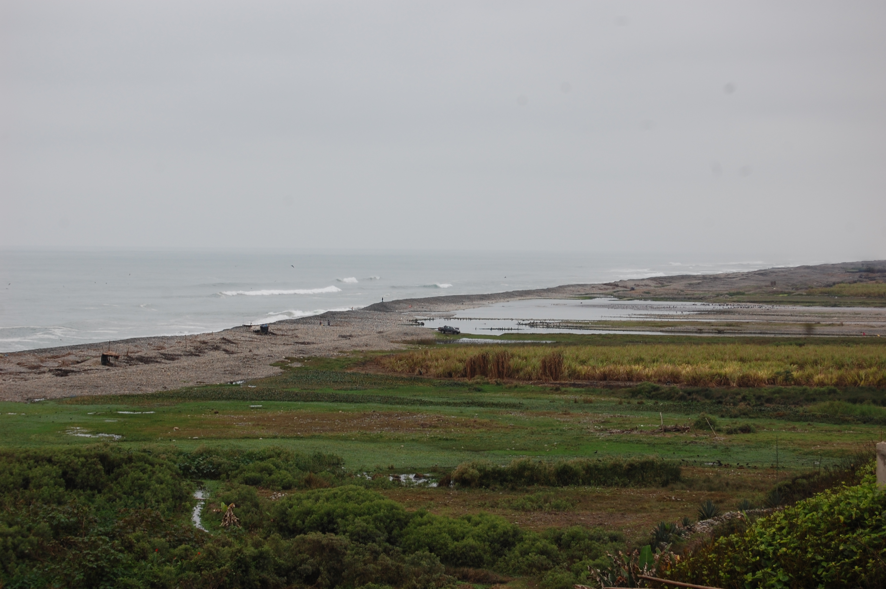 |
| Fig 1b. Site RC00A – looking across the Rio Canete estuary – showing barrier beach and lagoons behind. (Eustace Barnes). |
|
| Fig 1b. Site RC00A – looking across the Rio Canete estuary – showing barrier beach and lagoons behind. (Eustace Barnes). |
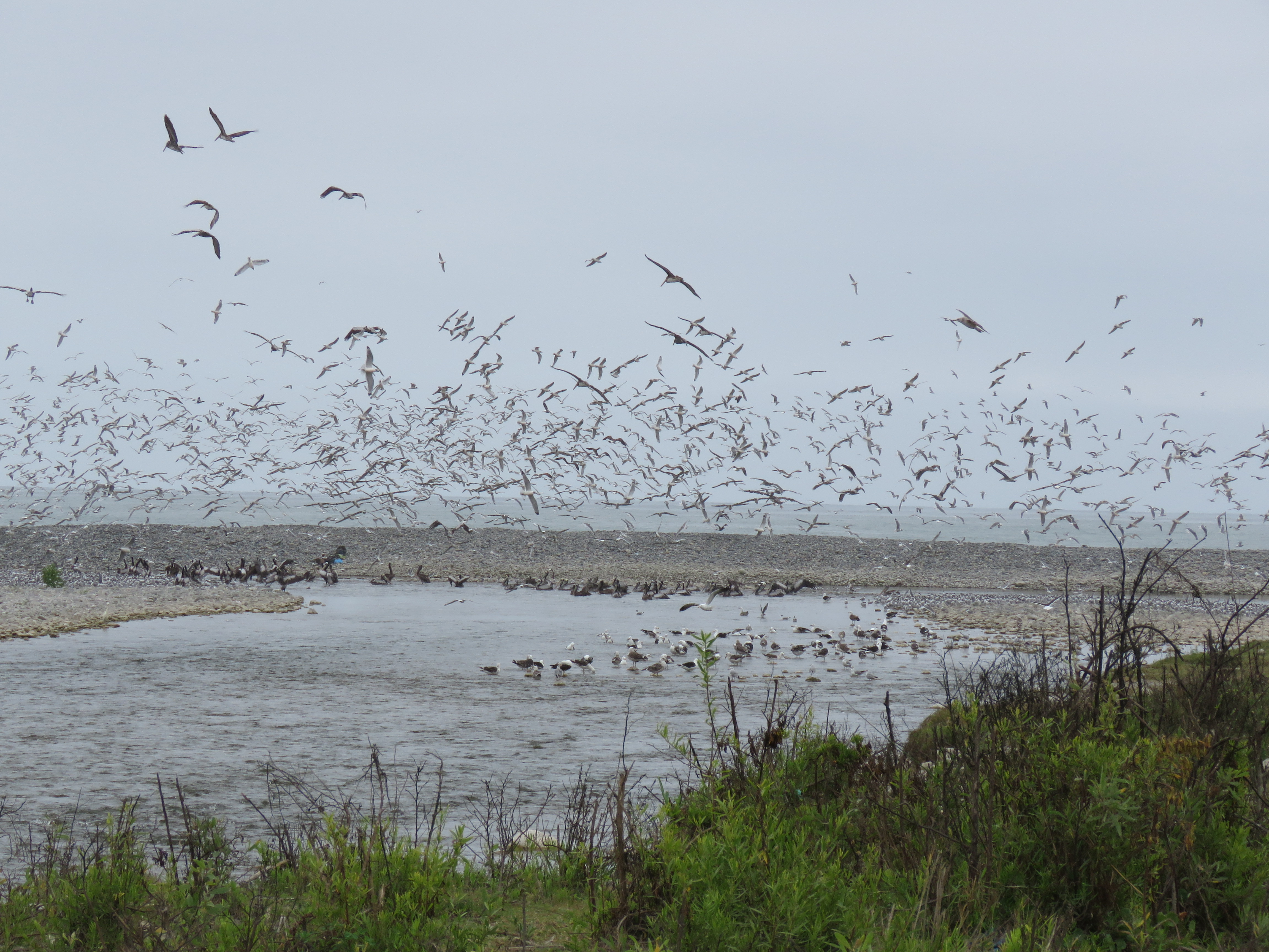
The Rio Cañete estuary is very important for the reproduction of Cryphiops caementarius, the Northern River shrimp. It is also an important site for breeding and migratory species of birds. As such the quality of water at this site requires careful monitoring. Many factors are instrumental in determining water quality in the estuary.
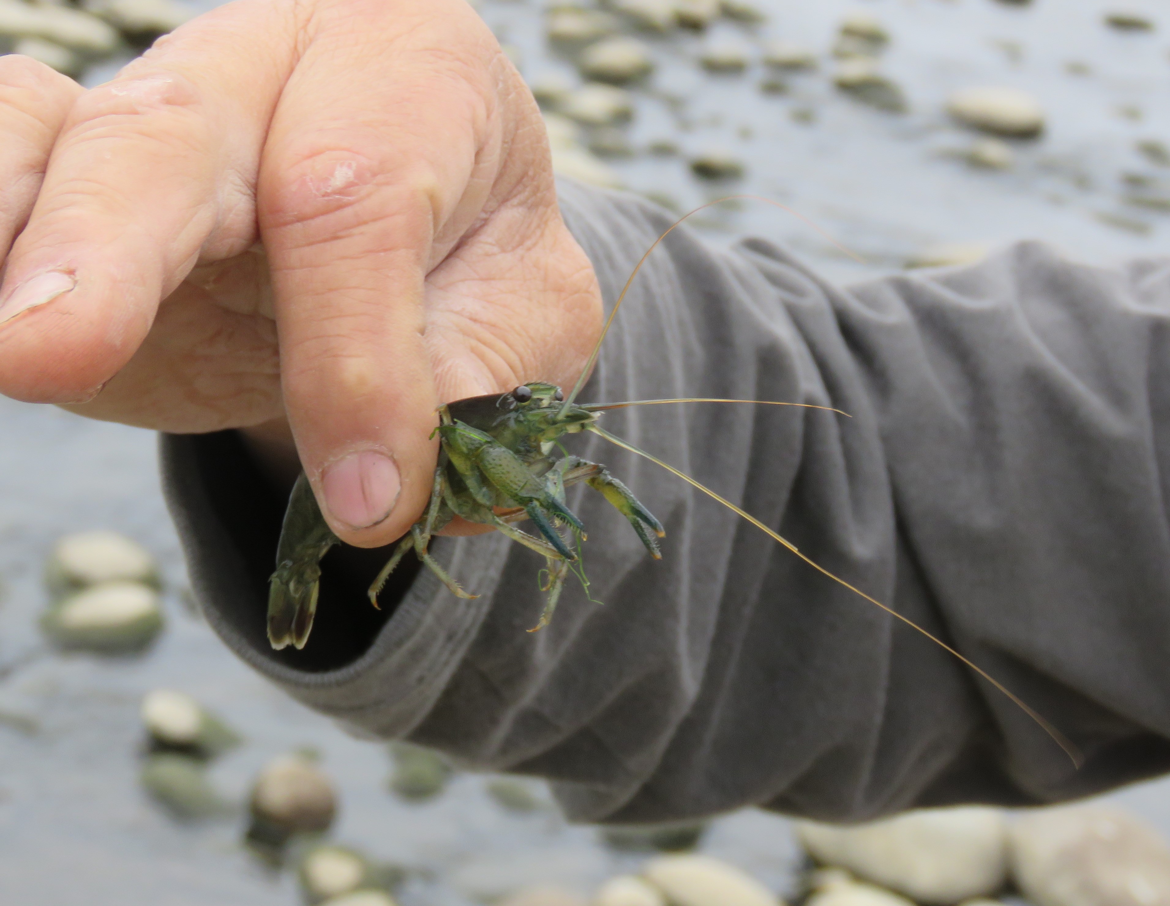
As part of our field work we have collected specimens of Northern River Shrimp, Cryphiops caementarius to assess the trophic transfer of trace metals. We aimed to collect 350gm of muscle flesh and a similar weight of carapace from however many individuals we needed to catch. Employing a local fisherman we arranged for him to catch the necessary number of River Shrimps at RC00b and two other sites in the lower catchment; Puente Socsi (RC02B) and Puente Catapalla (RC02C).
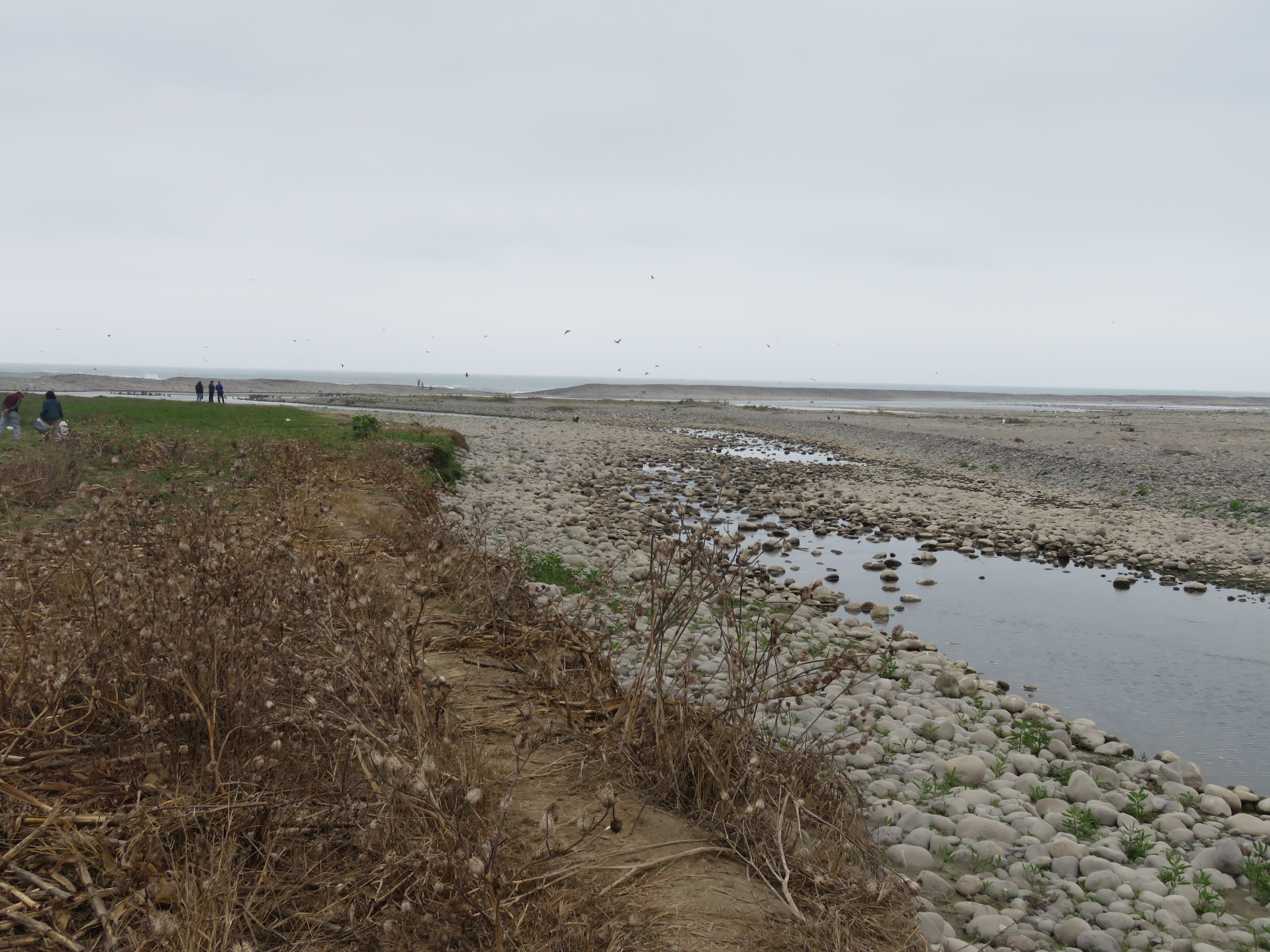 |
| Fig 1c. Site RC00A – looking towards the sea, lagoons in the far distance and the secondary channel in the foreground. (Eustace Barnes). |
 |
| Fig 1a. RC00A - Herbay Bajo on the south bank of the river. (Eustace Barnes). |
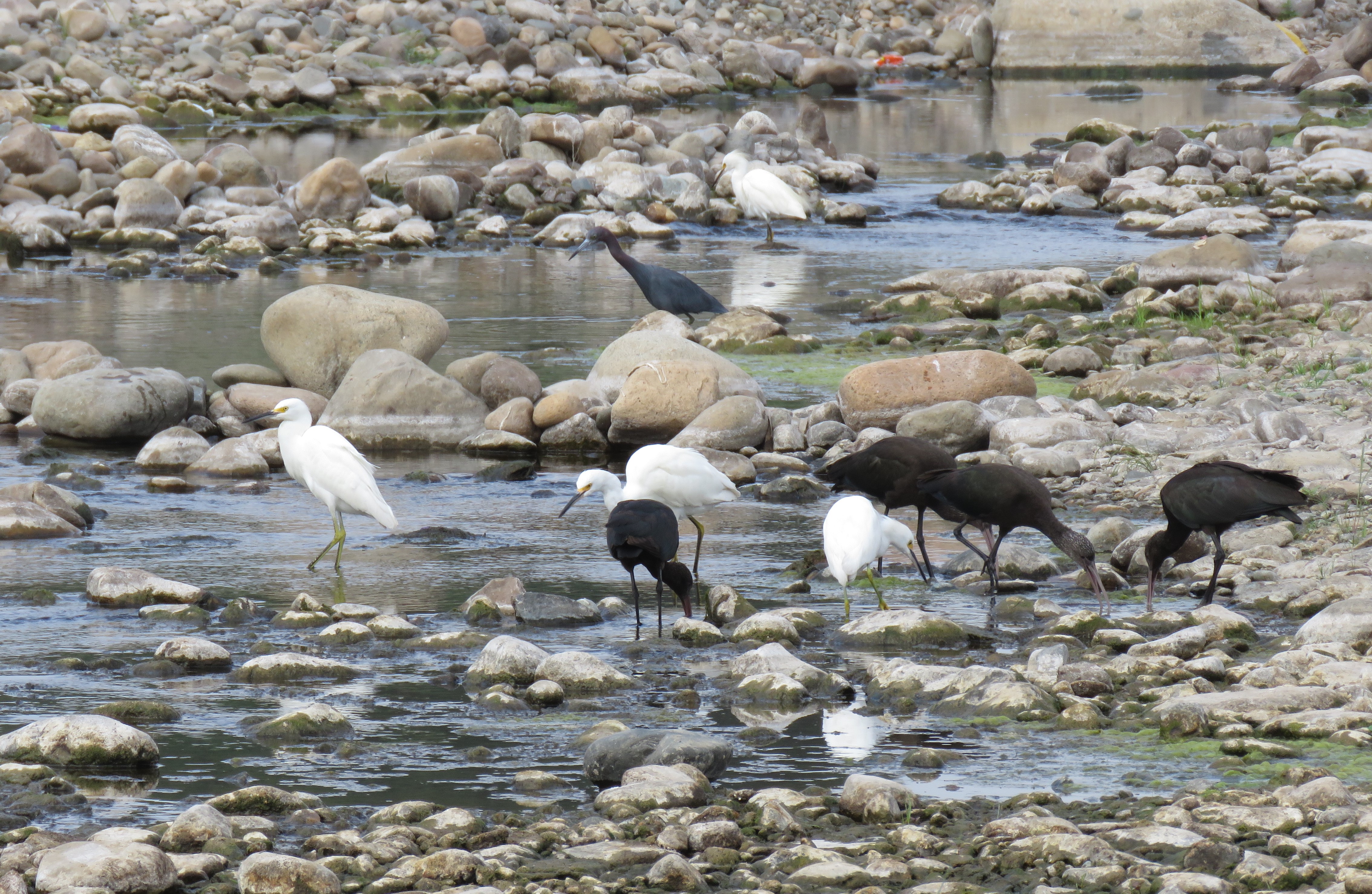 |
| Fig 1g RC00A – the estuarine lagoons are important for a wide variety of waterbirds: Little Blue Heron, Snowy Egret and Puna Ibis shown above. (Eustace Barnes). |
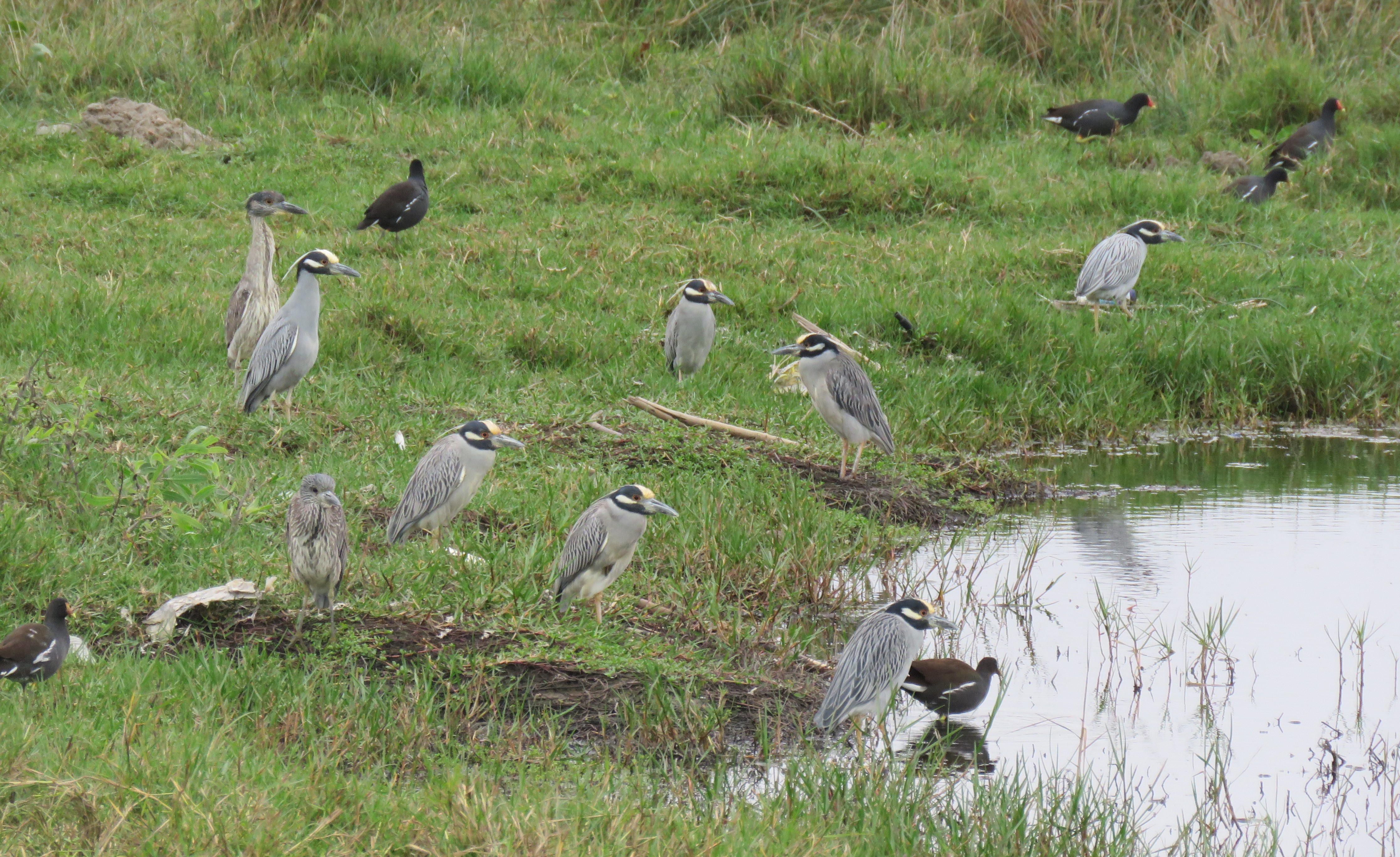 |
| Fig h. Site RC00A - other wetland species found in the estuary include Yellow-crowned Night Heron, Black-crowned night Heron and Common Gallinule. (Eustace Barnes). |
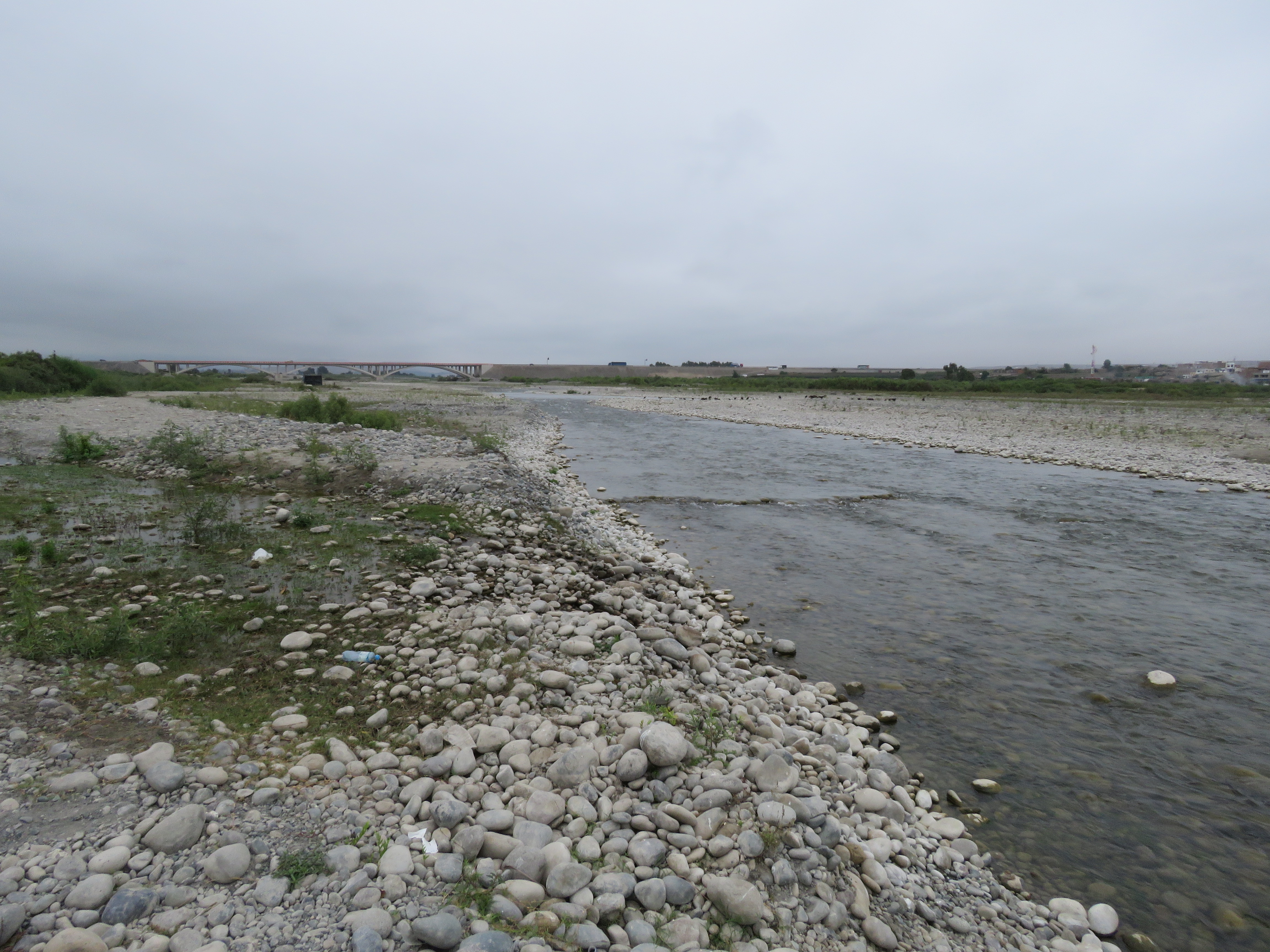
Site RC00B. Rio Cañete estuary – Boca del Rio (North side)
 |
| Fig 1i.RC00B - Boca del Rio on the north bank of the river looking southwards. (Eustace Barnes). |
Data Analysis
It is the case that the amount of dissolved oxygen at 100% saturation at sea level and at 20°C would be 9.03 mg/L. However, at 4.42-4.79mg/l the DO reading are on the low side. As both water and atmospheric temperature was 22.2-24.5°C there are some factors reducing DO levels at this site. At 4.42-4.79mg/l dissolved oxygen and 50% oxygen saturation aquatic vertebrates survive and invertebrates thrive. High concentrations of nutrients (particularly phosphorus and nitrogen) fuel algae blooms, which initially boosts dissolved oxygen levels but then rapidly reduce DO. When the algae die, bacterial decomposition spikes, using up most or all of the dissolved oxygen available. This creates an anoxic, or oxygen-depleted, environment where few organisms survive. Such nutrient levels can occur naturally but are more often caused by pollution from fertilizer runoff or poorly treated wastewaters which could apply to this site below Herbay Bajo. At these recorded levels, denitrification takes place as bacteria use nitrates to decompose organic matter. These conditions are referred to as ‘dead zones’ and are often found near larger human populations in estuaries and coastal zones.
The Conductivity reading at this site is 489-510 µS/cm. The level of conductivity in the Rio Cañete at RC00B is an indicator of some contamination from waste waters and agricultural runoff. This is however, lower than that found at Herbay Bajo, where sewage would be expected to raise conductivity. Generally, agricultural runoff and sewage will increase conductivity due to the additional chloride, phosphate and nitrate ions. Nitrate levels recorded at RC00B were also lower. Throughout the catchment nitrate levels ranged from ‘under range’ to 6.79mg/l NO3 perhaps underlining the limited extent of agriculture in the catchment.
At pH 8.55-8.79 the acidity of river waters is ideal for aquatic life and not approaching the tolerances of most aquatic vertebrates and invertebrates.
Site photos
|  |
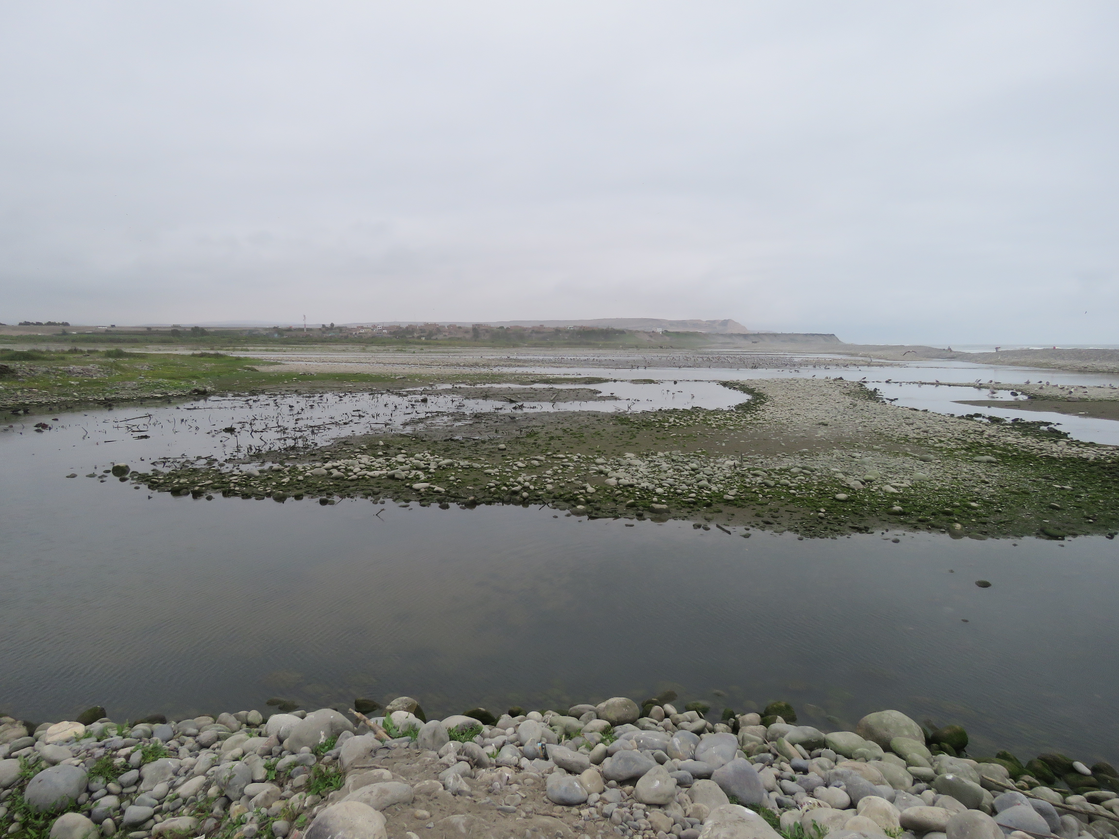
| Fig j Site RC00B – looking downstream, showing braided channel bed with low water in main channel. (Eustace Barnes) |
|
| Fig j Site RC00B – looking downstream, showing braided channel bed with low water in main channel. (Eustace Barnes) |
 |
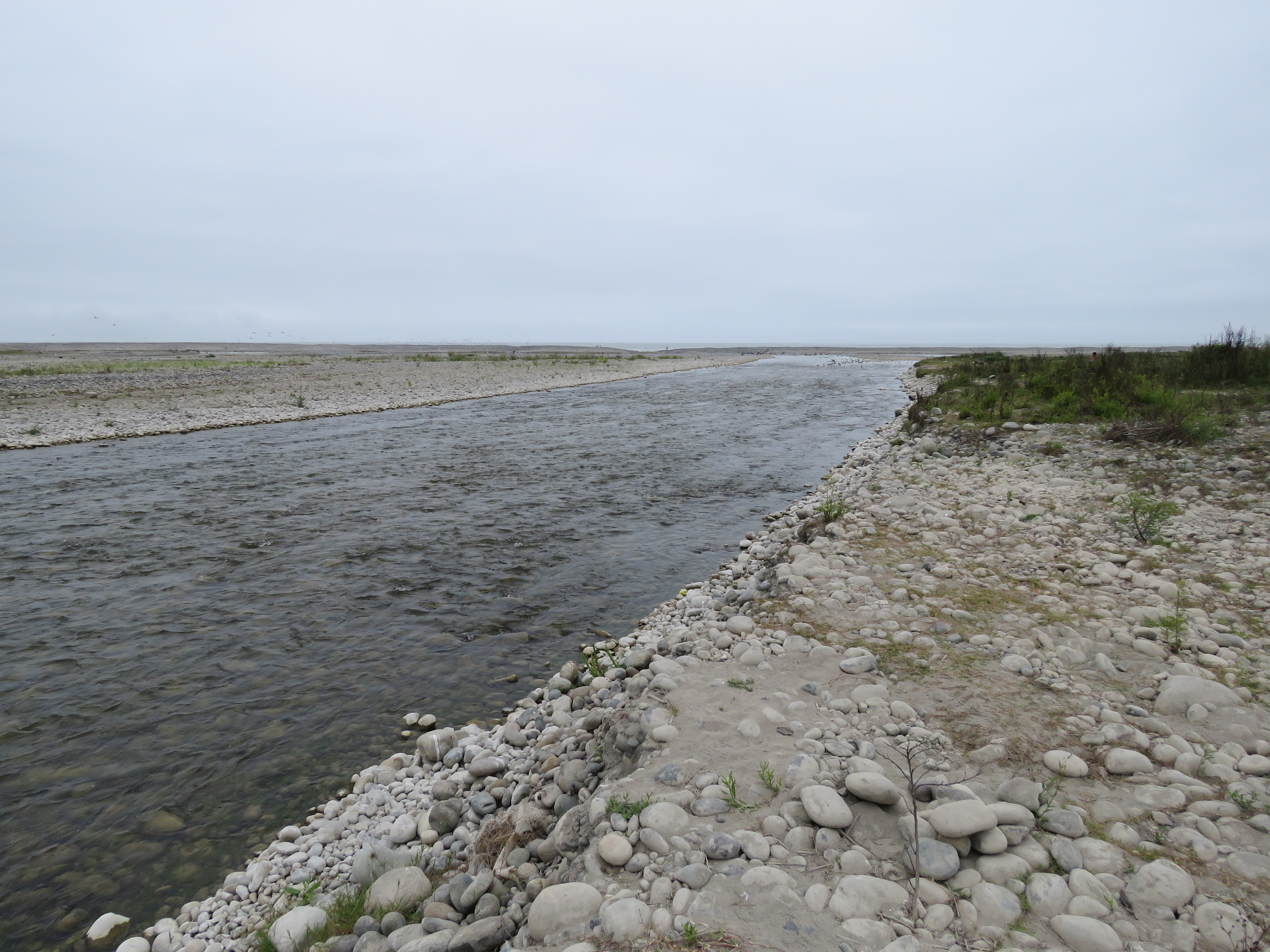
| Fig 1k Site RC00B – looking upstream, showing braided channel bed with low water in main channel. (Eustace Barnes). |
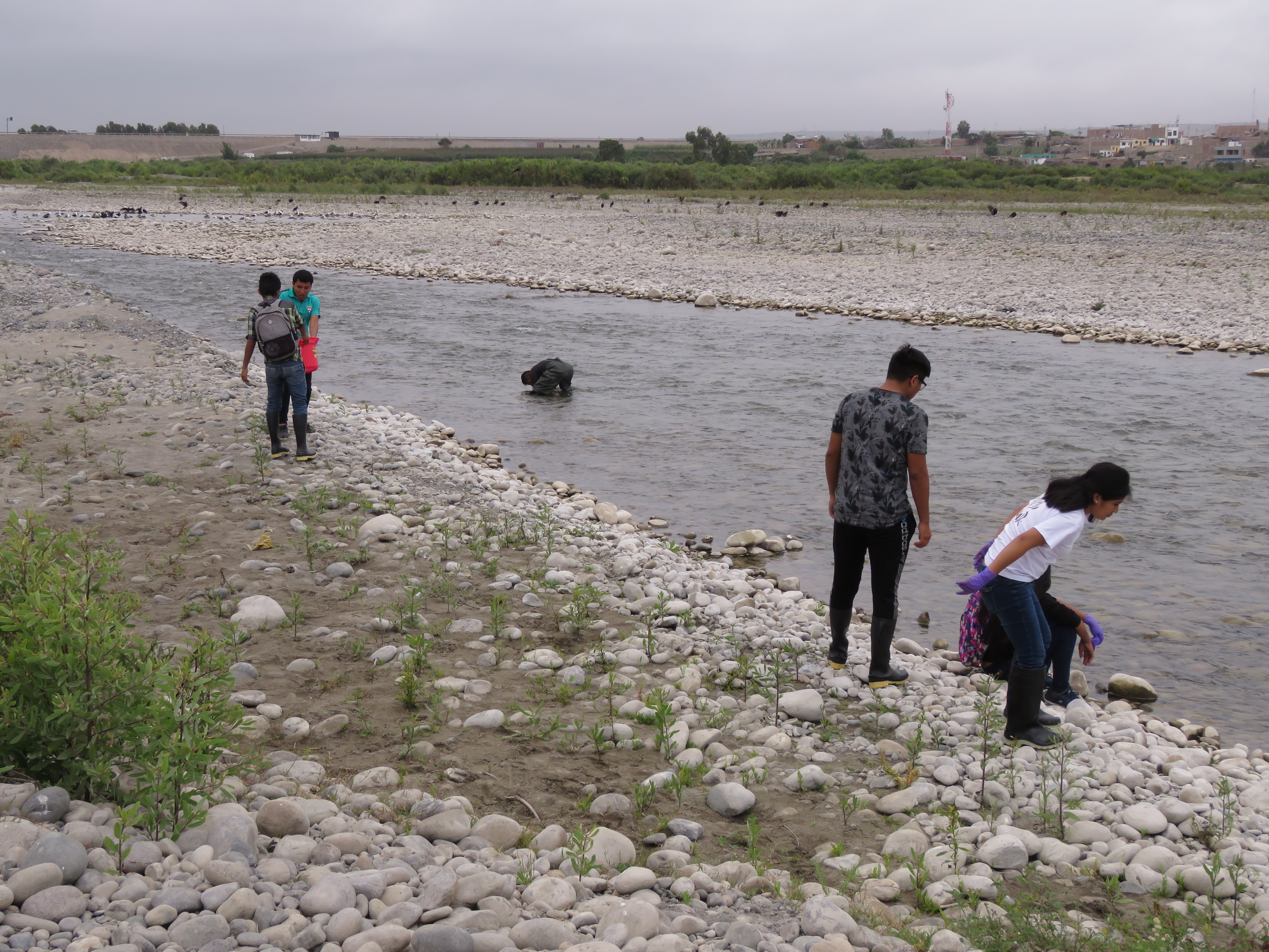 |
| _Fig 1l RC00B - looking upstream, with Shrimp catching team by the river channel. (Eustace Barnes). _ |
 |
 |
| Fig 1m Site RC00B - (Eustace Barnes). |
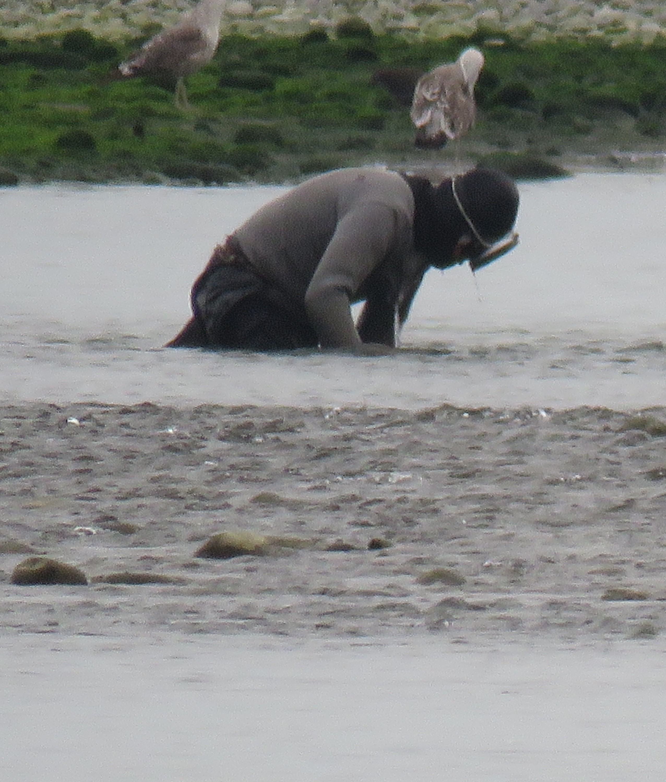 |
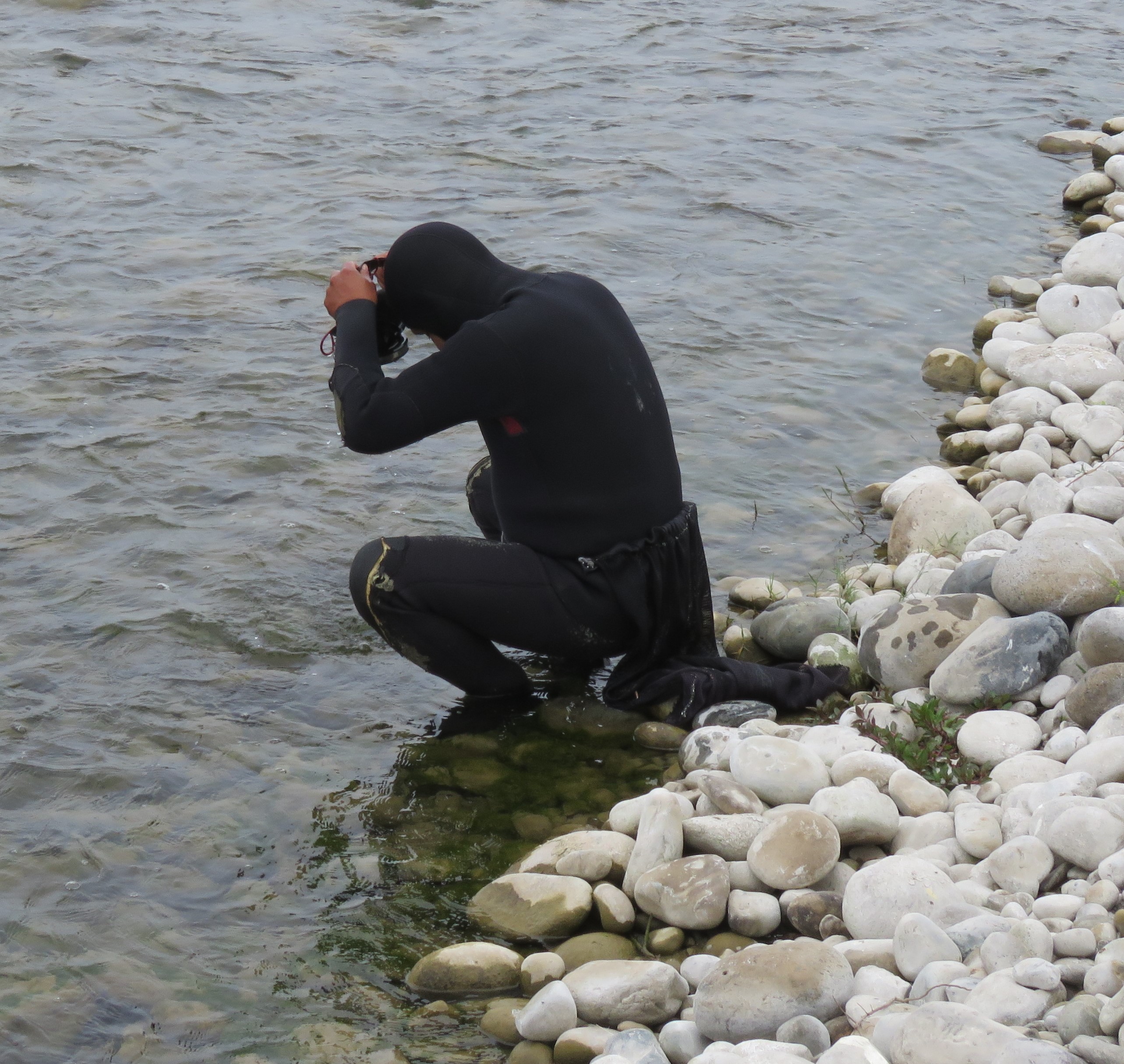
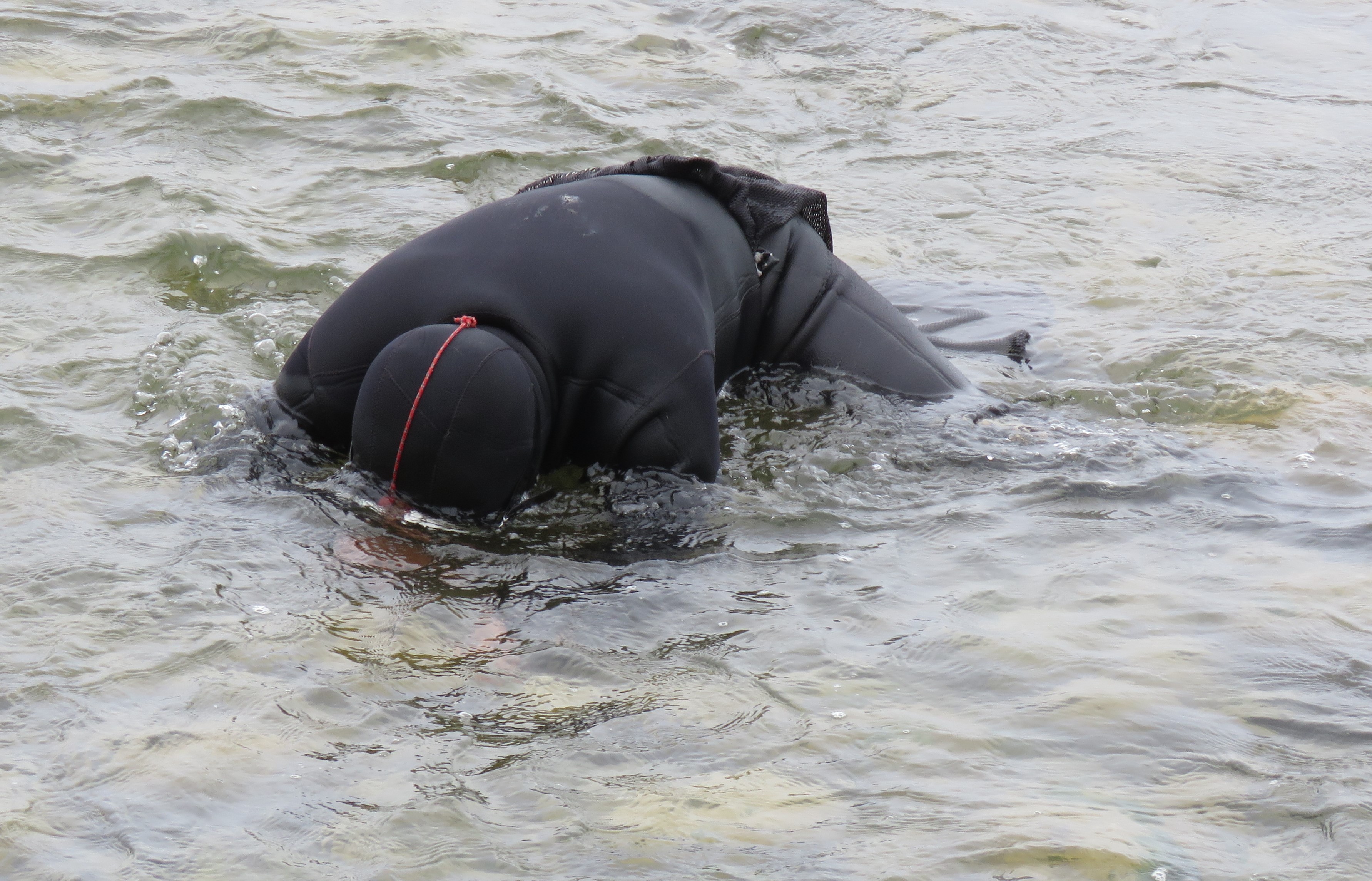
| Fig 1d. Site RC00B – Camarones catchers catching camarones in the estuary lagoons. In the estuary lagoons it is primarily females that are caught. See photos below of specimens caught the same day. (Eustace Barnes). |
 |
|
| Fig 1f. Site RC00B – female Cryphiops caementarius caught in the estuary lagoons. (Eustace Barnes). |
 |
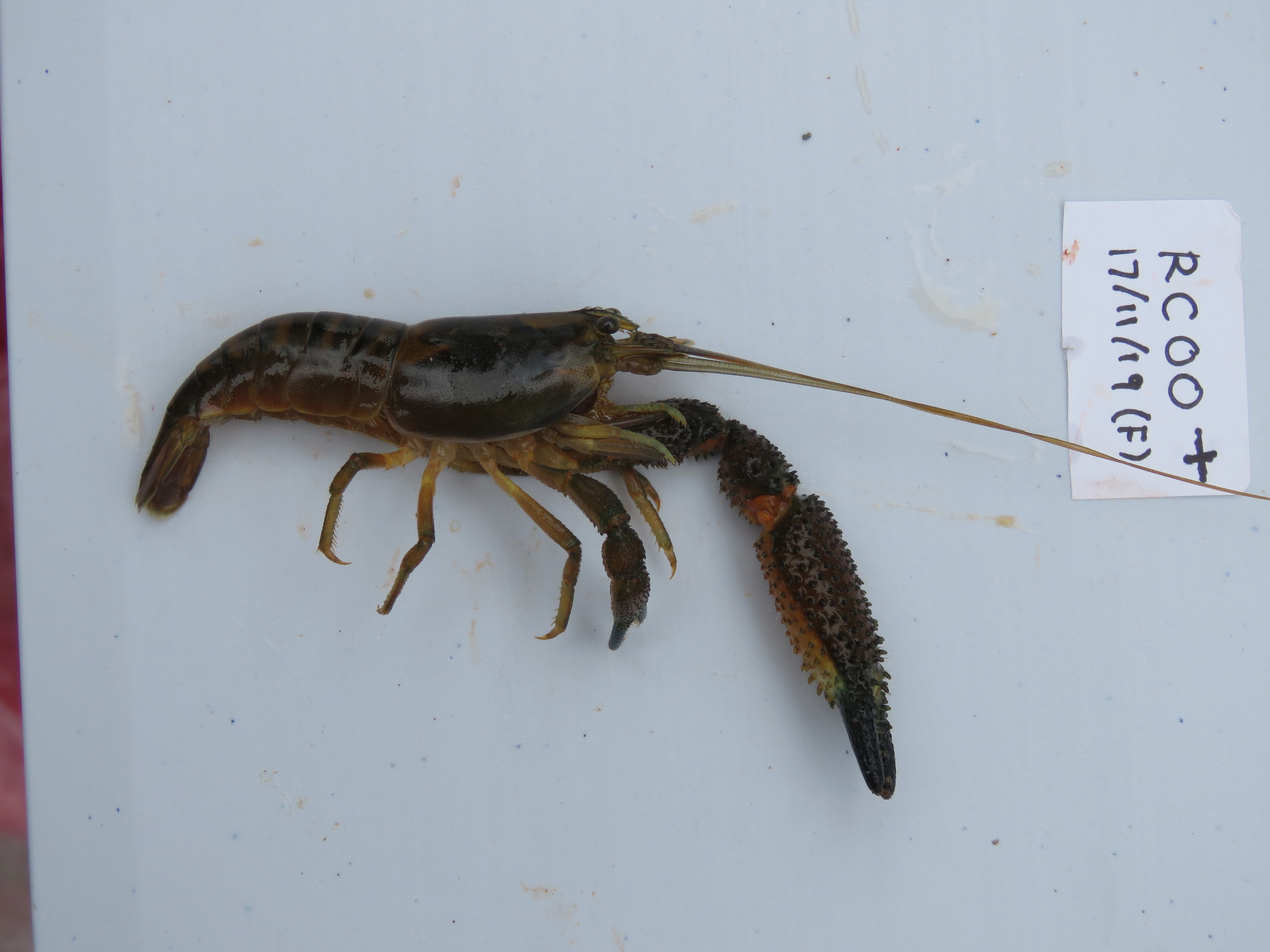 |
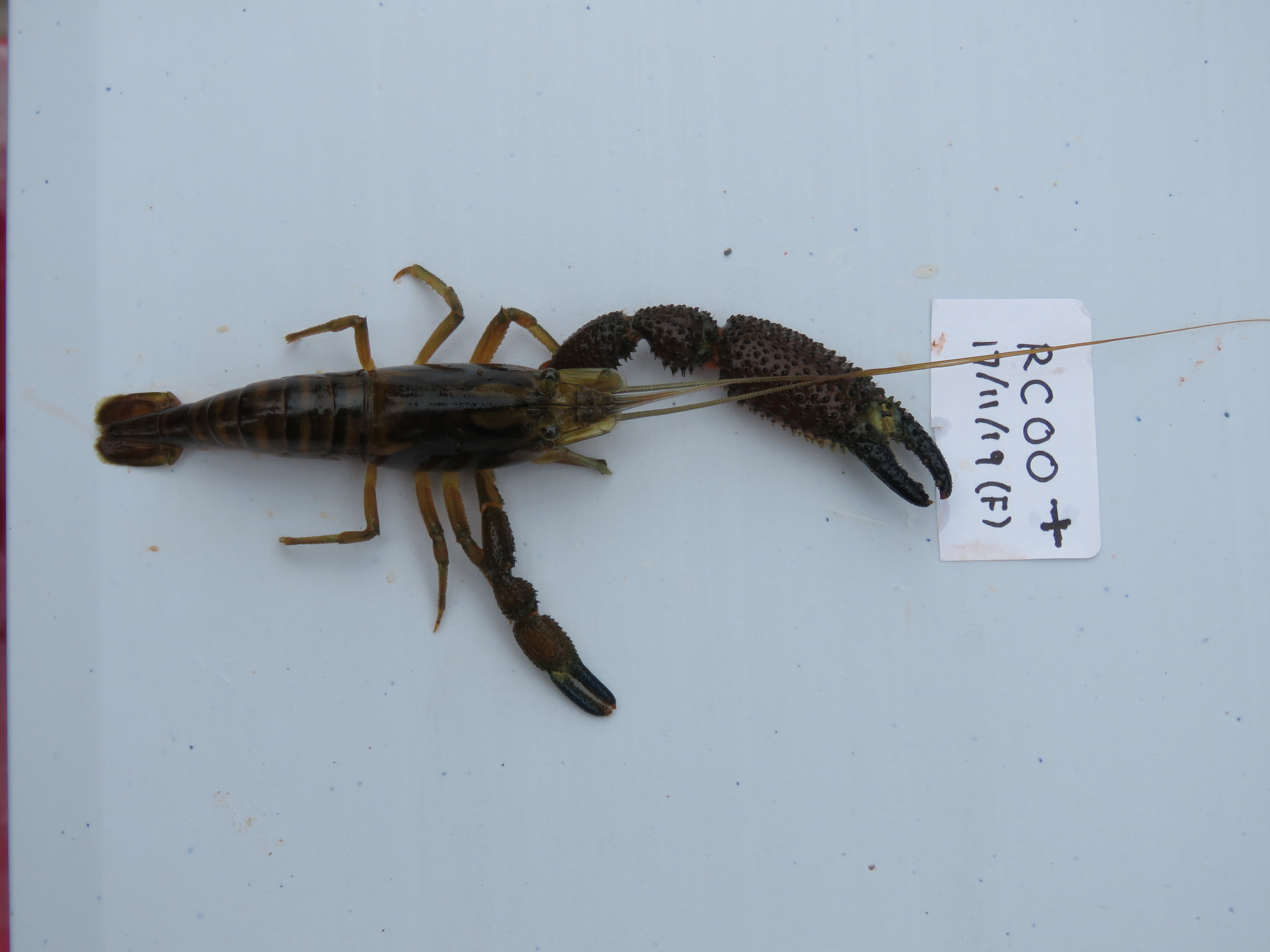
| Fig 1n RC00B. Female Cryphiops caementarius. Note that most specimens collected in the estuary were female. (Eustace Barnes). |
Site description
Site RC00B is located downstream of the Panamerican highway on the north side of the river channel. It is almost at sea level and is in the tropical zone. The Rio Cañete at this point is downriver of intensively farmed lands irrigated by waters extracted from the river at several points higher up. The valley at this point is a broad flat flood-plain to the north bounded to the south by a steep river cliff. The channel flow is highly variable from the dry season to the wet season, depending on water abstraction for agriculture and urban demand from the various abstraction points. The channel itself is highly braided at this time and made up largely of gravel and smaller boulders but the river has a significant discharge year-round. Discharge at the end of November is about 11.2 m³/s but would be 15 m³/s were no water abstracted. During the wet season discharge is considerably higher.
The banks are lined with river cane and scattered areas of stunted willow. Cultivated is intense at this elevation. The production of cotton, grapes, maize, ajo (garlic), aji (peppers), avocado dominates land use. There are smaller areas of sugar cane, a crop which dominates land use further north. There is little or no natural vegetation remaining in the lower valley and much of what was open desert has been irrigated and no highly productive agricultural lands. The water quality in the river at lower elevations is severely impacted by agricultural run-off and sewage disposal. The wider environment and fauna in the valley are largely determined by agriculture with many species expanding their range and abundance to occupy newly created agricultural lands. Desert fauna and flora has decreased accordingly.
 |
| Fig 1p. Site RC00B - (Eustace Barnes). |