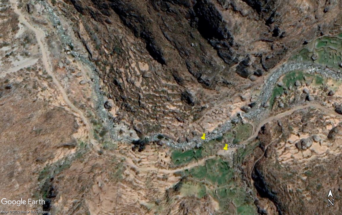
RT07B - Upper Huantan
Site Code: RT07B. GPS: S12°481396, W75°771821. Elevation: 3625m asl.
Water Quality Data
The following river and water quality data was collected from this site:
| RT07B | June 2022 |
|---|---|
| Season: | Austral Winter |
| Date: | 4.7.22 |
| Time: | 14.45 |
| Width (m) | 16.0 |
| Depth (Av.) (m) | 0.40 |
| CSA (Av.) (m²) | 6.40 |
| Velocity (Av.) (m/s) | 0.60 |
| Discharge (Av.) (m³/s) | 3.84 |
| Riverbed sediment | Mainly Cobbles |
| Temp. (Atmospheric) (°C) | 18 |
| Temp. (Water) (°C) | 8.65 |
| Atmospheric pressure (mbar) | <600 |
| Dissolved oxygen (mg/l) | 7.01 |
| Dissolved oxygen (%) | 102.25 |
| pH | 8.53 |
| Conductivity (µS/cm) | 135 |
| Total Dissolved Solids (ppm) | 68 |
| ORP (mV) | 117.15 |
| Turbidity | Clear: blue/grey |
| Alkalinity (mg/l CaCO₃) | 89 (1.6N) |
| Alkalinity Field Tester (ppm CaCO₃) | 67 |
Data Analysis
Discharge at this point along the Rio Huantan was nearly 4 cumecs, a not insignificant amount but much of it is diverted a short distance downstream to irrigate dairy cattle pastures around the village of Huantan.
At just over 3600m asl the DO readings at RT07B are as expected.
The conductivity readings at this site (135 µS/cm)is on the low side but as expected for such an elevation.
The average pH reading of 8.53 is as expected. At these levels the alkalinity of the river is suitable for aquatic life and indicative of clean water.
Site Description
Site RT07B lies in the Rio Huantan valley at 3625m asl, well above the village of Huantan and adjacent to a long abandoned village. River flow in the Rio Huantan is year-round and delivers a significant proportion of river discharge at this point in the catchment.
There is little or no agricultural cultivation along this section of the Rio Huantan apart from rough grazing of cattle and sheep. The lack of agricultural activity results from the lack of level ground and dominance of rocks and boulders lying across the steep slopes.
In the upper parts of this sub-catchment agriculture is low intensity and traditional and rural population low, having been subject to rural drift. In the headwaters there is a mining camp at Anexo Atcas. This mine may well impact water quality in the Rio Huantan as might the Mina Corihuami located on the Rio Huantan watershed.
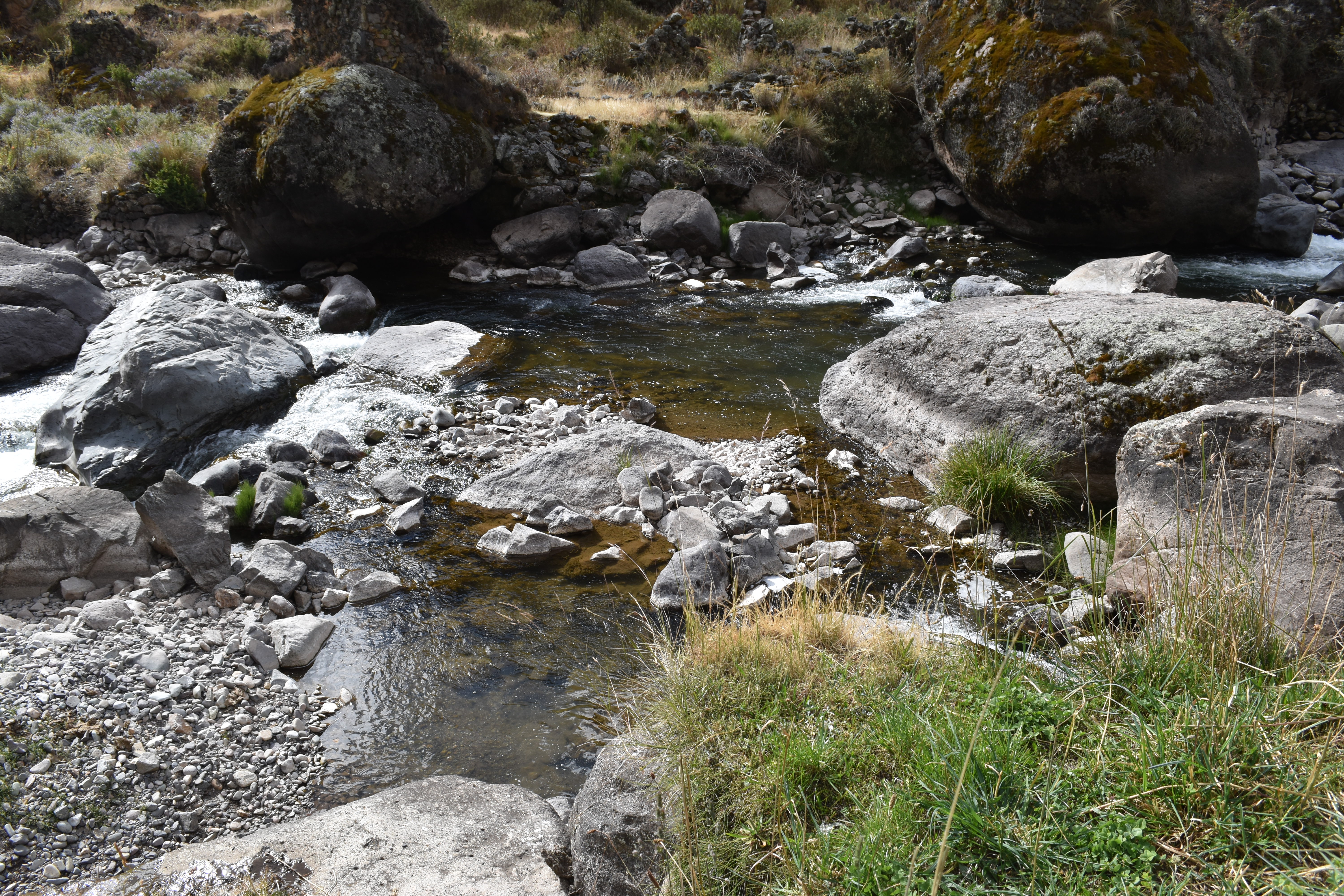
 Site RT07B - the study site location. (John Forrest)
 Site RT07B - the study site. (June 2022) (John Forrest)
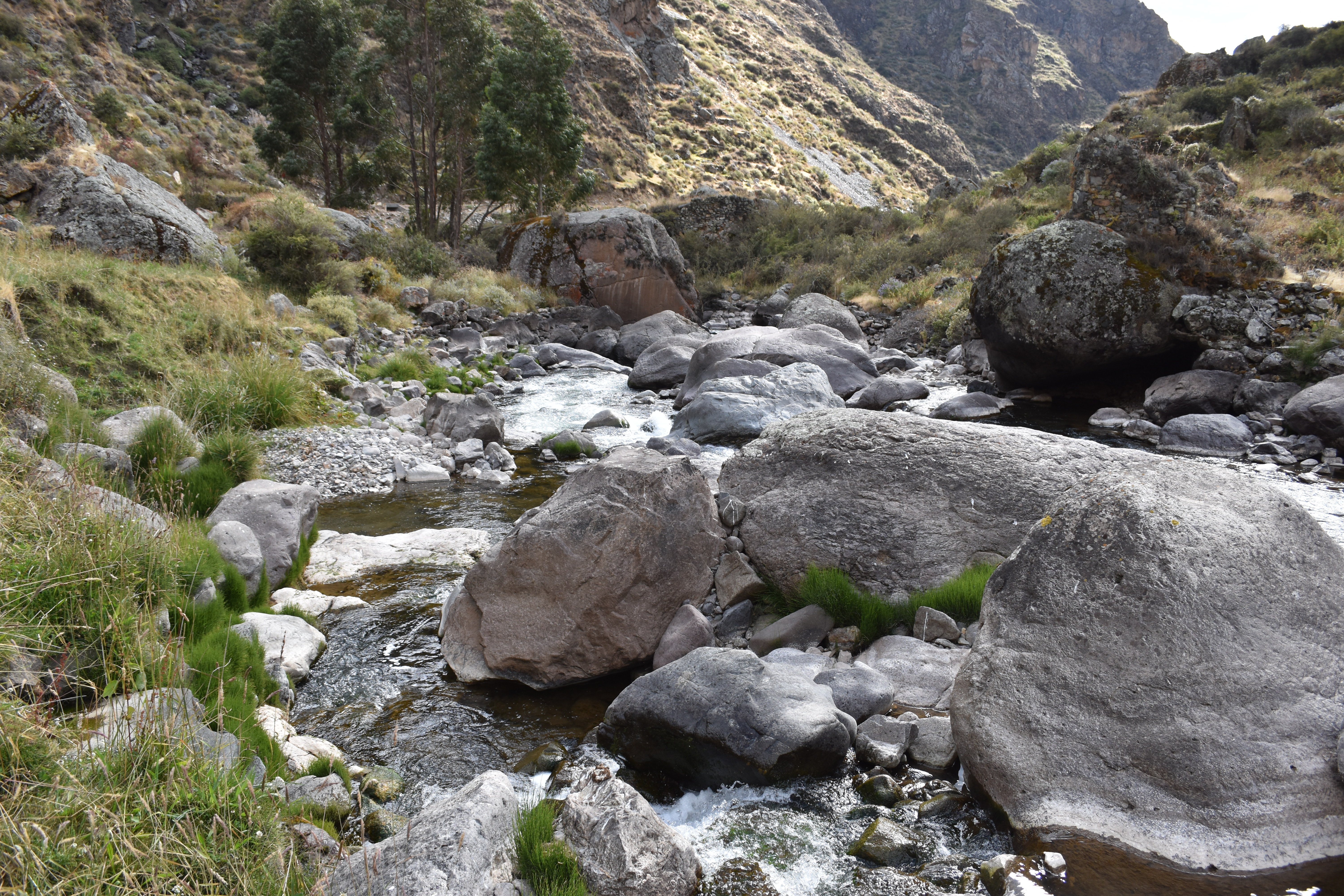 Site RT07B - View downstream from the study site. (June 2022) (John Forrest)
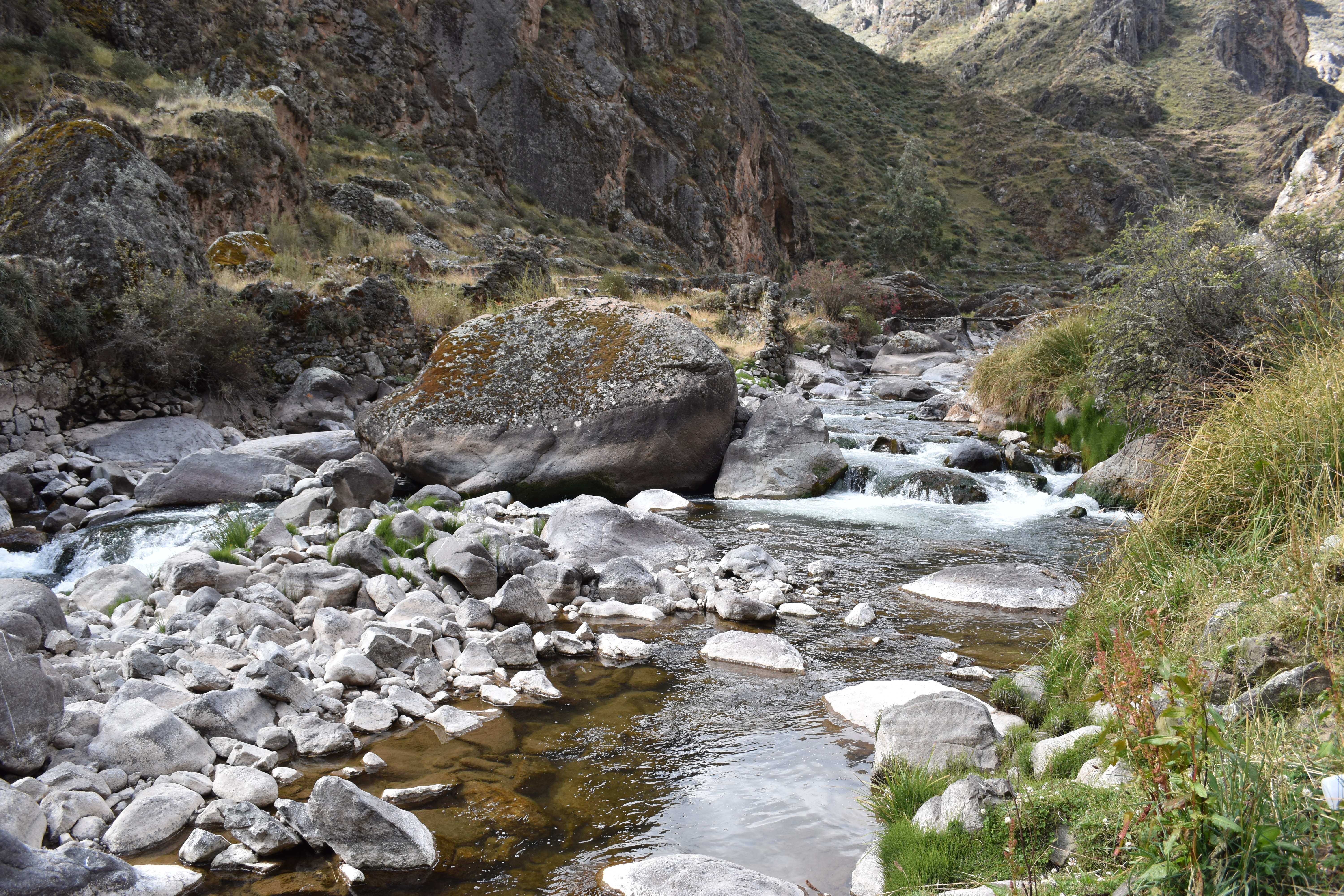 Site RT07B - View upstream from the study site. (June 2022) (John Forrest)