RC09 - Below Tinco
Site Code: RC09. GPS: S12°42661, W75°853404. Elevation: 2624m asl.
Water Quality Data
The following river and water quality data was collected from this site:
| RC09 | July 2019 | November 2019 | November 2021 | June 2022 |
|---|---|---|---|---|
| Season: | Austral Winter | Austral Summer | Austral Summer | Austral Winter |
| Date: | 11.07.19 | 20.11.19 | 14.11.21 | 27.6.22 |
| Time: | 10.00 | 15.30 | 9.30 | 14.45 |
| Width (m) | 24.0 | 28.0 | 31.4 | |
| Depth (Av.) (m) | 0.27 | 0.55 | 0.50 | |
| CSA (Av.) (m²) | 6.58 | 15.40 | 15.70 | |
| Velocity (Av.) (m/s) | 0.87 | 1.01 | 1.16 | |
| Discharge (Av.) (m³/s) | 5.747 | 15.554 | 18.212 | |
| Riverbed sediment | Cobbles, boulders & gravel | Mainly cobbles | Cobbles & boulders | |
| Temp. (Atmospheric) (°C) | 24 | 19 | 19 | 19 |
| Temp. (Water) (°C) | 10.78 | 14.04 | 13.10 | 13.02 |
| Atmospheric pressure (mbar) | 740 | 750 | 670 | |
| Dissolved oxygen (mg/l) | 6.43 | 4.73 | 7.09 | 7.92 |
| Dissolved oxygen (%) | 76.6 | 73.7 | 91.0 | 113.9 |
| pH | 8.70 | 8.34 | 8.54 | |
| Conductivity (µS/cm) | 479 | 423 | 583 | 493 |
| Total Dissolved Solids (ppm) | 239 | 211 | 292 | 247 |
| ORP (mV) | 353.2 | 152.9 | 63.1 | 162.5 |
| Turbidity | Clear: | Clear: slightly milky | Clear: | Clear: blue/grey |
| Alkalinity (mg/l CaCO₃) | 206 (1.6N) | - | 122 (1.6N) | 147 (1.6N) |
| Alkalinity Tester (ppm CaCO₃) | - | - | 135 | 146 |
Data Analysis
Discharge at this point along the rio Cañete reflects the seasonal variations in precipitation. In November 2019 the discharge has gradually reduced to its baseflow prior to the onset of rains start in the headwater areas while in November 2021 the discharge figure reflects that the rains had already started. The June 2022 level reflects rainfall earlier in the year and ice melt at higher elevations.
At just over 2400m asl the DO readings at RC09 fall within the range to be expected for the June and November data sets. Again, the increased elevation and diurnal fluctuations in temperature in narrow, sheltered sections of the valley will produce fluctuations in maximum absolute oxygen capacity and, in consequence, percentage saturation. This then fluctuates with that rhythm accordingly. The DO level variations at this site may indicate that the conditions for life are likewise rather variable.
The upper conductivity readings at this site (583 µS/cm) is on the high side for this elevation but the others are more in-line with expectastions.
pH readings of about 8.5 are as expected. At these levels the alkalinity of the river remains suitable for aquatic life and not approaching the tolerances of most aquatic vertebrates and invertebrates.
Site Description
Site RC09 is located in the upper sub-tropics, below the settlement of Tinco and the bridge of the same name. It lies in the Rio Cañete valley at 2430m asl and just below the confluence with the Rio Huantan. The valley at this point has a pronounced v-shaped profile and is opening out after flowing through a canyon above Tinco. River flow is high and fast at this point with a variable extent of shingle banks, depending on the time of year.
There are few areas of cultivation lining the river which is dominated by riparian woodlands and scrub. Above the narrow flood-plain valley sides are arid, supporting a xeric vegetation with increased woody shrubs and trees lining some of the more sheltered areas. Along the valley bottom, the vegetation is dominated by Salix and endemic species typical of this elevation. A few Eucalyptus have been planted but otherwise this remains largely natural. Of the natural vegetation, there are clumps of river cane and willows along the river edge along with increasing numbers of species typical of the relictual pacific woodlands found in the temperate zone.
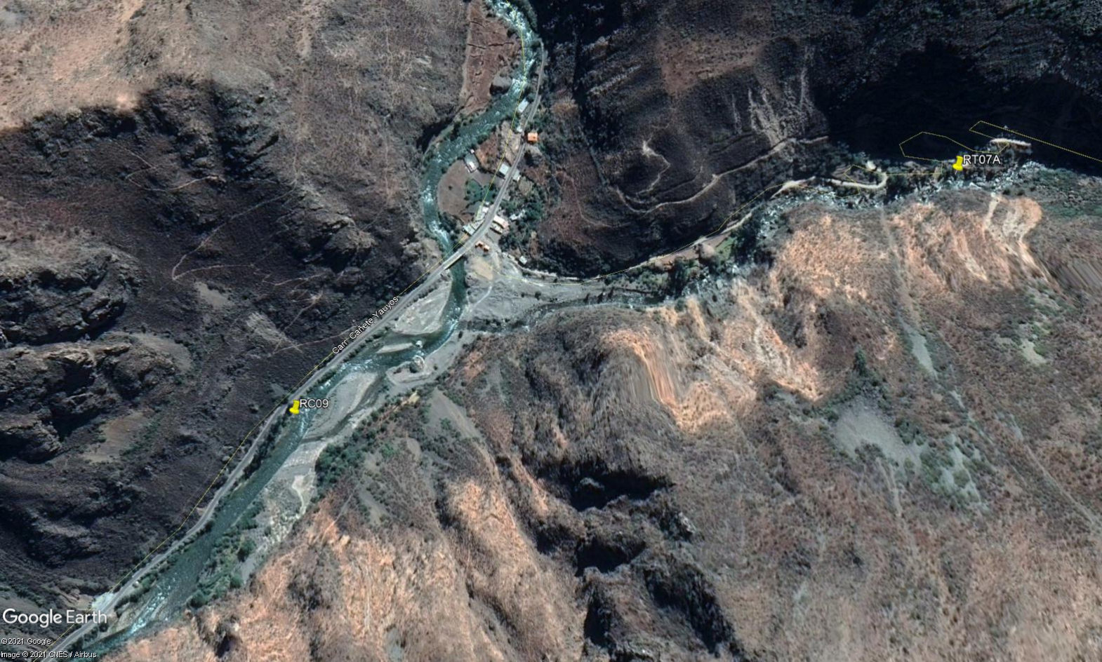 Site RC09 - Study site location: just below Puente Aquicha (Tingo).
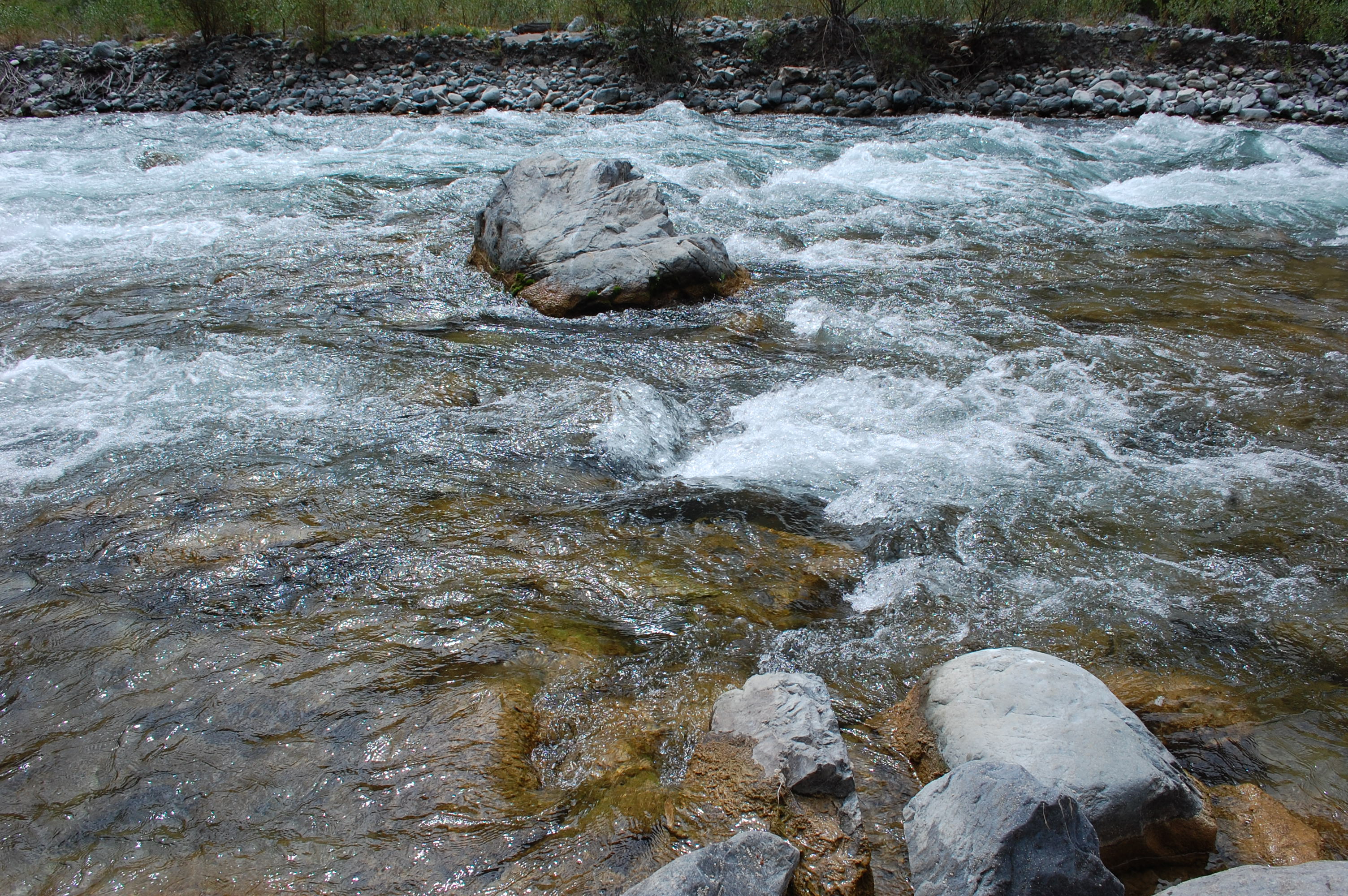 Site RC09 - the study site. (November 2019) (John Forrest)
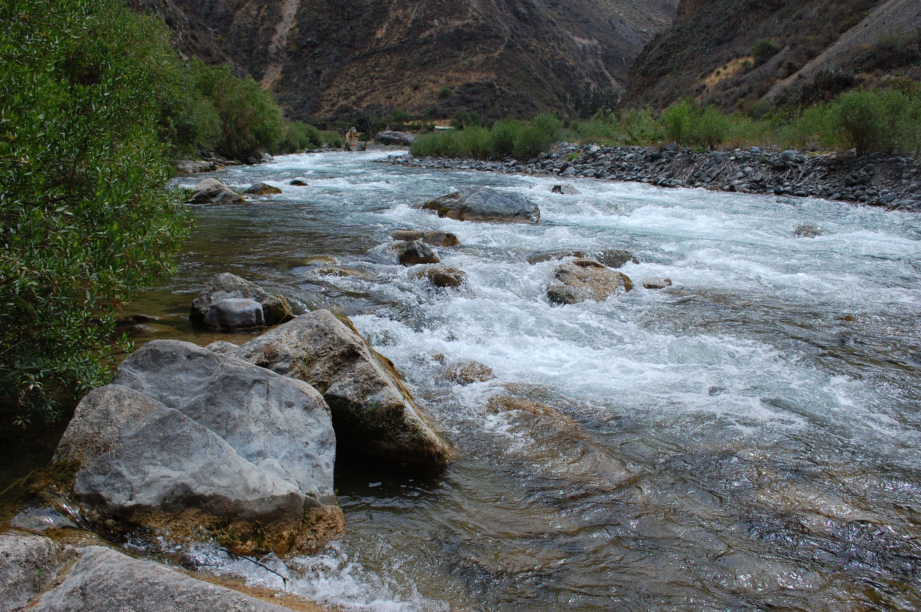 Site RC09 - View upstream. (November 2019) (John Forrest)
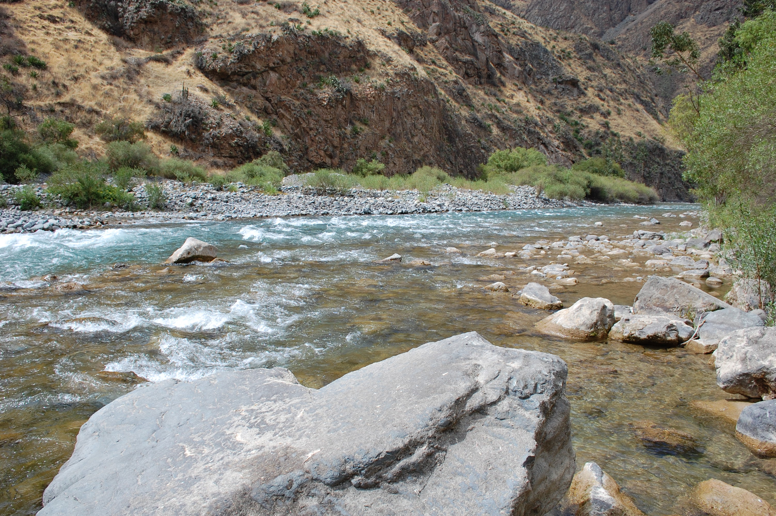 Site RC09 - View downstream. (November 2019) (John Forrest)