RT09C - Upper Alis
Site Code: RT09C. GPS: S12°277975, W75°644980. Elevation: 4180m asl.
Water Quality Data
The following river and water quality data was collected from this site:
| T9c | November 2021 | March 2022 |
|---|---|---|
| Season: | Austral Summer | Austral Summer |
| Date: | 18.11.21 | 28.3.2022 |
| Time: | 8.00 | 14.45 |
| Width (m) | 2.05 | 1.75 |
| Depth (Av.) (m) | 0.07 | 0.50 |
| CSA (Av.) (m²) | 0.14 | 0.88 |
| Velocity (Av.) (m/s) | 0.16 | 0.50 |
| Discharge (Av.) (m³/s) | 0.023 | 0.438 |
| Riverbed sediment | Pebbles & Cobbles | Pebbles & Cobbles |
| Temp. (Atmospheric) (°C) | 12 | 9.25 |
| Temp. (Water) (°C) | 8.08 | 12.66 |
| Atmospheric pressure (mbar) | 621 | |
| Dissolved oxygen (mg/l) | 5.01 | 4.14 |
| Dissolved oxygen (%) | 69.05 | 66.88 |
| pH | 7.92 | 8.55 |
| Conductivity (µS/cm) | 773 | 366 |
| Total Dissolved Solids (ppm) | 387 | 183 |
| ORP (mV) | 47.2 | 119.8 |
| Turbidity | Clear: | Clear: colourless |
| Alkalinity (mg/l CaCO₃) | 170 | - |
| Alkalinity Field Tester (ppm CaCO₃) | - | - |
Data Analysis
Discharge at this point on the Rio Alis was very low in November 2021 suggesting that the rains had not yet started in the headwaters of this sub-catchment though the size of the channel suggested that it rarely carried much more water though the discharge was slightly greater in March 2022 during the rainy season.
At nearly 4200m asl the DO readings at RT09C were lower than at many other sites but still fall within the range to be expected for a November data set.
The conductivity reading (773 µS/cm) in November 2021 was slightly higher than expected for a site located above all major settlements within a sub-catchment but probably reflects the low discharge at that time of year whereas it was somewhat higher in March 2022 with a higher discharge.
The pH readings of around 8.0 are as expected. At these levels the alkalinity of the river is suitable for aquatic life and indicative of clean water.
Site description
Site RT09C lies in the Rio Alis valley at 4180m asl. The valley at this point is wide with a u-shaped profile and a wide flood-plain though there is little evidence of the river frequently overflowing its narrow channel. River flow in the Rio Alis is year-round and overall makes a significant input to the Rio Cañete further downstream.
Bed load in the river channel is comprised almost entirely of smaller sediment material.
There is no agricultural cultivation taking place, the banks and hillsides are lined with open pasture where cattle and alpacas graze. However, there is some evidence of more intensive land use having taken place in the past; old corrals being located nearby. Currently, there is only permanent settlement (homestead) slightly higher up the valley.
Andean goose, Andean and Puna Ibis are found feeding in the wetter soils and marshland.
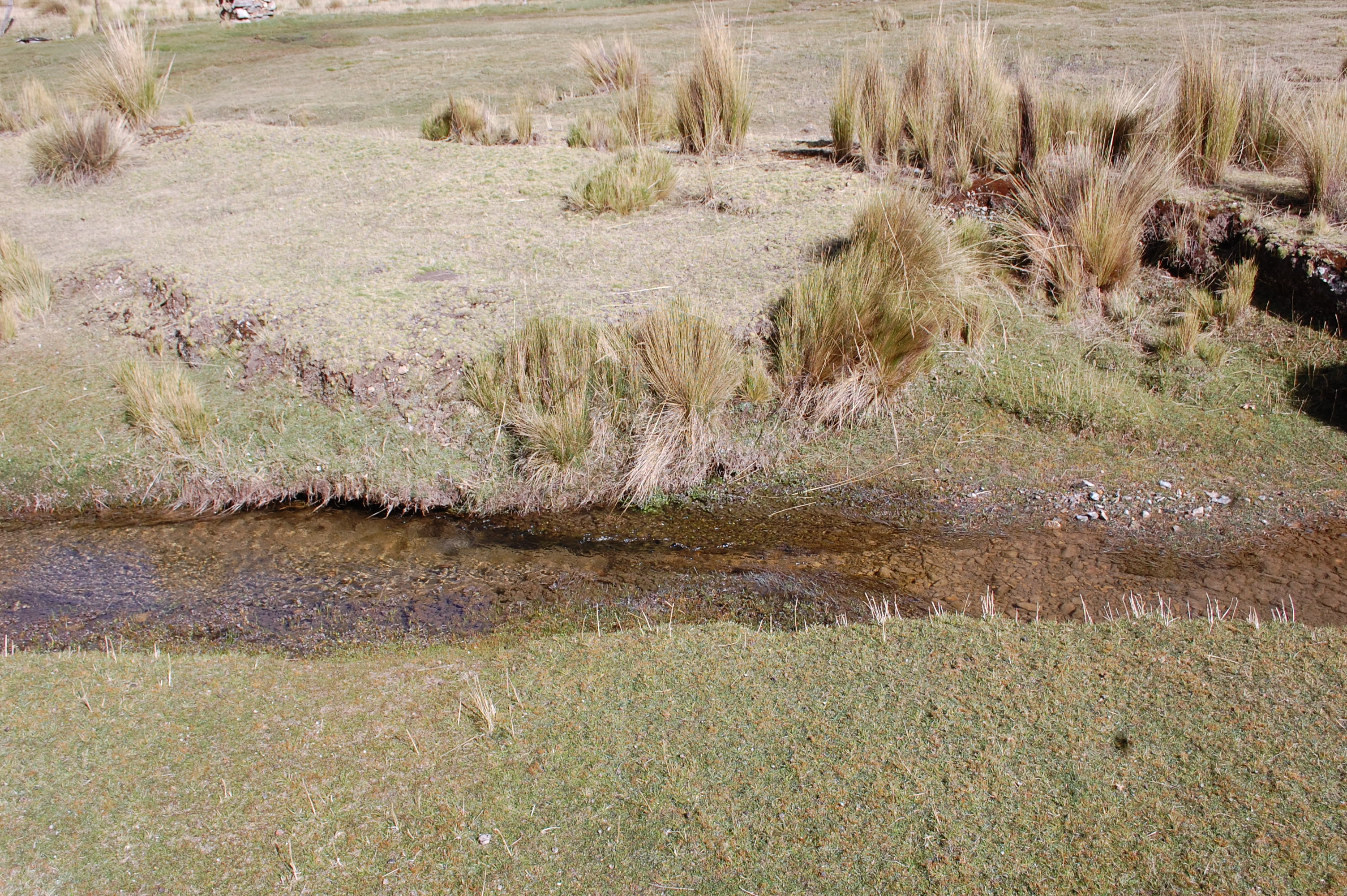 Site RT09C - the study site (November 2021) (John Forrest)
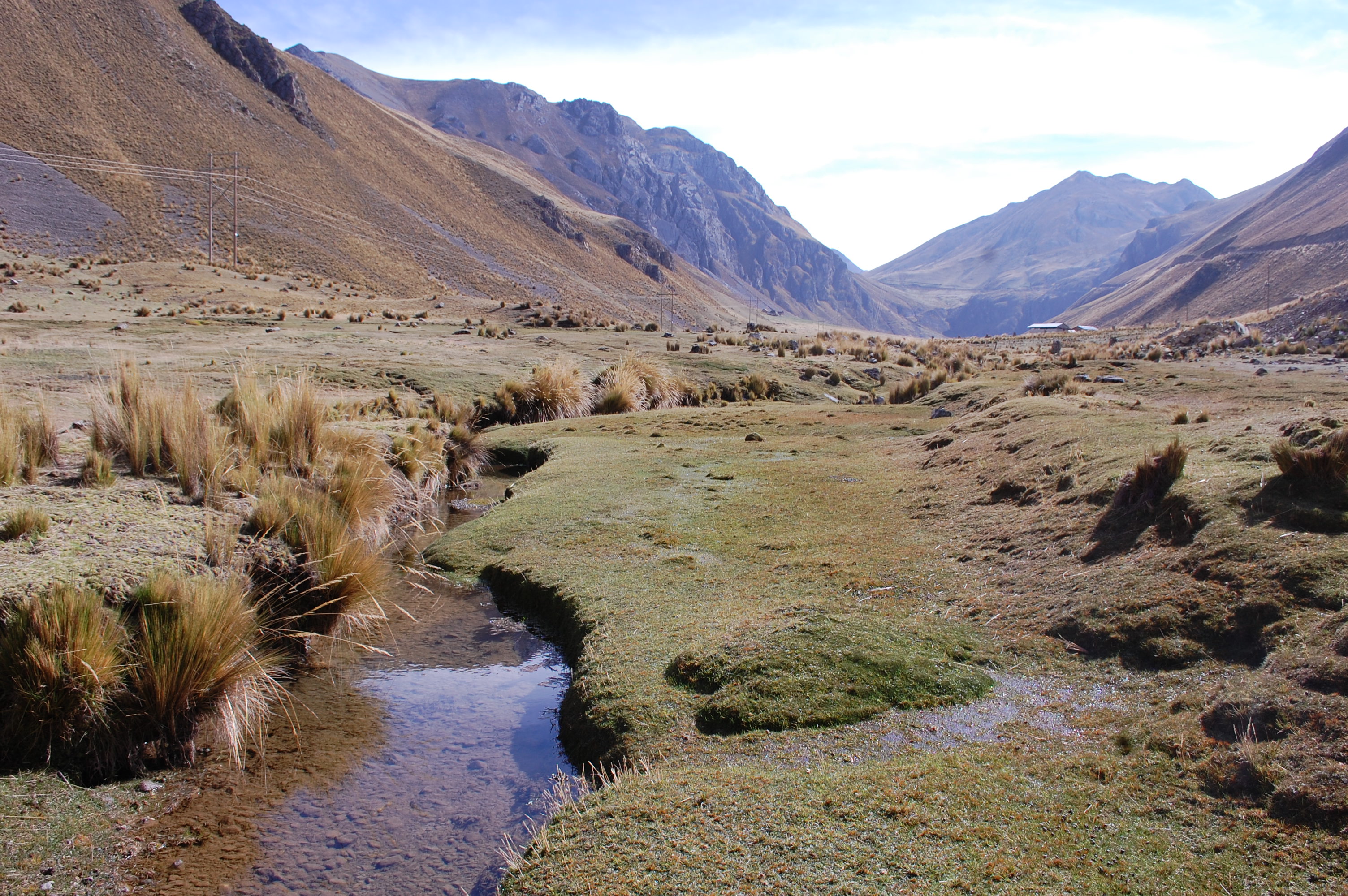 Site RT09C - the view upstream (November 2021) (John Forrest)
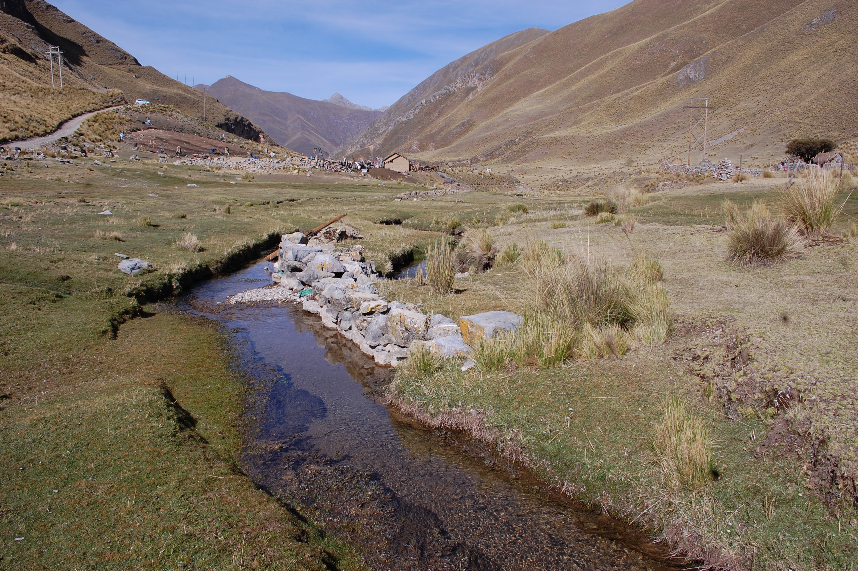 Site RT09C - the view downstream (November 2021) (John Forrest)