RC11 - Above Llapay HEP
Site Code: RC11. GPS: S12°33693, W75°825592. Elevation: 2921m asl.
Water Quality Data
The following river and water quality data was collected from this site:
| RC11 | July 2019 | November 2019 | November 2021 | June 2022 |
|---|---|---|---|---|
| Season: | Austral Winter | Austral Summer | Austral Summer | Austral Winter |
| Date: | 11.07.19 | 20.11.19 | 15.11.21 | 28.6.22 |
| Time: | 12.45 | 11.30 | 9.45 | 10.45 |
| Width (m) | 17.0 | 17.0 | 17.8 | |
| Depth (Av.) (m) | 0.39 | 0.62 | 0.74 | |
| CSA (Av.) (m²) | 6.55 | 10.54 | 13.17 | |
| Velocity (Av.) (m/s) | 0.42 | 0.90 | 0.94 | |
| Discharge (Av.) (m³/s) | 2.742 | 9.486 | 12.382 | |
| Riverbed sediment | Cobbles & Boulders | Cobbles & Boulders | Mainly Boulders | Cobbles & Boulders |
| Temp. (Atmospheric) (°C) | 24 | 23 | 17 | 22 |
| Temp. (Water) (°C) | 12.16 | 13.50 | 12.69 | 11.79 |
| Atmospheric pressure (mbar) | 640 | 736 | (<600) | 620 |
| Dissolved oxygen (mg/l) | 5.34 | 3.87 | 6.75 | 7.12 |
| Dissolved oxygen (%) | 68.9 | 62.7 | 88.8 | 106.9 |
| pH | 8.72 | 8.31 | 8.49 | |
| Conductivity (µS/cm) | 453 | 445 | 579 | 456 |
| Total Dissolved Solids (ppm) | 228 | 222 | 289 | 228 |
| ORP (mV) | 350.5 | 119.6 | 143.9 | 157.08 |
| Turbidity | Clear: | Clear: | Clear: | Clear: blue/grey |
| Alkalinity (mg/l CaCO₃) | 164 (1.6N) | - | 140 (1.6N) | 158 (1.6N) |
| Alkalinity Tester (ppm CaCO₃) | - | - | - | 141 |
Data Analysis
Discharge at this point along the Rio Cañete is subject to precipitation in the headwaters of the valley. The data suggests that in November 2019 the rains had yet to arrive while in November 2021 they had already arrived, while the June 2022 discharge figure reflects continuing outflow resulting from heavy rain earlier in the year.
At nearly 2900m asl the DO readings at RC11 are low but fall within the range to be expected for both July and November data sets and follow the catchment trend.
The conductivity readings at this site have been constant and follow the catchment trends. Conductivity tends to be lower for the tributary sites than for main channel sites - the impact of chemical weathering is much reduced in the sub-catchments as they are of shorter length.
pH readings of around 8.5 are as expected for a clean river and appropriate for most aquatic life.
Site Descriptions
Site RC11 lies in the Rio Cañete valley at 2914m asl in the arid temperate zone. It is just above the El Platanal HEP (G2) and below the confluence with the Rio Laraos. The valley at this point is narrow with a pronounced v-shaped profile and steep valley sides. River flow is year-round and fast at this point.
The site is similar to RC10, with little or no agricultural cultivation along this section of the Rio Cañete, which is dominated by riparian Alders, tall thorn scrub and scattered clumps of Eucalyptus planted for timber and building materials. Above the narrow flood plain valley sides are arid, supporting a xeric vegetation with increased woody shrubs and trees lining some of the more sheltered ravines. The limited agricultural activity results from the narrow floodplain.
This site retains the typical avifauna of the lower elevations and shares the same fauna and flora as at RC10, with American Kestrel, Blue and yellow Tanager, Scrub Blackbird, Black-necked Woodpecker, Golden Grosbeak, Chiguanco Thrush, Golden-billed Saltator, House Wren and Hooded Siskin being species that now reflect more strongly the temperature zone community. The hillsides at this elevation have more extensive areas of relictual Pacific woodlands that typify vegetative associations higher up the valley. Arid slopes additionally hold Streaked Tit Spinetail, Cinereous Conebill, Band-tailed Seedeater and Band-tailed Sierra Finch.
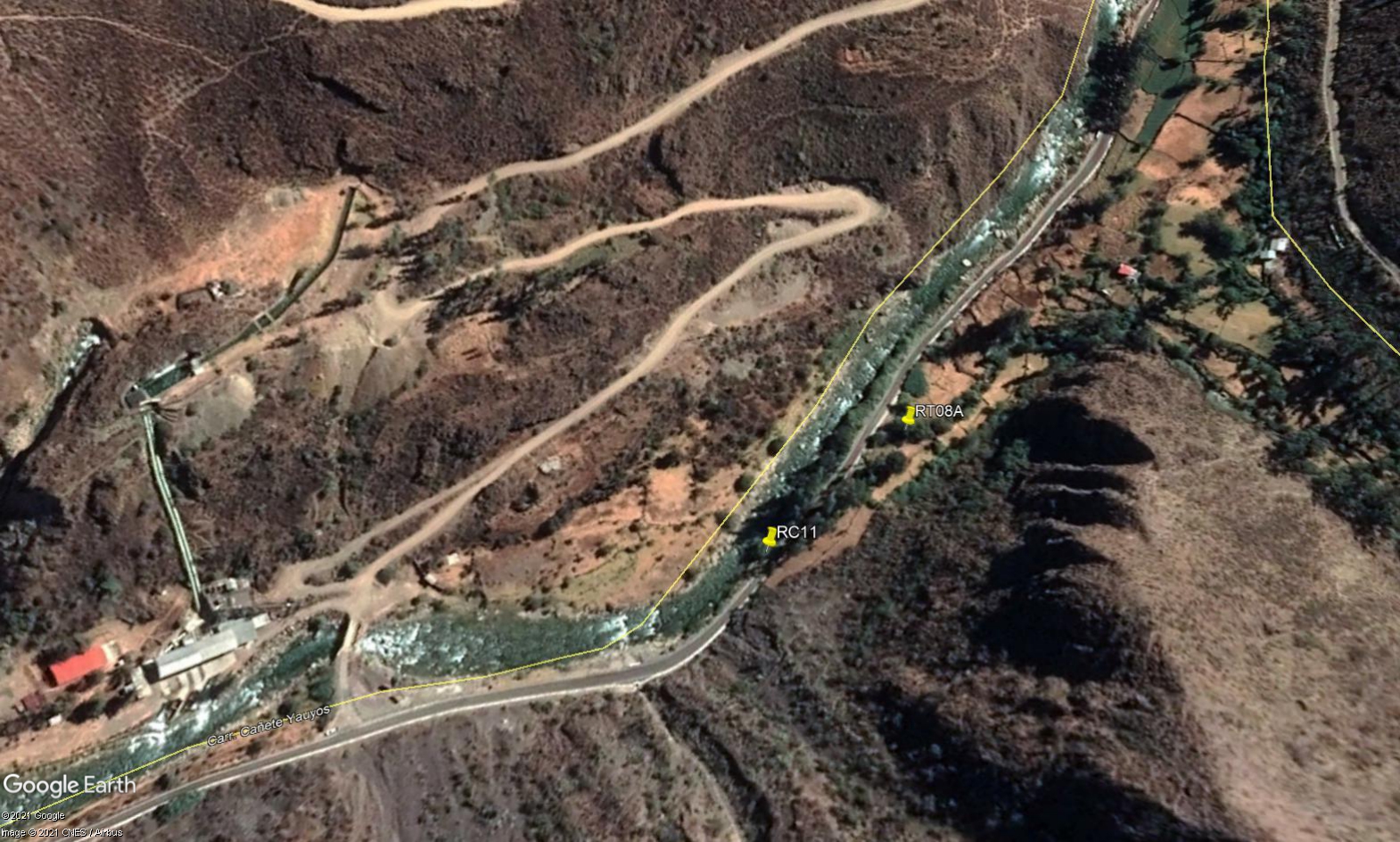 Site RC11 - Study site location: just above LLapay HEP station.
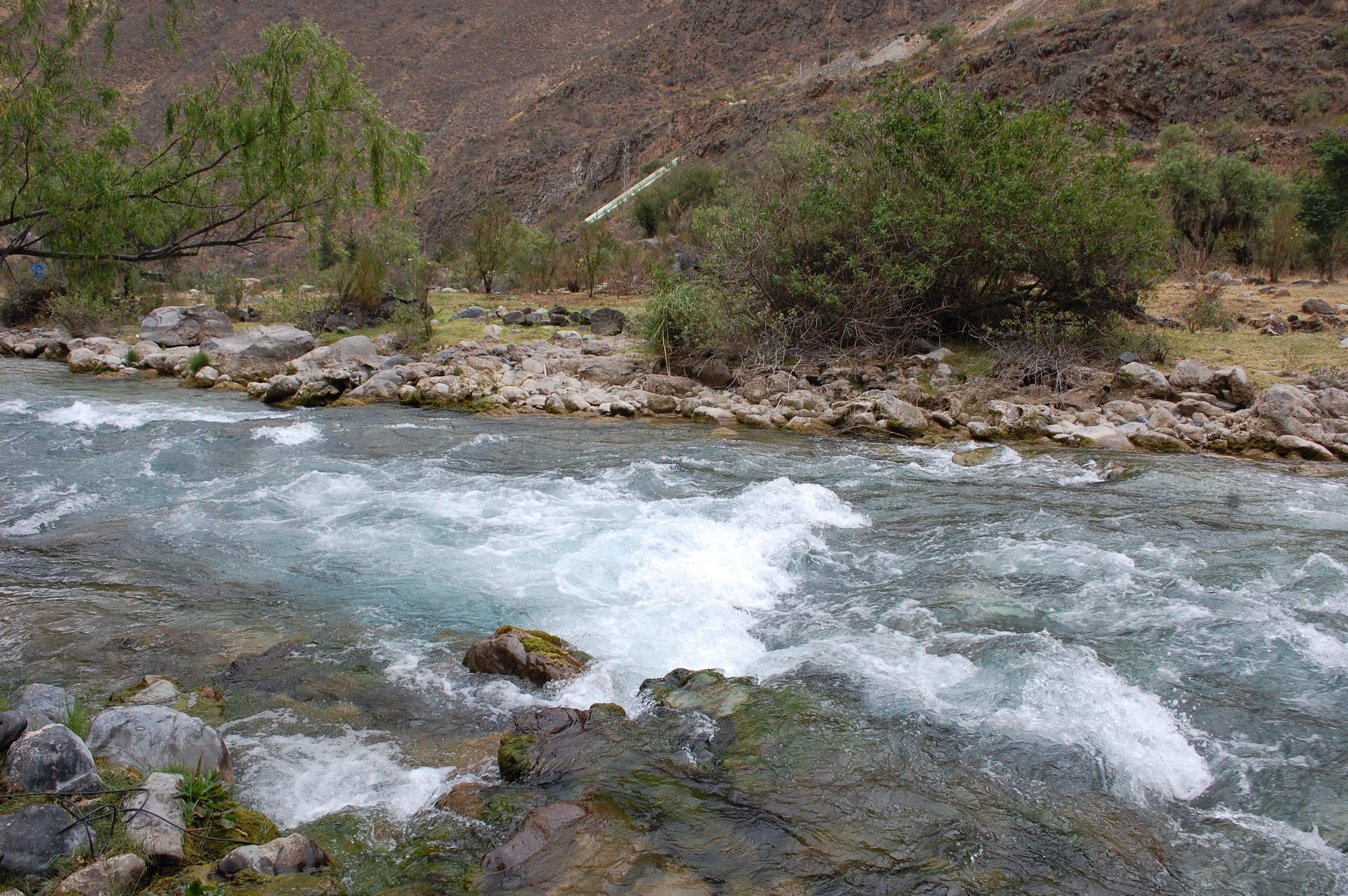 Site RC11 - the study site. (November 2019) (John Forrest)
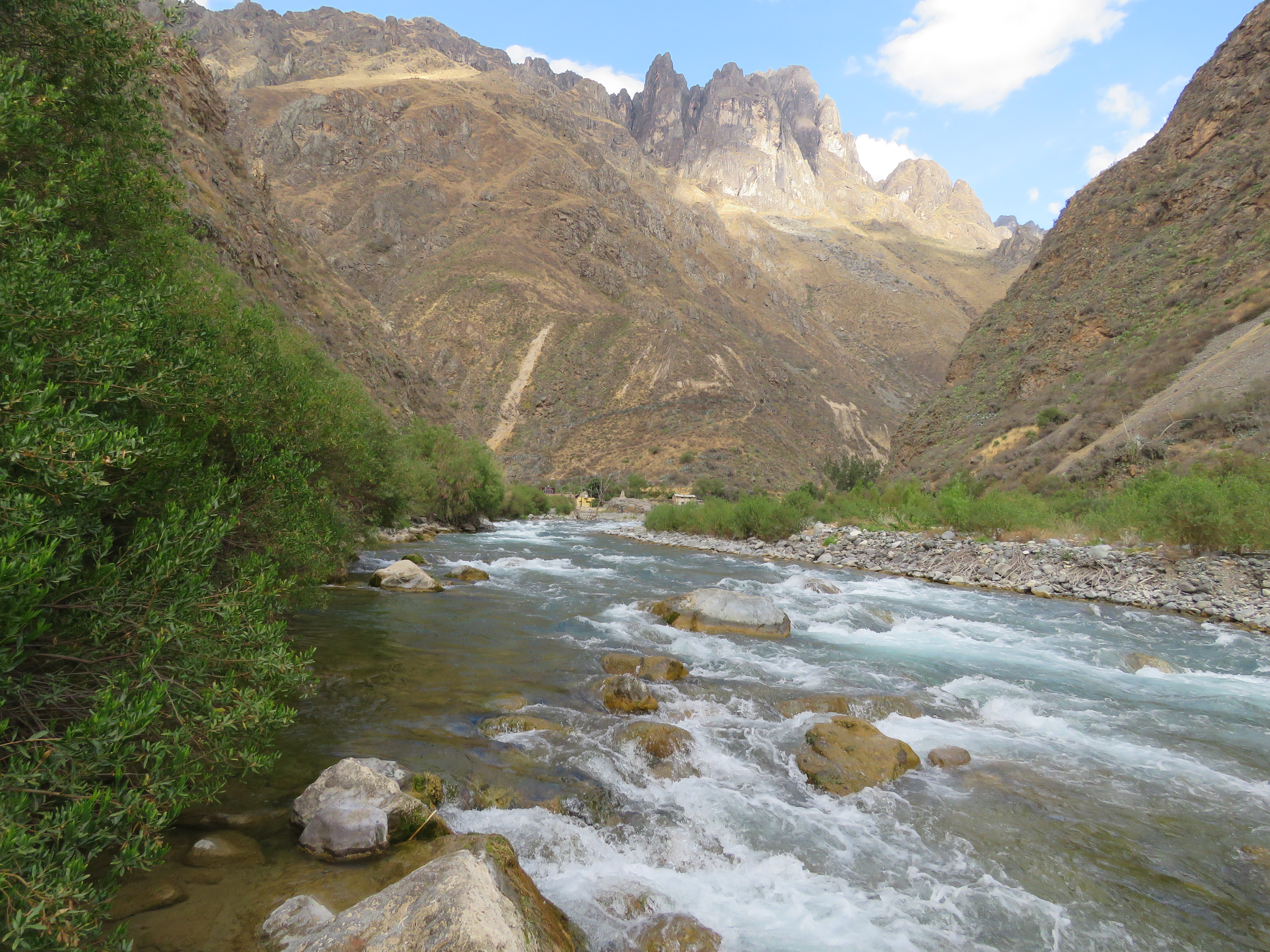 Site RC11 - View upstream. (November 2019) (John Forrest)
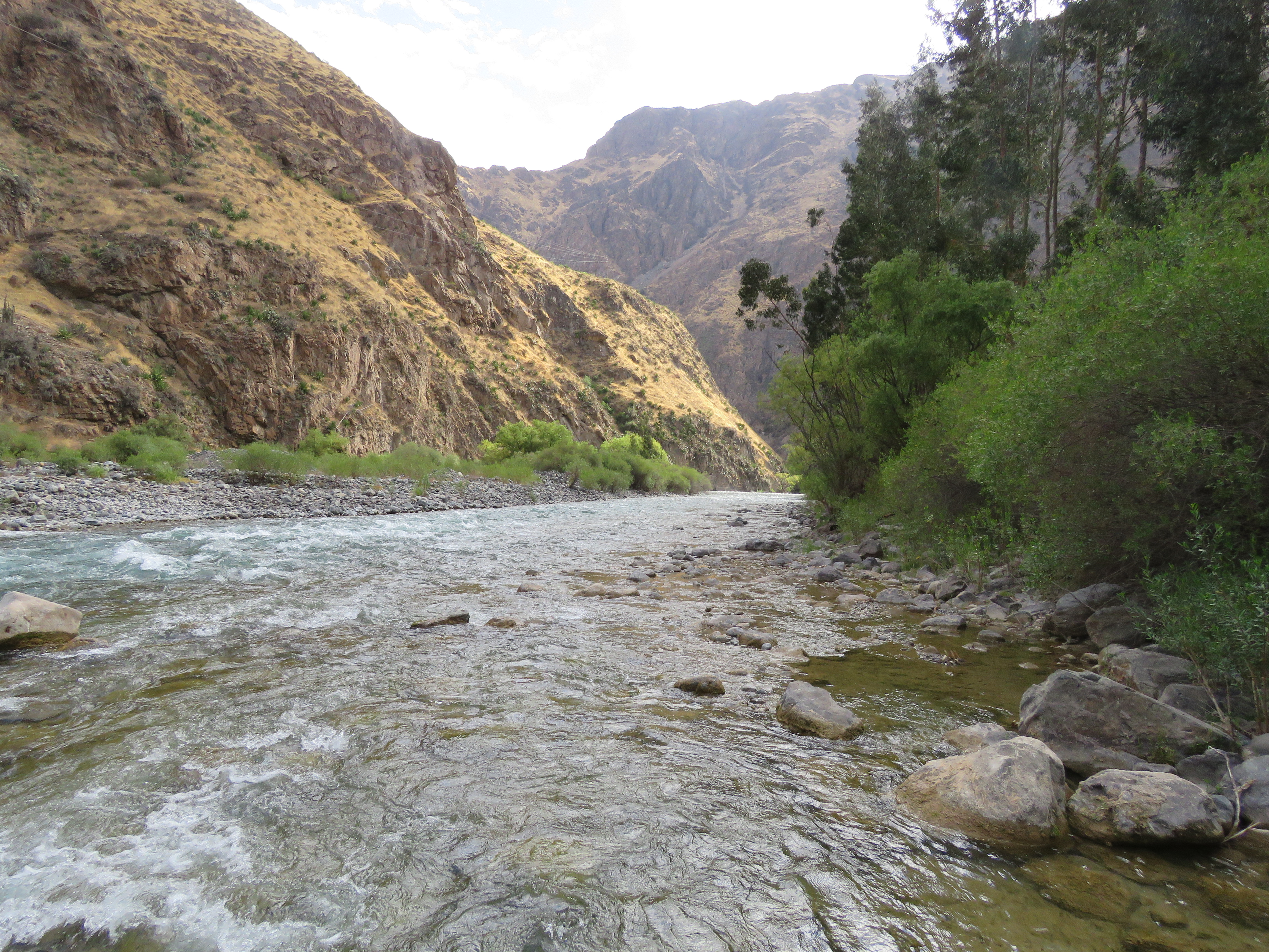 Site RC11 - View downstream. (November 2019) (John Forrest)