RC01 - Herbay Alto
Site Code: RC01. GPS: S13°12433, W76°347125. Elevation: 66m asl.
Water Quality Data
The following river and water quality data was collected from this site:
| RC01 | July 2019 | November 2019 | November 2021 | June 2022 |
|---|---|---|---|---|
| Season: | Austral Winter | Austral Summer | Austral Summer | Austral Winter |
| Date: | 9.07.19 | 17.11.19 | 8.11.21 | 25.6.22 |
| Time: | 11.15 | 13.15 | 9.15 | 13.00 |
| Width (m) | 39.0 | 33.0 | 21.0 | 20.6 |
| Depth (Av.) (m) | 0.27 | 0.21 | 0.30 | 1.10 |
| CSA (Av.) (m²) | 10.58 | 6.86 | 6.22 | 22.66 |
| Velocity (Av.) (m/s) | 0.48 | 0.36 | 0.46 | 0.50 |
| Discharge (Av.) (m³/s) | 5.07 | 2.50 | 2.86 | 11.33 |
| Riverbed sediment | Cobbles & Boulders | Cobbles & Boulders | Cobbles & Boulders | Cobbles & Boulders |
| Temp. (Atmospheric) (°C) | 19 | 25 | 20 | 19.75 |
| Temp. (Water) (°C) | 19.1 | 22.6 | 20.6 | 21.2 |
| Atmospheric pressure (mbar) | 1008 | 1000 | 1015 | 1018 |
| Dissolved oxygen (mg/l) | 6.82 | 8.35 | 8.46 | 11.32 |
| Dissolved oxygen (%) | 73.8 | 97.5 | 94.6 | 126.5 |
| pH | 8.58 | 8.10 | 8.53 | |
| Conductivity (µS/cm) | 459 | 555 | 609 | 548 |
| Total Dissolved Solids (ppm) | 230 | 277 | 305 | 274 |
| ORP (mV) | 352.3 | 169.2 | 135.2 | 126.8 |
| Turbidity | Clear: slightly green | Slight greenish colouration | Clear: slightly cloudy | Greenish |
| Alkalinity (mg/l CaCO₃) | 122 (1.6N) | 121 (1.6N) | 154 (1.6N) | 127 (1.6N) |
| Alkalinity Tester (ppm CaCO₃) | - | - | - | 123 |
Data Analysis
A significantly higher discharge was recorded in November 2021 which could reflect the early onset of rains in the headwaters combined with less water being abstracted for irrigation and the Cañete urban area, as well as or instead of more water being released by the El Platanal scheme.
It is the case that the amount of dissolved oxygen expected at 100% saturation at sea level and at 20°C would be 9.03 mg/l or slightly less as the site is at 300m asl. At 6.82 mg/l in July 2019 the DO reading is low with water temperatures at around 19°C, but within the tolerances of most higher order invertebrates. The higher November DO data represents a level of super-saturation with water temperatures at around 21°C. High concentrations of nutrients (particularly phosphorus and nitrogen) fuel algae blooms, which initially boosts dissolved oxygen levels but then rapidly reduce DO. When the algae die, bacterial decomposition spikes, using up most or all of the dissolved oxygen available. This creates an anoxic, or oxygen-depleted, environment where few organisms survive. Such nutrient levels can occur naturally but are more often caused by pollution from fertilizer runoff or poorly treated waste waters which could apply to this site below Herbay Alto. At these recorded levels, denitrification takes place as bacteria use nitrates to decompose organic matter. These conditions are referred to as ‘dead zones’ and are often found near larger human populations in estuaries and coastal zones.
The range of conductivity readings at this site (459-609 µS/cm) suggests some contamination from waste waters and agricultural runoff, especially the figure for November 2021. This is, however, lower than that found at RC00a or b, where sewage and agricultural waste would be expected to raise conductivity. Generally, agricultural runoff and sewage will increase conductivity due to the additional chloride, phosphate, and nitrate ions.
The average pH of 8.4 is as expected and falls within the tolerances of most aquatic vertebrates and invertebrates.
Site Description
Site RC01 is flanked by intensively farmed lands on riverine terraces irrigated by waters extracted from the river at several points higher up. The settlement of Herbay Alto is located atop a high riverine terrace on the south side of the channel.
The channel flow is highly variable from the dry to wet season and from year to year, especially in El Niño years when the valley may be subject to major flooding. However, the river holds water year-round, unlike many rivers entering the coastal plain along the west flank of Peru. More generally water levels are a function of the levels of abstraction for agriculture and urban demands. The chnnale is braided and made up largely of cobbles and some small boulders.
The banks are lined with extensive river cane, scattered acacia and stands of stunted willow. This area is designated as a ‘bosque de proteccion’ affording some degree of protection to this relictual area of natural vegetation. This area is an important reserve for populations of Slender-billed Finch, a near threatened species with a limited distribution from northern Chile to the rio Cañete, in Peru. This area also holds populations of mountain Parakeet and endemic Black-necked Woodpecker.
There is little or no natural vegetation remaining in the lower valley away from the banks and much of what was open desert on the coastal plain has been irrigated and is now highly productive agricultural lands. The production of avocado dominates along with viticulture, ajo (garlic), aji (peppers) together with limited areas of apple, pear, and citrus orchards. There are smaller areas of sugar cane, a crop which dominates land use further north. The water quality in the river at lower elevations is impacted by agricultural run-off and sewage disposal. The wider environment and fauna in the valley are largely determined by agriculture with many species expanding their range and abundance to occupy newly created agricultural lands. Desert fauna and flora has decreased accordingly.
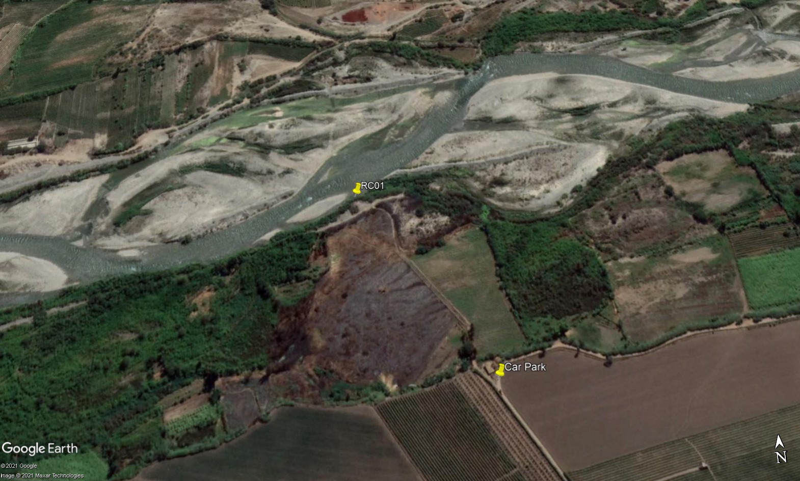 Site RC01 - Study site location: below the village of Herbay Alto.
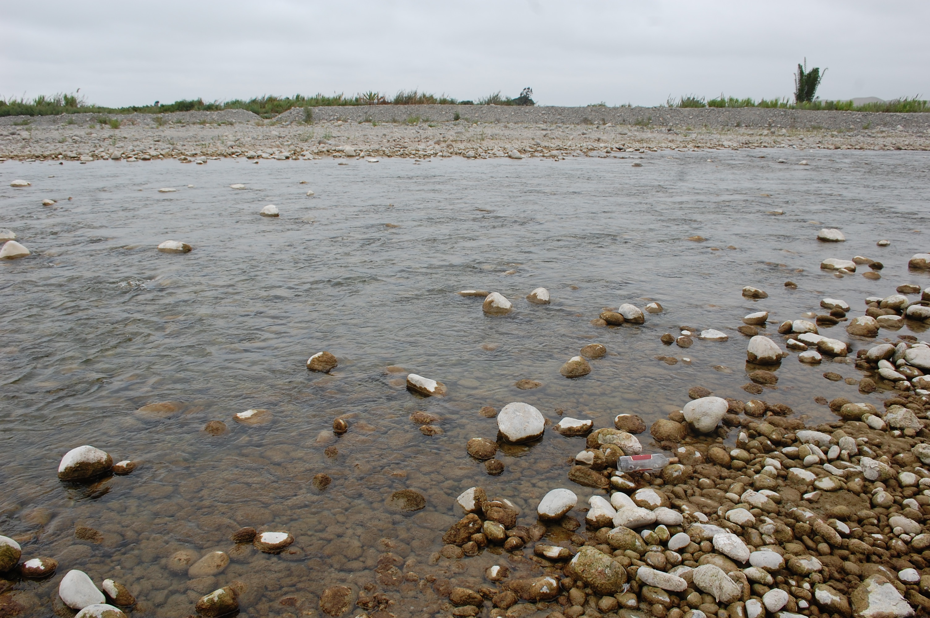 Site RC01 - the study site. (November 2019) (John Forrest)
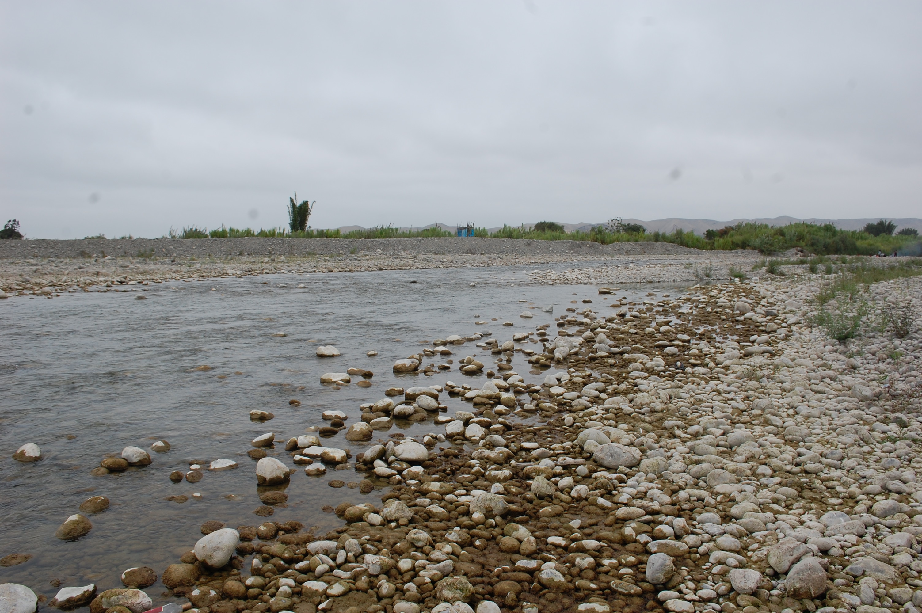 Site RC01 - View upstream. (November 2019) (John Forrest)
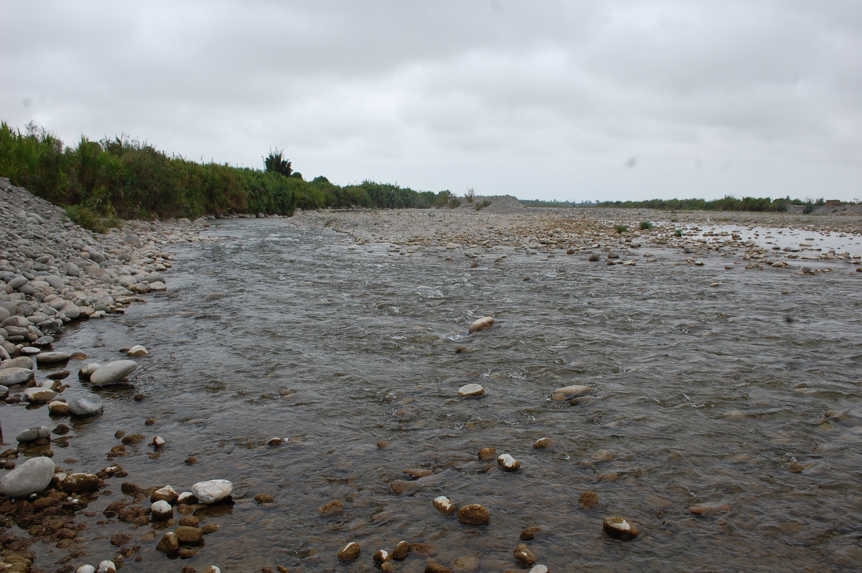 Site RC01 - View downstream. (November 2019) (John Forrest)