RT08A - Lower Laraos
Site Code: RT08A. GPS: S12°33656, W75°825343. Elevation: 2924m asl.
Water Quality Data
The following river and water quality data was collected from this site:
| RT08A | July 2019 | November 2019 | November 2021 | June 2022 |
|---|---|---|---|---|
| Season: | Austral Winter | Austral Summer | Austral Summer | Austral Winter |
| Date: | 11.07.2019 | 20.11.2019 | 15.11.2021 | 28.6.22 |
| Time: | 12.30 | 11.00 | 10.15 | 11.15 |
| Width (m) | 3.0 | 3.0 | 3.4 | 4.6 |
| Depth (Av.) (m) | 0.11 | 0.16 | 0.28 | 0.19 |
| CSA (Av.) (m²) | 0.34 | 0.47 | 0.96 | 0.88 |
| Velocity (Av.) (m/s) | 0.65 | 0.34 | 0.44 | 1.11 |
| Discharge (Av.) (m³/s) | 0.221 | 0.161 | 0.420 | 0.970 |
| Riverbed sediment | Gravel, cobbles & boulders | Cobbles & Boulders | Mainly Cobbles | Cobbles & Boulders |
| Temp. (Atmospheric) (°C) | 12 | 23 | 20 | 22 |
| Temp. (Water) (°C) | 11.93 | 12.85 | 12.28 | 12.22 |
| Atmospheric pressure (mbar) | 697 | 726 | 624 | |
| Dissolved oxygen (mg/l) | 5.24 | 3.99 | 6.71 | 6.95 |
| Dissolved oxygen (%) | 67.3 | 63.3 | 87.2 | 106.1 |
| pH | 8.68 | 8.33 | 8.43 | |
| Conductivity (µS/cm) | 263 | 296 | 371 | 272 |
| Total Dissolved Solids (ppm) | 132 | 148 | 186 | 136 |
| ORP (mV) | 350.2 | 123.6 | 146.1 | 156.2 |
| Turbidity | Slightly turbid | Clear: | Clear: | Clear: |
| Alkalinity (mg/l CaCO₃) | 119 (1.6N) | - | 110 (1.6N) | 120 (1.6N) |
| Alkalinity Tester (ppm/ CaCO₃) | - | - | - | 102 |
Data Analysis
Discharge at this point along the Rio Laraos is always low. It is a small tributary and significant water abstraction takes place for the small town of Laraos and the irrigation of extensive Andenes (terraced hillsides) above the site. An additional factor is that a significant quatity of any rainfall in the headwaters is retained in a natural reservoir immediately above Laraos (Laraos sits atop a terminal moraine) which helps to control the river flow throughout the year.
At just over 2900m asl the DO readings at RT08A fall within the range to be expected for both July and November data sets. During the day, atmospheric temperatures are often much higher than water temperatures which vary little on a diurnal basis. The latter can account for the limited reductions in DO levels.
The conductivity readings at this site (263-371 µS/cm) are as expected for a sub-catchment at this elevation.
Average pH readings of about 8.5 are as expected. At these levels the alkalinity of the river is highly suitable for aquatic life and indicative of clean water.
Site Description
Site RT08A lies in the Rio Laraos valley at 2914m asl and just above the confluence with the Rio Cañete. It is located in the temperate zone, above the HEP station, in a picturesque section of the valley. The valley at this point is narrow with a v-shaped profile and a narrow flood-plain. River flow in the Rio Laraos is year-round but delivers a minimal input to the Rio Cañete. This is probably because water abstraction is significant for the settlement of Laraos and the extensive terraces downstream of it.
The study site is dominated by alders, agaves, and tall natural scrub. Above the narrow flood plain, the valley sides are similar to RC11 and all the observations made for that site apply to RT08A as it is only 100 metres away.
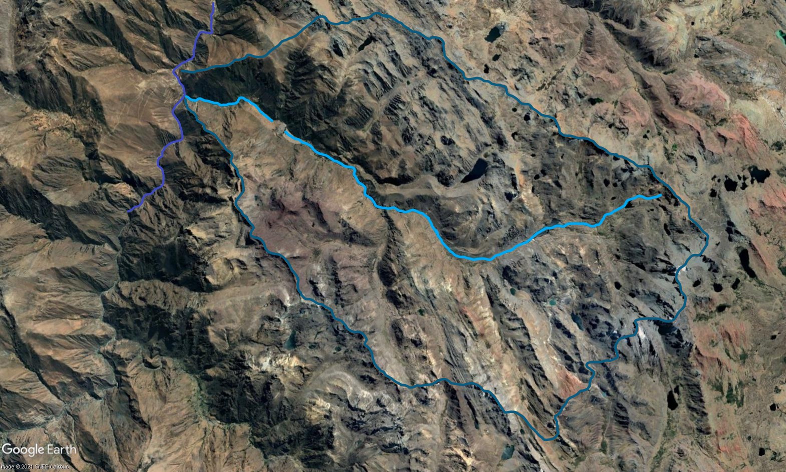 Tributary 08 - the Laraos subcatchment. (Eustace Barnes)
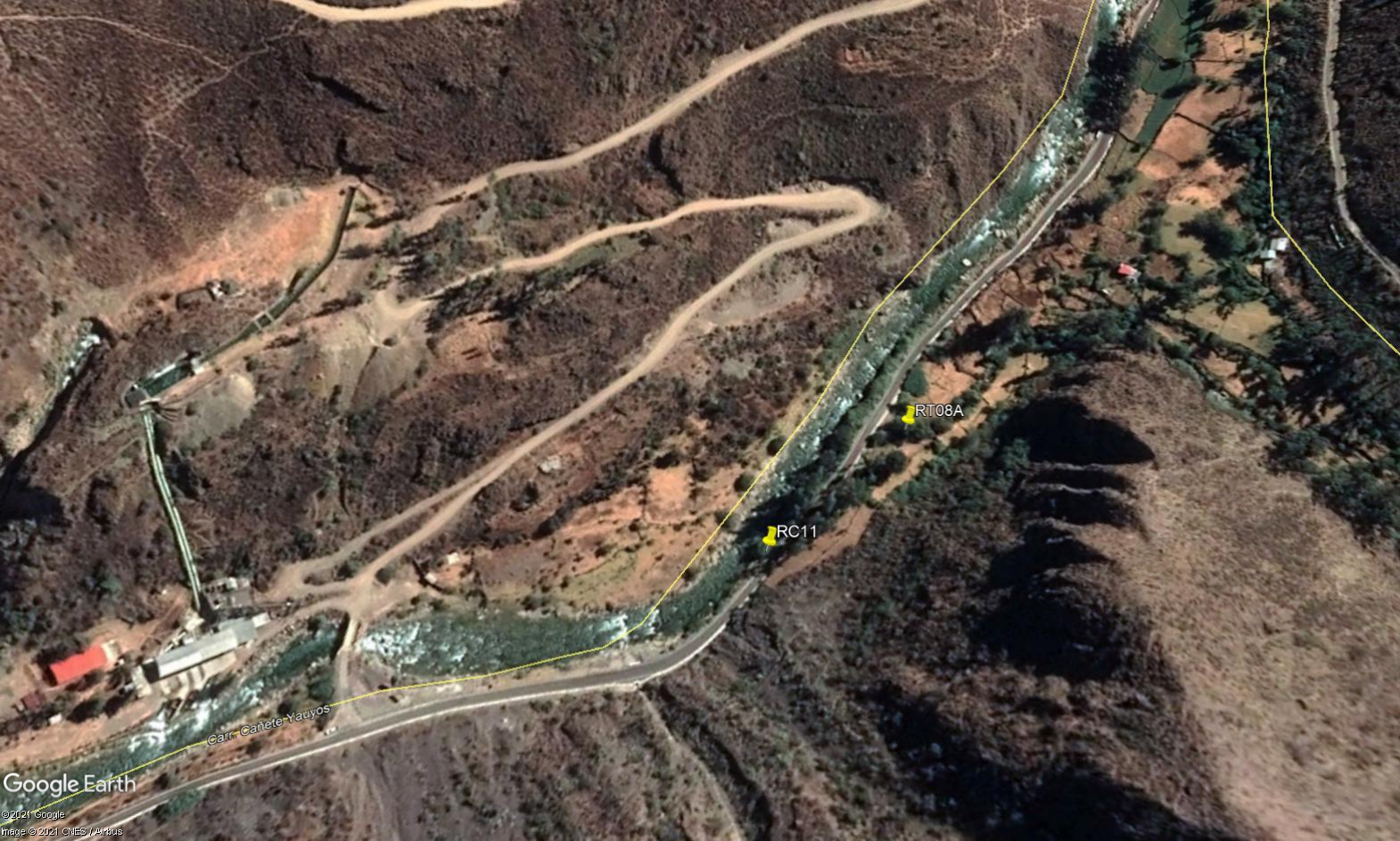 Site RT08A - the study site location: just beside the main valley highway. (John Forrest)
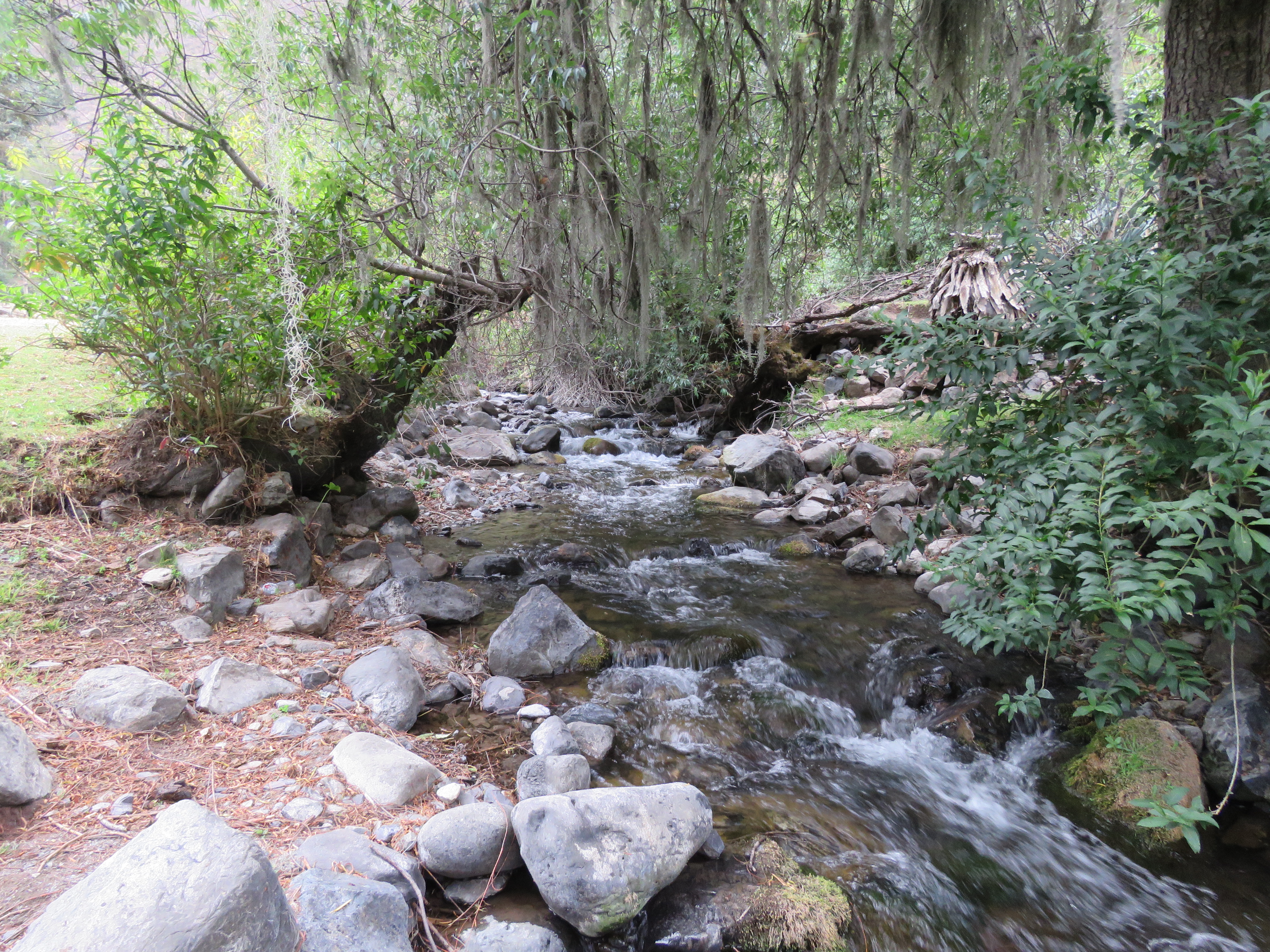 Site RT08A - the study site. (July 2019) (John Forrest)
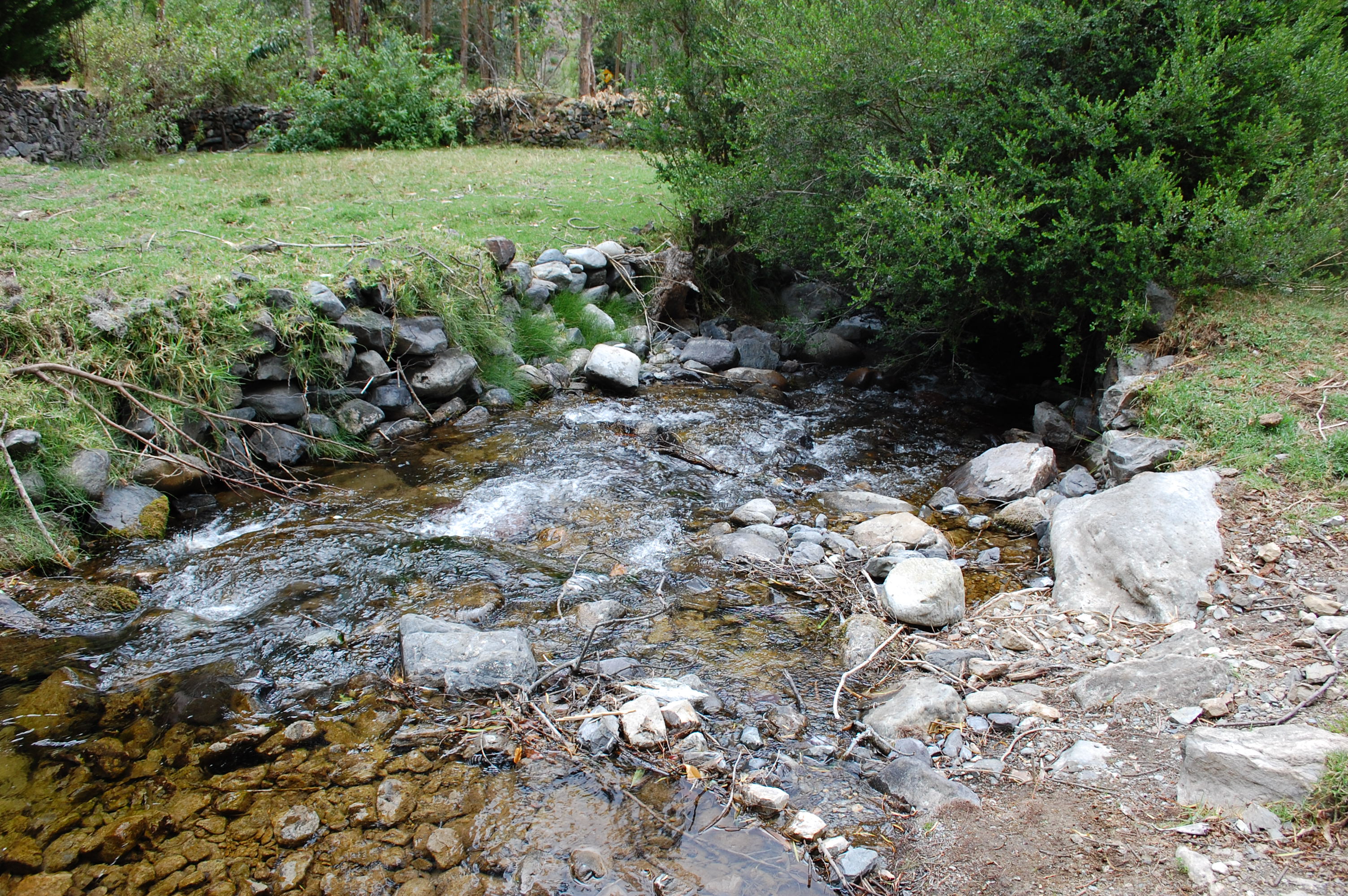 Site RT08A - View upstream from the study site. (July 2019) (John Forrest)