RC15A - Puente Vilca
Site Code: RC15A. GPS: S12°12978, W75°818722. Elevation: 3822m asl.
Water Quality Data
The following river and water quality data was collected from this site:
| RC15A | November 2019 | November 2021 | July 2022 |
|---|---|---|---|
| Season: | Austral Summer | Austral Summer | Austral Winter |
| Date: | 22.11.19 | 21.11.21 | 3.7.22 |
| Time: | 9.00 | 11.00 | 9.45 |
| Width (m) | 27.0 | 27.0 | 14.0 |
| Depth (Av.) (m) | 0.58 | 0.58 | 0.31 |
| CSA (Av.) (m²) | 15.66 | 15.67 | 4.38 |
| Velocity (Av.) (m/s) | 1.45 | 1.46 | 0.60 |
| Discharge (Av.) (m³/s) | 22.754 | 22.770 | 2.629 |
| Riverbed sediment | Gravel, cobbles & small boulders | Mainly cobbles | Mainly pebbles |
| Temp. (Atmospheric) (°C) | 11 | 11 | 9 |
| Temp. (Water) (°C) | 11.43 | 11.97 | 5.65 |
| Atmospheric pressure (mbar) | 678 | (<600) | <600 |
| Dissolved oxygen (mg/l) | 3.56 | 5.42 | 5.91 |
| Dissolved oxygen (%) | 50.50 | 78.25 | 86.93 |
| pH | 8.45 | 8.21 | 8.20 |
| Conductivity (µS/cm) | 410 | 528 | 530 |
| Total Dissolved Solids (ppm) | 205 | 264 | 265 |
| ORP (mV) | 126.2 | 66.5 | 91.93 |
| Turbidity | Clear: | Clear: | Clear: |
| Alkalinity (mg/l CaCO₃) | - | 165 (1.6N) | 178 (1.6N) |
| Alkalinity Field Tester (ppm CaCO₃) | - | - | 154 |
Data Analysis
Discharge at this point along the Rio Cañete is high at over 22 m³/s in the Summer but significantly less in the Winter. The fluctuations in discharge throughout the catchment reflect variations in precipitation and in the operations of the El Platanal hydro-electric plant (HEP) with respect to the release of water from the upper reservoir (Pucaracocha). High discharge figures in November probably reflect the onset of the seasonal rains and the release of water from the HEP dam while the July figure reflects reduced rainfall and the storage of water at the HEP upstream.
At almost 3800m asl the DO readings at RC15A fall within the range to be expected. It again follows the pattern in which DO readings slowly fall as elevation increases. The measurements for conductivity and total solids are fairly high, which probably reflects local geological conditions and weathering processes in the river channel, but this is yet to be determined. At these levels of conductivity and total solids, water quality is good.
The pH readings of above 8.0 are as expected for a clean river and appropriate for most forms of aquatic life.
As the population density above Puente Vilca is very low, the impact of anthropic activity is minimal. There is some mainly pastoral agriculture associated with the village of Vilca.
Site Descriptions
Site RC15A lies in the arid temperate zone well above the town of Huancaya at 3877m asl. At this point the valley has a U-shaped profile and is shallower. This reflects the fact that we are reaching the headwaters and clearly glaciated landscapes. The channel gradient is also broken by a series of lakes, marshy areas and bofedales. The bed load in the river channel is mainly comprised of gravels, pebbles and smaller boulders. The site is located at a bridge which partially dams the river creating a small lake behind it. Three tunnels permit water to drain from the lake. Totora beds occupy much of the lake immediately upstream from the bridge.
There is no agricultural activity in the valley or on the valley sides. Otherwise, extensive pastoralism dominates rural land use throughout the headwater areas.
At these elevations the fauna and flora are now more typical of the high Andes. Andean Goose, Yellow-billed Teal, Yellow-billed Pintail, Puna Teal, Andean Coot, Spot-winged Pigeon, Black-winged Ground Dove and Mountain Caracara are now commonly observed.
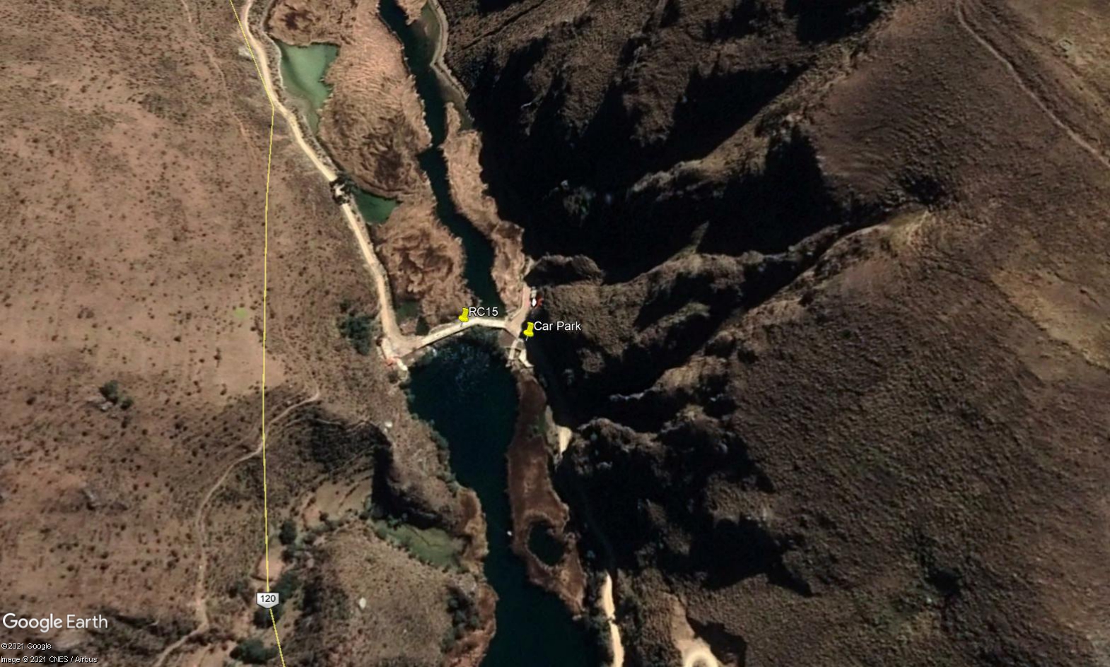 Site RC15A - Study site location: lake outflow.
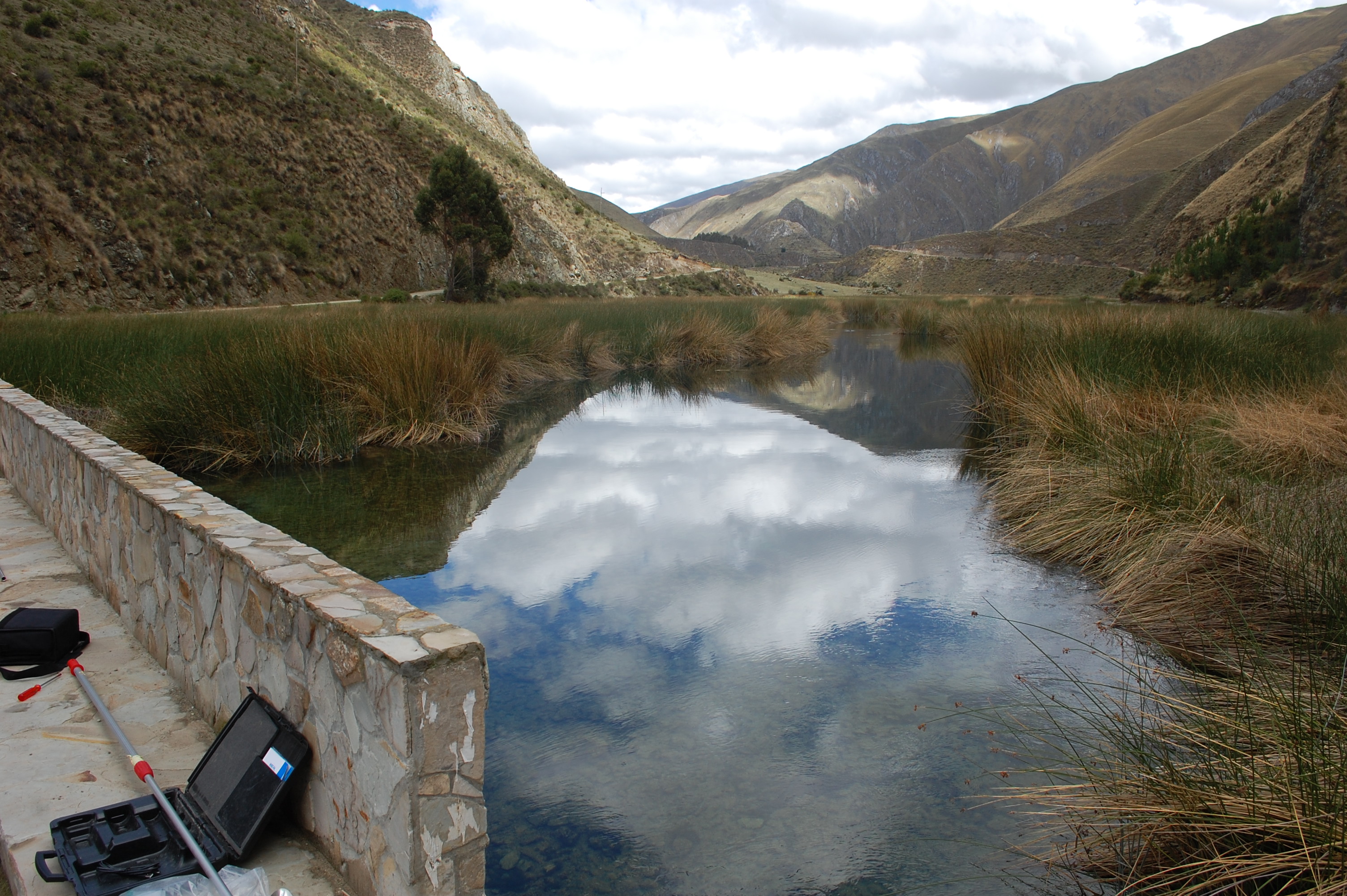 Site RC15A - the study site & view upstream. (November 2019) (John Forrest)
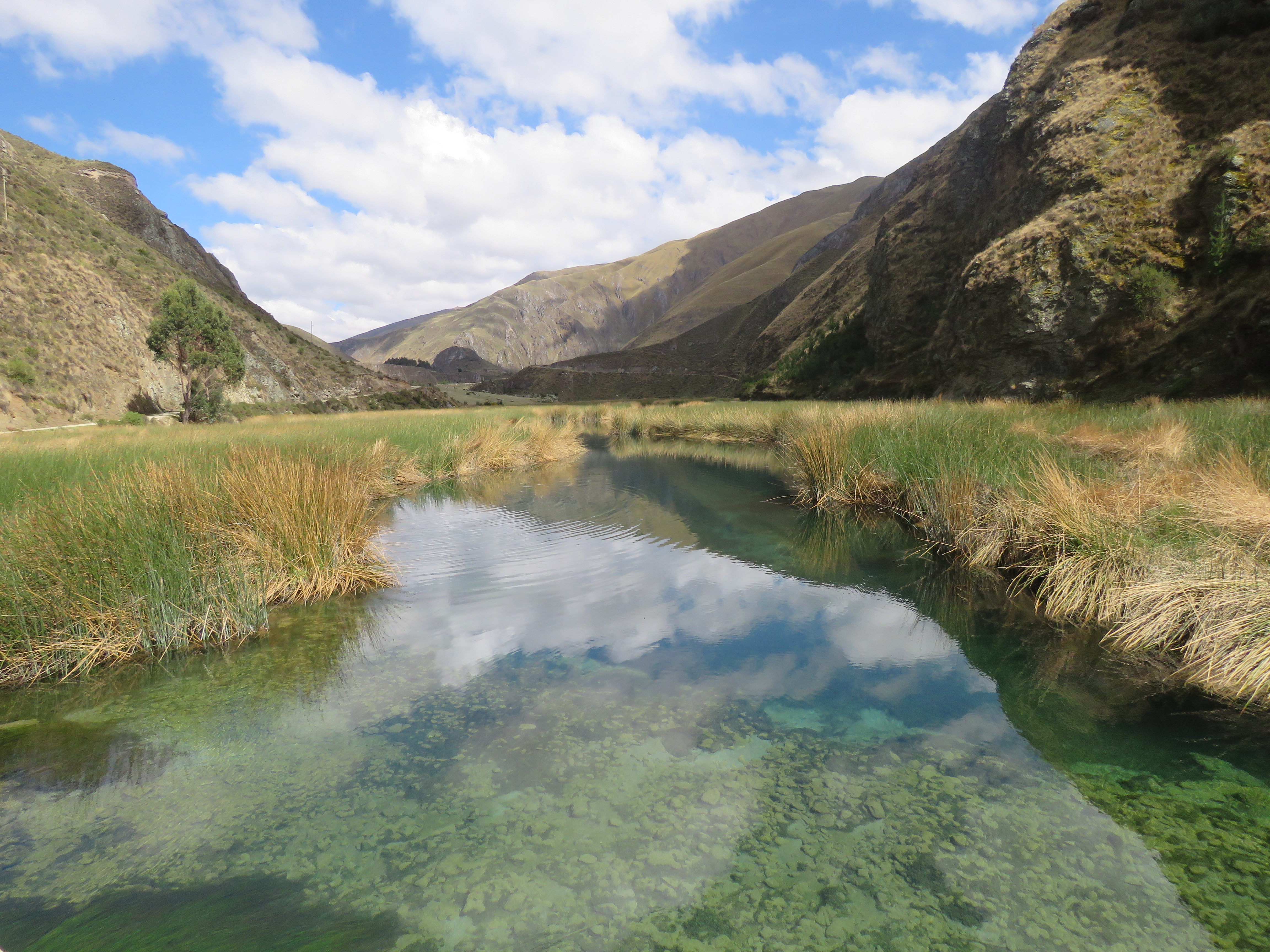 Site RC15A - View upstream. (November 2019) (John Forrest)
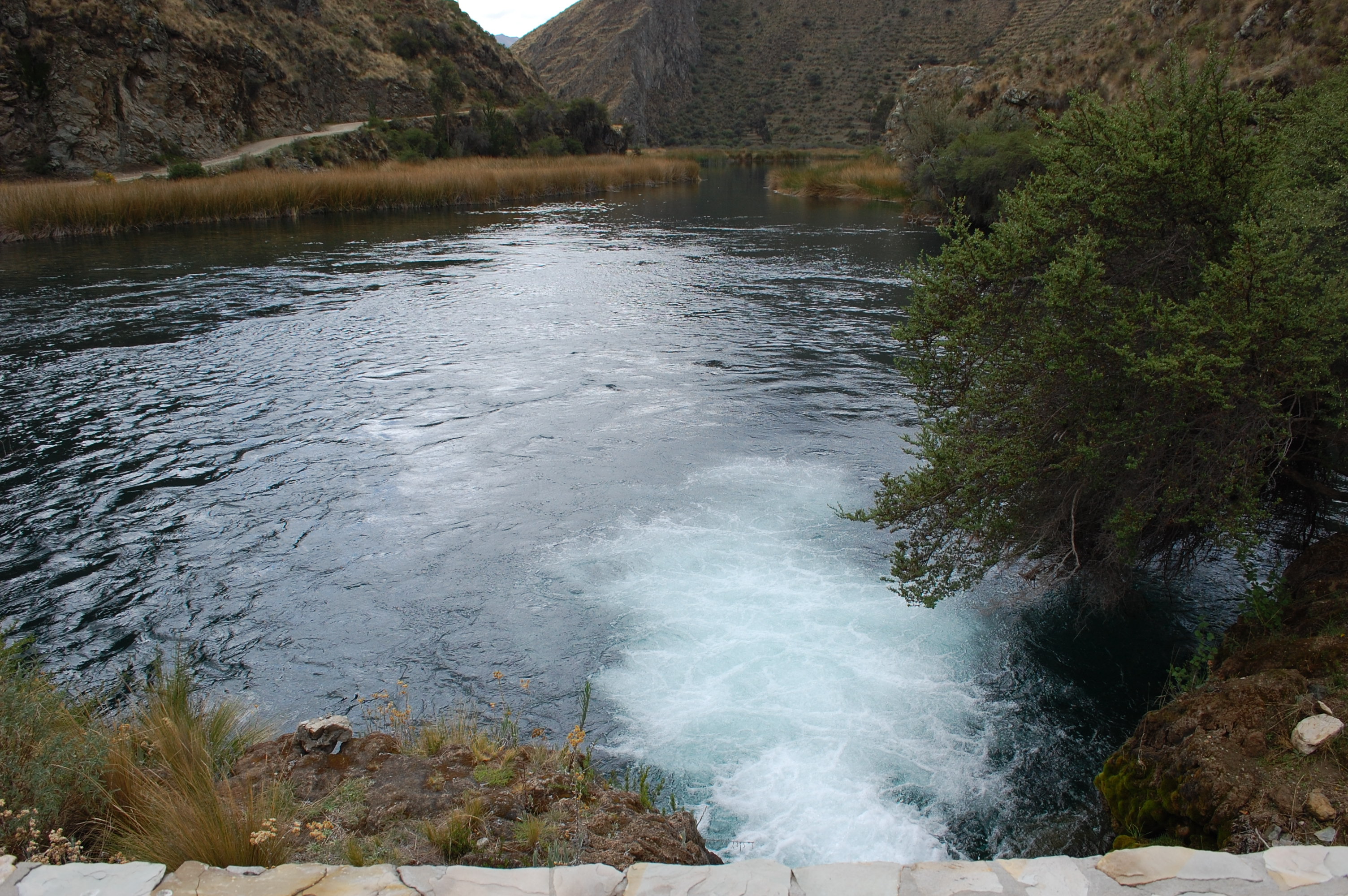 Site RC15A - View downstream. (November 2019) (John Forrest)