RC16 - Above Tanta
Site Code: RC16. GPS: S12°12428, W76°0141. Elevation: 4275m asl.
Water Quality Data
The following river and water quality data was collected from this site:
| RC16 | November 2019 | November 2021 | June 2022 |
|---|---|---|---|
| Season: | Austral Summer | Austral Summer | Austral Winter |
| Date: | 22.11.19 | 21.11.21 | 3.7.22 |
| Time: | 12.00 | 12.50 | 14.30 |
| Width (m) | 17.0 | 13.0 | 10.6 |
| Depth (Av.) (m) | 0.06 | 0.35 | 0.14 |
| CSA (Av.) (m²) | 1.07 | 4.55 | 1.48 |
| Velocity (Av.) (m/s) | 0.11 | 0.75 | 0.25 |
| Discharge (Av.) (m³/s) | 0.112 | 3.413 | 0.374 |
| Riverbed sediment | Cobbles & Boulders | Mainly cobbles | Pebbles, Cobbles & Boulders |
| Temp. (Atmospheric) (°C) | 9 | 15 | 14 |
| Temp. (Water) (°C) | 8.50 | 14.85 | 12.26 |
| Atmospheric pressure (mbar) | 659 | (<600) | <600 |
| Dissolved oxygen (mg/l) | 3.10 | 4.83 | 6.02 |
| Dissolved oxygen (%) | 52.07 | 81.66 | 94.75 |
| pH | 8.44 | 8.25 | 8.26 |
| Conductivity (µS/cm) | 132 | 106 | 147 |
| Total Dissolved Solids (pp8) | 66 | 54 | 74 |
| ORP (mV) | 136.7 | 92.3 | 122.0 |
| Turbidity | Clear: | Clear: | Clear: greyish |
| Alkalinity (mg/l CaCO₃) | - | 44 (1.6N) | 74 (1.6N) |
| Alkalinity Field Tester (ppm CaCO₃) | - | - | 57 |
Data Analysis
Discharge for the Rio Cañete at this point is fed by a series of bofedales located beneath the remaining glaciers higher up the valley. This generates a consistent discharge of below one cumec. However, subsequent to heavy rainfall or sudden snow melt higher up the valley there may be a major increase as in November 2021 though this may well be a significant over-estimate of the discharge at this time.
At nearly 4300m asl the DO readings at RC16 fall within the range to be expected. They again follow the pattern in which DO readings slowly fall as elevation increases. The measurements for conductivity and total solids are low, reflecting the fact that channel flow is derived from bofedales where the water has been filtered.
The pH readings of well over 8.0 are as expected for a clean river and appropriate for most forms of aquatic life.
As there is only a low population density above this point in the headwaters anthropic impact is low. There is some pastoral agriculture associated with the town of Tanta, principally the keeping of large herds of alpcas, llamas and sheep on the surrounding bofedales which is more intensive close to the town.
.jpg)
Site RC16 - satellite image of Tanta village - the study site is located below the bofedal, just above the village.
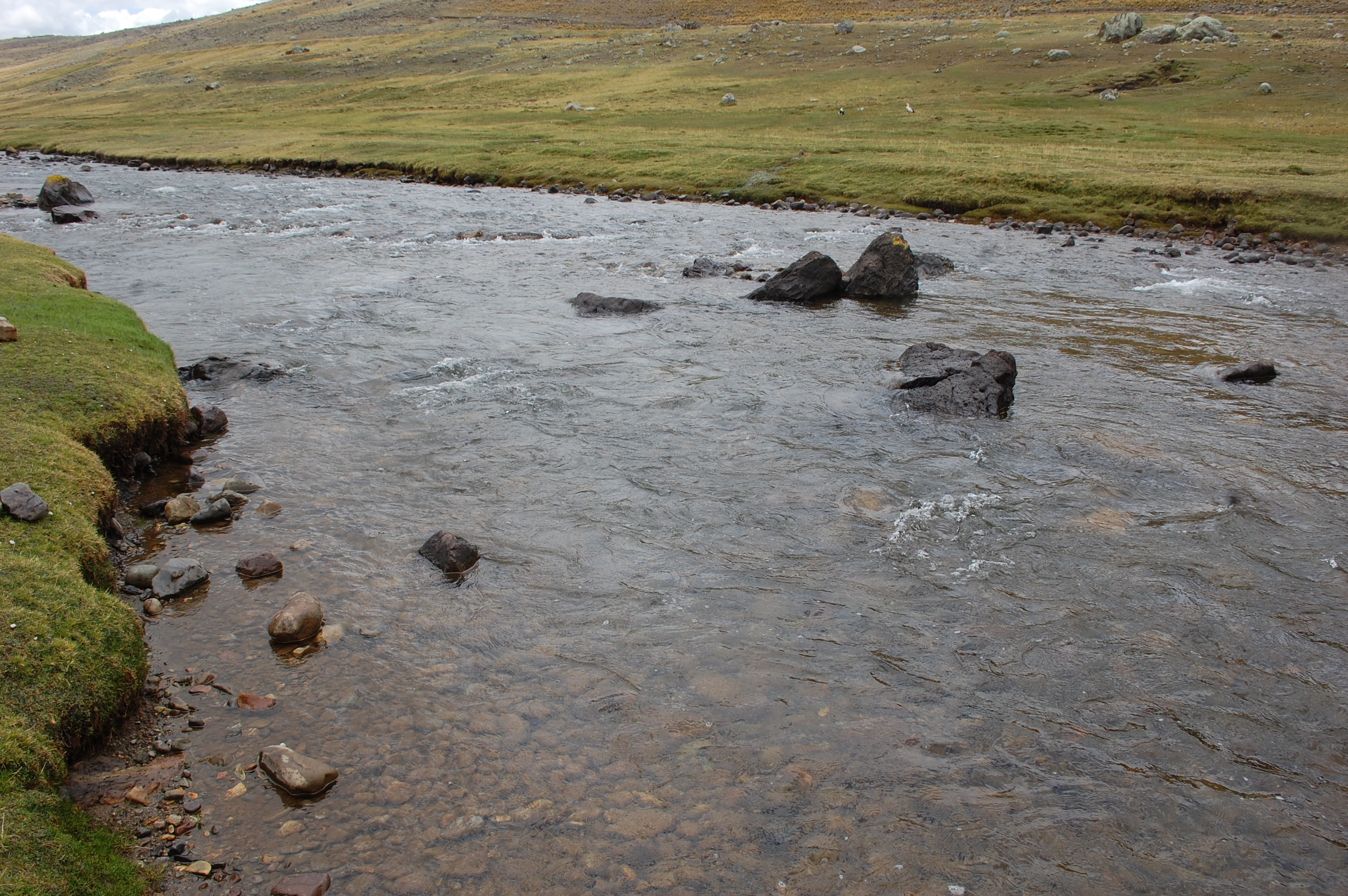 Site RC16 - the study site. (November 2019) (John Forrest)
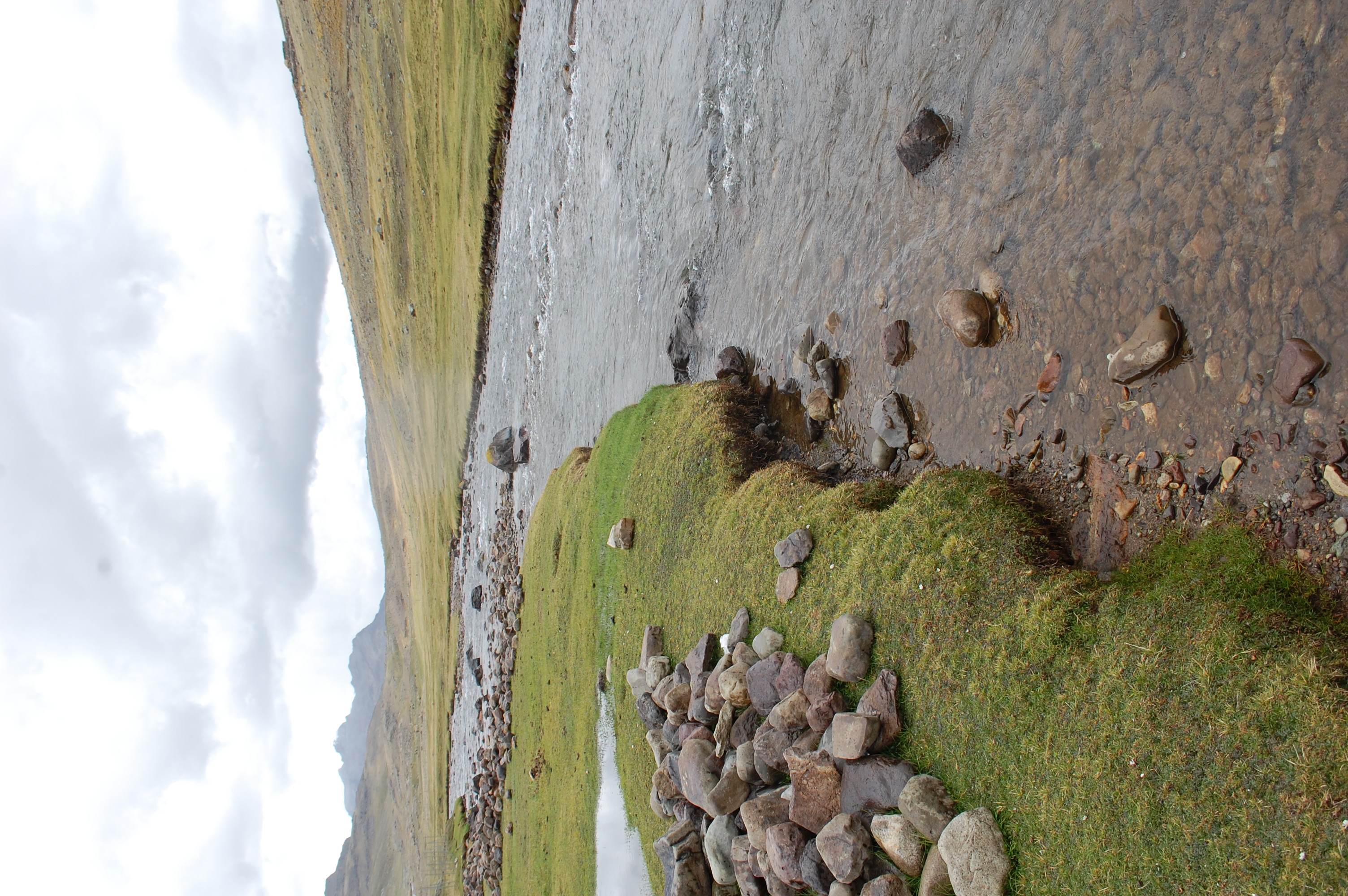 Site RC16 - the study site, view upstream. (November 2019) (John Forrest)
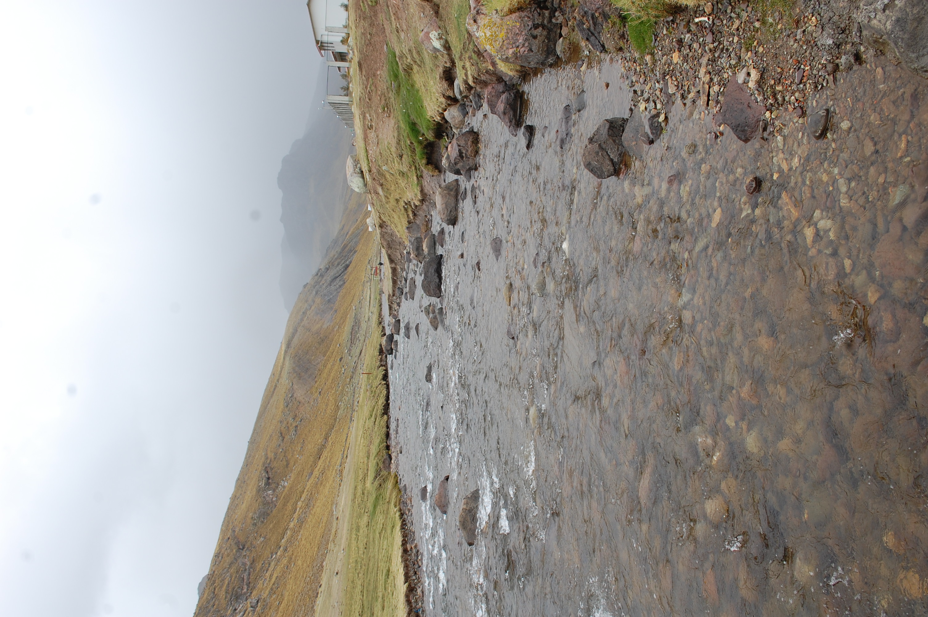 Site RC16 - the study site, view downstream. (November 2019) (John Forrest)
Site description
Site RC16 lies in the puna zone above the small town of Tanta at 4275m asl. At this point the valley has a U-shaped profile typical of glaciated landscapes and is dominated by the nearby snow-covered peaks and valley bofedales. The bed load in the river channel is comprised of fluvio-glacial boulders, pebbles, gravels, and sands. The river flow in the Rio Cañete is year-round.
There is no agricultural cultivation taking place, with pastoralism dominating rural land use. This area was always been a transhumance focal point and would have been more densely populated during the Inca empire and earlier. The principal anthropic impacts at this site would be overgrazing and the cutting of peat from the bofedales. The latter is always a destructive process, impacting negatively on water availability and quality as well as soil erosion and flood risk and thus, is another practice best avoided.
The flora and fauna at this elevation is dominated by high elevation components and communities. In addition to those species mentioned so far, the bofedale habitats also support a highly specialised fauna. This might include Puna Tinamou, Rufous-bellied Seedsnipe, Diademed Sandpiper-Plover, White-bellied Cinclodes, Olivaceous Thornbill, Black-breasted Hillstar and Dark-winged Miner along with other Furnarids and Tyrannids. The biodiversity of these bofedales is the subject of on-going investigation.