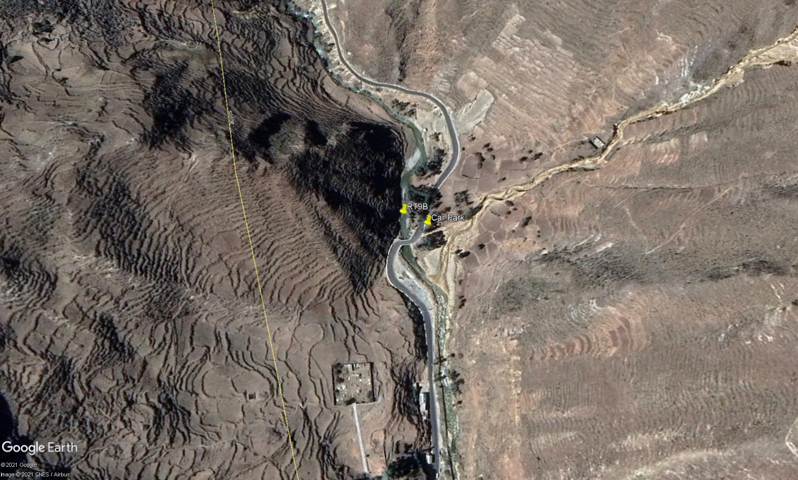
RT09B - Middle Alis (Above Puente Huancachi)
Site Code: RT09B. GPS: S12°25671, W75°715075. Elevation: 3750m asl.
Water Quality Data
The following river and water quality data was collected from this site:
| RT09B | November 2019 | November 2021 | March 2022 | June 2022 |
|---|---|---|---|---|
| Season: | Austral Summer | Austral Summer | Austral Summer | Austral Winter |
| Date: | 21.11.2019 | 17.11.21 | 28.3.2022 | 29.6.22 |
| Time: | 16.45 | 11.15 | 12.00 | 14.30 |
| Width (m) | 13.0 | 7.5 | 8.00 | 10.0 |
| Depth (Av.) (m) | 0.11 | 0.14 | 0.18 | 0.13 |
| CSA (Av.) (m²) | 1.40 | 1.03 | 1.44 | 1.30 |
| Velocity (Av.) (m/s) | 0.66 | 0.65 | 0.75 | 0.81 |
| Discharge (Av.) (m³/s) | 0.923 | 0.673 | 1.080 | 1.049 |
| Riverbed sediment | Cobbles & Boulders | Mainly Pebbles | Mainly Boulders | Mainly Pebbles |
| Temp. (Atmospheric) (°C) | 16 | 12 | 11.1 | 19.5 |
| Temp. (Water) (°C) | 10.73 | 11.11 | 9.65 | 9.72 |
| Atmospheric pressure (mbar) | 650 | 657 | <600 | |
| Dissolved oxygen (mg/l) | 3.64 | 5.41 | 4.58 | 6.69 |
| Dissolved oxygen (%) | 56.1 | 76.05 | 68.80 | 101.43 |
| pH | 8.62 | 8.27 | 8.57 | 8.48 |
| Conductivity (µS/cm) | 442 | 670 | 402 | 485 |
| Total Dissolved Solids (ppm) | 221 | 335 | 201 | 242 |
| ORP (mV) | 179.5 | 102.7 | 115.1 | 124.75 |
| Turbidity | Clear: | Clear: slightly turbid | Slightly cloudy: grey, green | Clear: slightly grey |
| Alkalinity (mg/l CaCO₃) | - | 90 (1.6N) | 141 (1.6N) | 128 (1.6N) |
| Alkalinity Tester (ppm CaCO₃) | - | - | 108 | 101 |
Data Analysis
Discharge at this point along the Rio Alis is low, especially by the end of the dry season but appears to be similar and fairly constant throughout the year.
At well over 3500m asl the DO readings at RT09B fall within the range to be expected at this elevation.
Conductivity levels are on the high side but at these levels the water quality is not poor. They may reflect local geological conditions and weathering processes, or the presence of a large mine upstream. The impact of the Yauricocha mine is not known, but it is this section of the catchment where mining is concentrated and might have an impact.
The average pH recordings at over 8.5 are as expected and appropriate for aquatic life.
Between November 2019 and November 2021 but probably during mid-2021, the channel above Puente Huancachi was deepended and the material excavated piled up along the right hand bank for approx. 100 metres upstream from the bridge. The deposited material, consequently, also narrowed the channel.
Site Description
Site RT09B lies in the arid temperate zone above the small town of Huancachi at 3689m asl. It is located in the temperate zone in the upper valley. At this point the valley retains a v-shaped profile. The classic U-shaped valley profile of glaciated uplands only appears in the uppermost sections of the headwaters and close to Mina Yauricocha. The river flow in the Rio Alis here is year-round with discharge in November perhaps still close to baseflow.
There is little or no agricultural cultivation taking place at present, with pastoralism dominating rural land use. There are extensive areas of terracing on steeper and more mesic west facing slopes. Although these slopes are largely unused nowadays, the traditional practice of burning hillsides can be clearly seen. This is a highly detrimental practice; accelerating soil erosion, reducing slope stability and reducing biodiversity. It is undertaken to promote grazing for the tiny number of goats, sheep and cattle held by subsistence farmers.
Changes in agricultural production reflecting both population declines in the early period of Hispanic colonisation and, more recently, rural drift. The riverbanks are dominated by riparian scrub and small alders with stands of Eucalypts. Above the uneven flood plain valley sides are dominated by arid scrub, with polylepis groves clinging to the sheltered watershed slopes. This site displays a fauna and flora typical of the high temperate habitats. Chiguanco Thrush, House Wren and Hooded Siskin remain. Cream-winged and White-winged Cinclodes, Striated Earthcreeper, Peruvian Sierra Finch, Plumbeous Sierra Finch, Band-tailed and Plain-coloured Seedeaters, and Black-throated Flowerpiercer are common here.
High above the settlements of Tomas and Huancachi there are areas of bofedales and polylepis groves which support populations of several rare and endangered species. Bofedales here are considered possible sites for the critically endangered White-bellied Cinclodes (Cinclodes palliatus). In these areas the critically endangered White-bellied Cinclodes may occur, along with Diademed Sandpiper-Plover (Phegornis mitchellii). These are both specialised species, whose presence is indicative of high environmental quality, as they are highly sensitive to water quality changes.
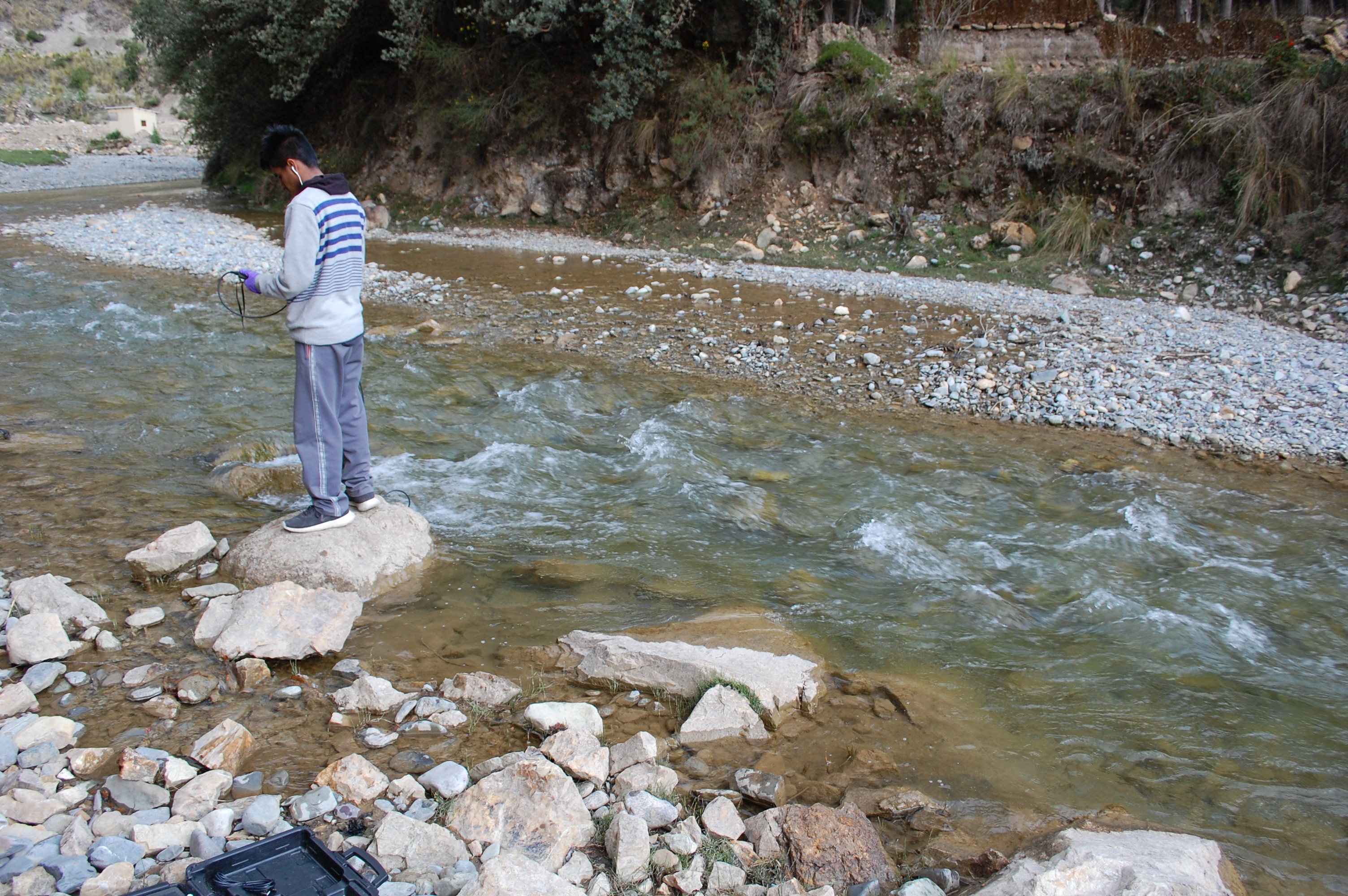
 Site RT09B - the study site location just above Puente Huancachi. (John Forrest)
 Site RT09B - the study site. (November 2019) (John Forrest)
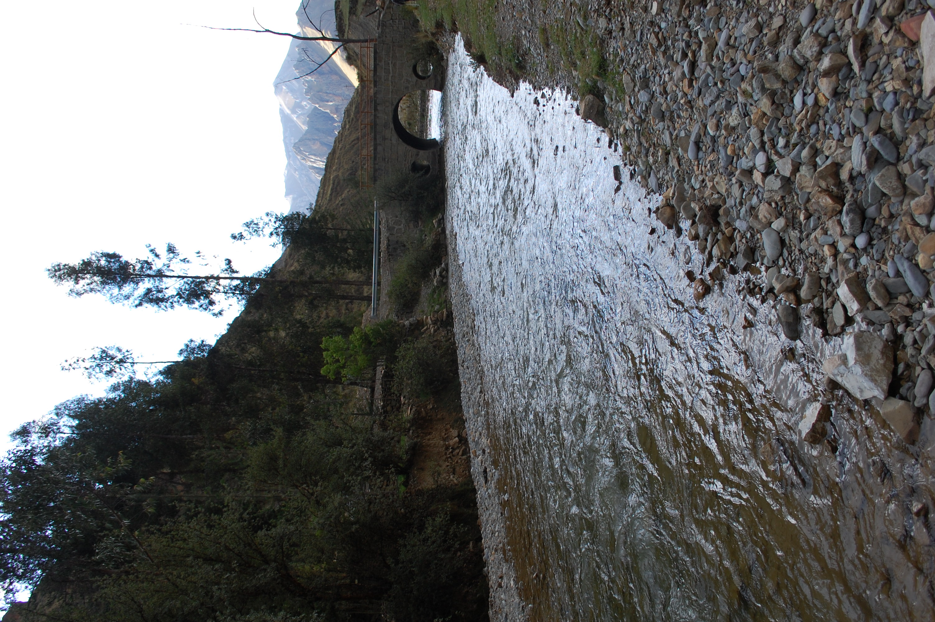 Site RT09B - View downstream from the study site. (November 2019) (John Forrest)
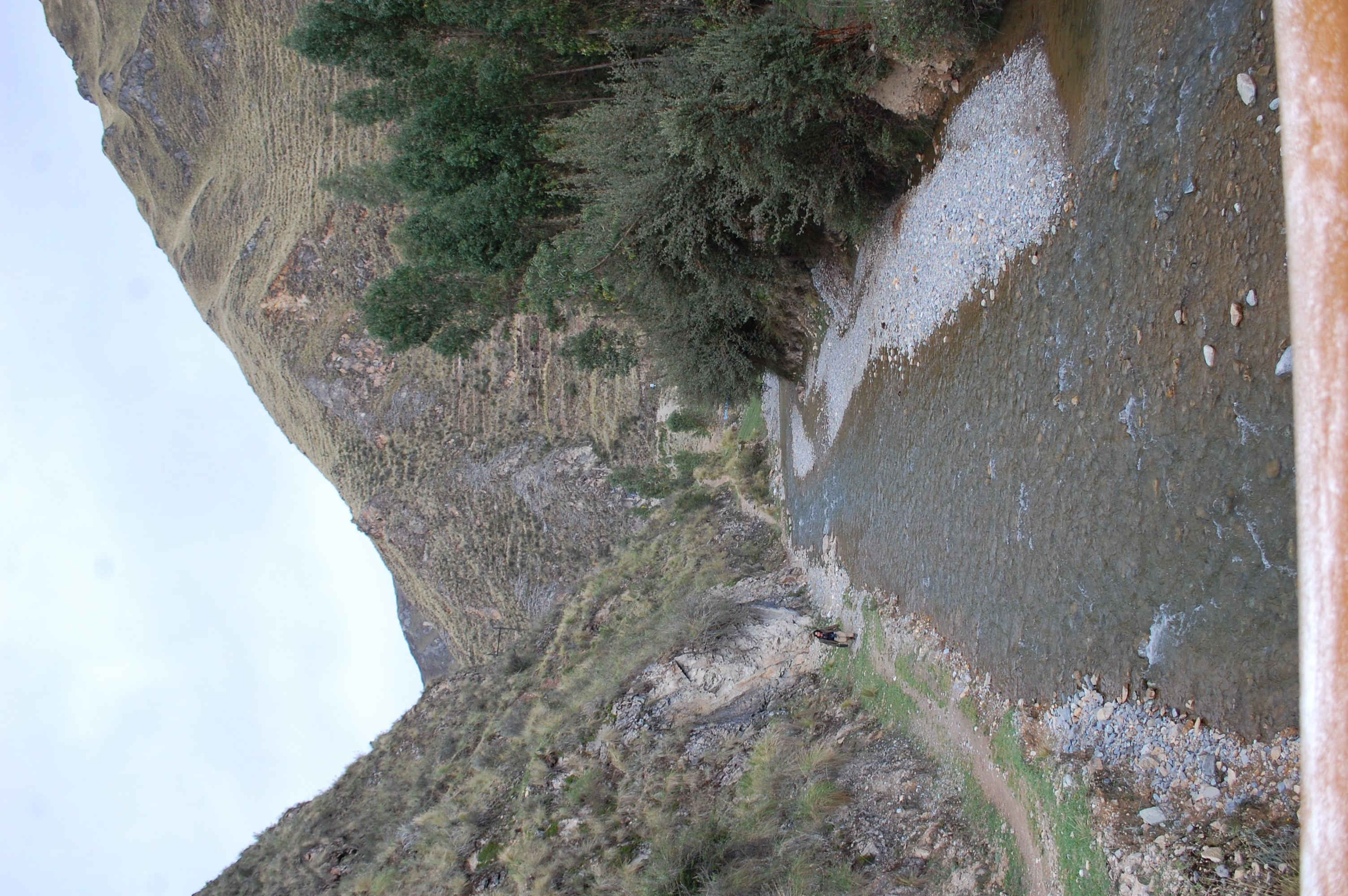 Site RT09B - View upstream from the study site. (November 2019) (John Forrest)