RC12 - Villarma (Hotel)
Site Code: RC12. GPS: S12°29821, W75°814258. Elevation: 3053m asl.
Water Quality Data
The following river and water quality data was collected from this site:
| RC12 | July 2019 | November 2019 | November 2021 | March 2022 | June 2022 |
|---|---|---|---|---|---|
| Season: | Austral Winter | Austral Summer | Austral Summer | Austral Summer | Austral Winter |
| Date: | 11.07.19 | 20.11.19 | 15.11.21 | 27.3.22 | 28.6.22 |
| Time: | 15.30 | 12.15 | 11.00 | 16.00 | 12.45 |
| Width (m) | 14.0 | 18.0 | 14.0 | 18.0 | 18.3 |
| Depth (Av.) (m) | 0.97 | 0.80 | 0.91 | 1.01 | 0.64 |
| CSA (Av.) (m²) | 13.56 | 14.35 | 12.74 | 18.18 | 11.66 |
| Velocity (Av.) (m/s) | 1.10 | 1.06 | 0.90 | 1.07 | 0.83 |
| Discharge (Av.) (m³/s) | 14.96 | 15.235 | 11.466 | 19.453 | 9.675 |
| Riverbed sediment | Cobbles & Boulders | Cobbles & Boulders | Mainly boulders | Pebbles, cobbles & boulders | |
| Temp. (Atmospheric) (°C) | 18 | 24.5 | 18 | 14 | 21 |
| Temp. (Water) (°C) | 11.48 | 13.13 | 12.95 | 12.77 | 12.00 |
| Atmospheric pressure (mbar) | 605 | 708 | 713 | 604 | |
| Dissolved oxygen (mg/l) | 5.07 | 3.99 | 6.67 | 4.65 | 7.37 |
| Dissolved oxygen (%) | 66.0 | 64.1 | 88.6 | 74.9 | 112.4 |
| pH | 8.67 | 8.27 | 8.61 | 8.48 | |
| Conductivity (µS/cm) | 525 | 457 | 602 | 327 | 541 |
| Total Dissolved Solids (ppm) | 263 | 229 | 301 | 164 | 271 |
| ORP (mV) | 347.1 | 154.6 | 166.7 | 64.6 | 161.7 |
| Turbidity | Clear: | Clear: | Clear: | Slightly milky: blue/green | Clear: blue/grey |
| Alkalinity (mg/l CaCO₃) | 167 (1.6N) | - | 143 (1.6N) | 146 (1.6N) | 180 (1.6N) |
| Alkalinity Tester (ppm CaCO₃) | - | - | - | 133 | 162 |
Data Analysis
Discharge at this point along the Rio Cañete is in the range of 10-15cumecs, in other words, there is significant flow all year round at this site. The lower flow data recorded may therefore represent base flow at around 10cumecs. The rains from November to March should recharge the catchment, and raise discharge to a peak in March/April but equally sudden heavy rains in November could significantly increase the dischare ony single day. The data suggests that the rains had already arrived in the headwaters in November 2021 while in July 2019 significant rains earlier in the year were still reflected in the flow. The sample point lies just below the confluence with the Rio Alis which is major contributor to the discharge here.
At over 3000m asl the DO readings at RC12 are low but fall within the range to be expected. The DO levels are very similar for all sample times. Conductivity readings at this site range from 327-602 µS/cm. At the upper end, it is on the high side, but RC12 is located in the upper mid-catchment.
The pH readings of about 8.5 are as expected for a clean river and appropriate for most forms of aquatic life.
Site Description
Site RC12 lies in the Rio Cañete valley at 3032m asl in the arid temperate zone. It is just below the confluence with the Rio Alis at Tinco Alis. The valley at this point is narrow with a pronounced v-shaped profile and steep valley sides. River flow is year-round and fast at this point.
The level flood-plain lands are only cultivated to a limited extent. There is some limited pastoralism and subsistence production of maize and quinua but little else. The riverbanks and nearby fields are lined with Alders, broom (retama), tall thorn scrub and scattered Eucalyptus sp.
Above the narrow flood-plain valley sides are arid, supporting a xeric vegetation with increased woody shrubs and trees lining some of the more sheltered ravines. The north facing slope is rather more densely covered with shrubs and trees associated with the relictual pacific woodlands found a little higher up the valley. This site retains the typical avifauna of these elevations as outlined for sites RC10 and RC11.
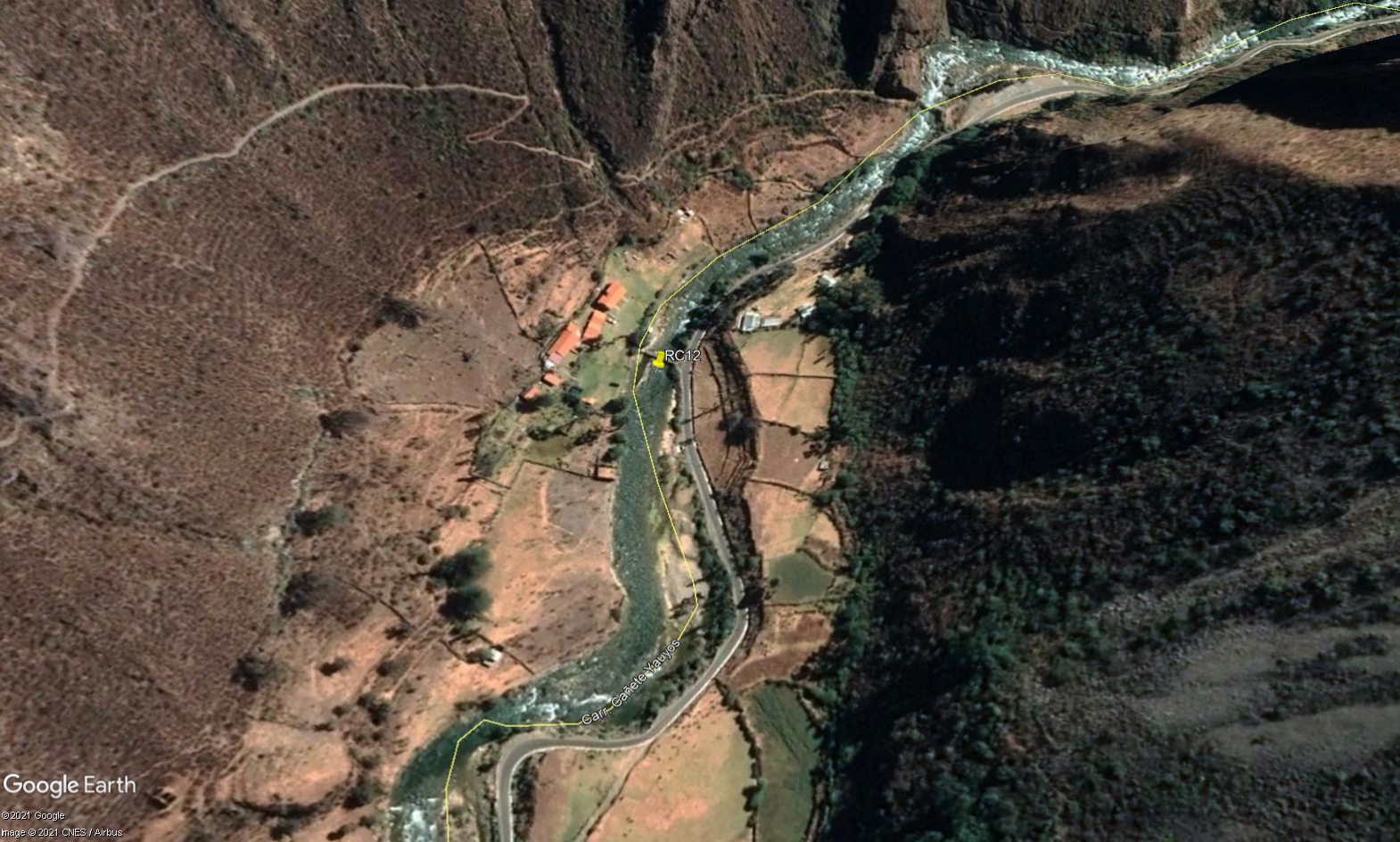 Site RC12 - Study site location: in front of the Villa de Arma lodge, below the bridge.
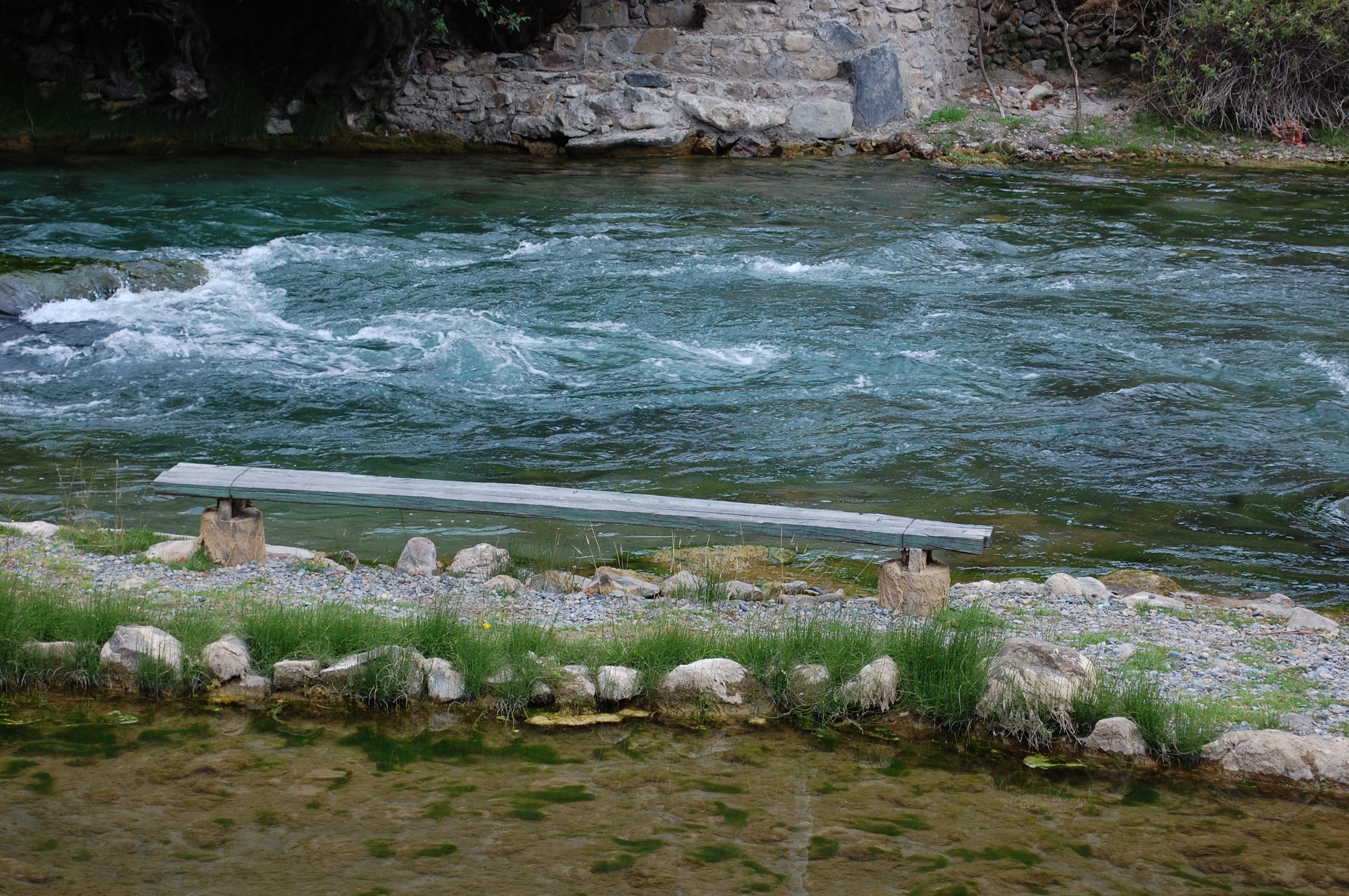 Site RC12 - the study site. (November 2019) (John Forrest)
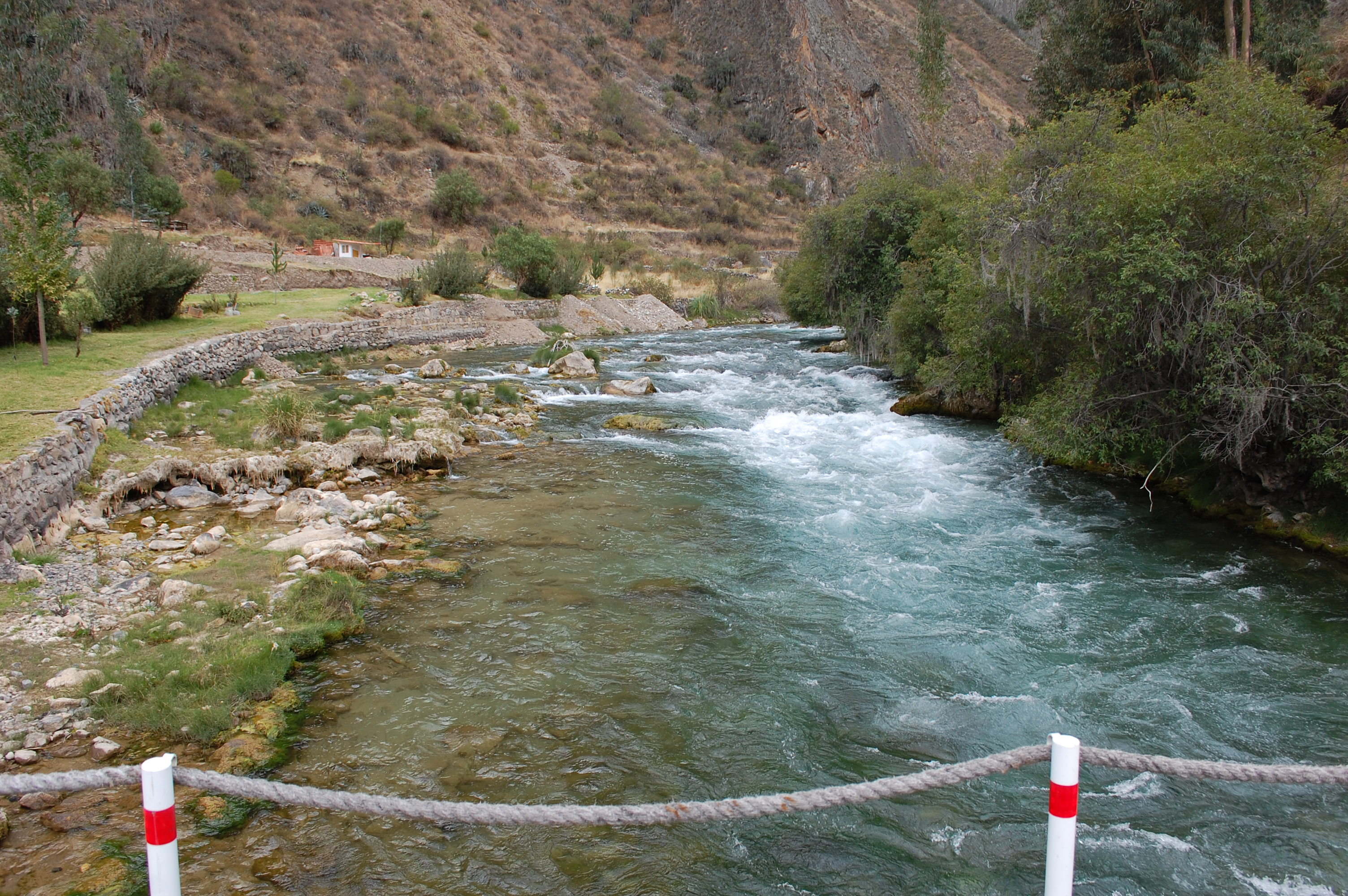 Site RC12 - View upstream. (November 2019) (John Forrest)
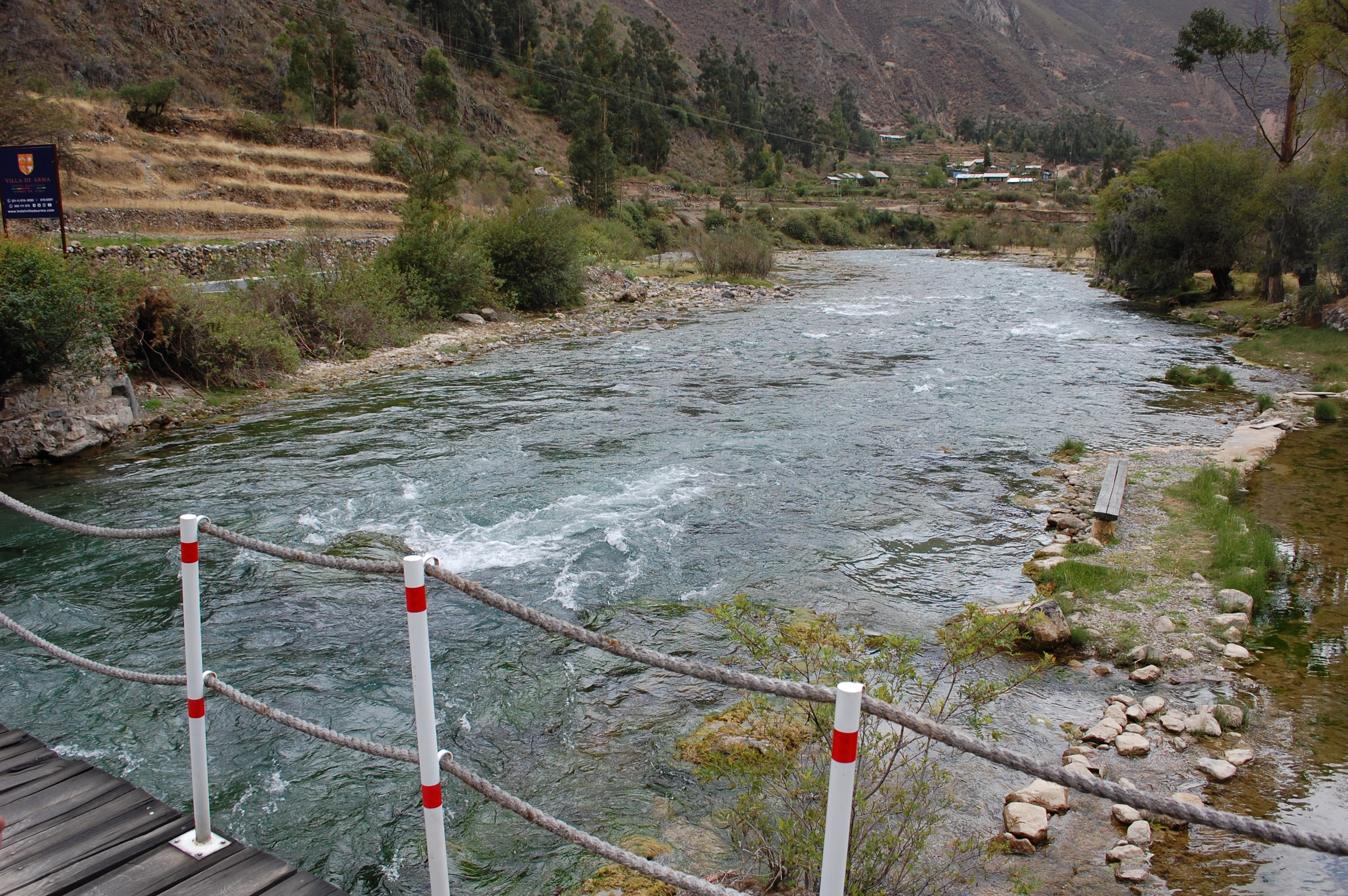 Site RC12 - View downstream. (November 2019) (John Forrest)