RT09A2.M - Lower Alis (Manantial)
Site Code: RT092A.M. GPS: S12°266150, W75°768910. Elevation: 3415m asl.
Water Quality Data
The following river and water quality data was collected from this site:
| RT09A2.M (Source) | November 2021 | June 2022 |
|---|---|---|
| Season: | Austral Summer | Austral Winter |
| Date: | 16.11.2021 | 29.6.22 |
| Time: | 9.00 | 9.45 |
| Width (m) | 18.0 | - |
| Depth (Av.) (m) | 0.16 | - |
| CSA (Av.) (m²) | 2.88 | - |
| Velocity (Av.) (m/s) | 0.62 | - |
| Discharge (Av.) (m³/s) | 1.786 | 1.80 |
| Riverbed sediment | - | - |
| Temp. (Atmospheric) (°C) | 17 | 14.6 |
| Temp. (Water) (°C) | 12.45 | 12.6 |
| Atmospheric pressure (mbar) | <600 | |
| Dissolved oxygen (mg/l) | 3.22 | 3.43 |
| Dissolved oxygen (%) | 45.33 | 55.35 |
| pH | 7.16 | 7.28 |
| Conductivity (µS/cm) | 920 | 718 |
| Total Dissolved Solids (ppm) | 460 | 359 |
| ORP (mV) | 150.7 | 177.6 |
| Turbidity | Clear: | Clear: |
| Alkalinity (mg/l CaCO₃) | 210 (1.6N) | 238 (1.6N) |
| Alkalinity Field Tester (ppm CaCO₃) | - | 225 |
| RT09A2.M (Exit) | June 2022 |
|---|---|
| Season: | Austral Winter |
| Date: | 29.6.2022 |
| Time: | 10.45 |
| Width (m) | 0.6 |
| Depth (Av.) (m) | 1.0 |
| CSA (Av.) (m²) | 0.6 |
| Velocity (Av.) (m/s) | 3.0 |
| Discharge (Av.) (m³/s) | 1.80 |
| Riverbed sediment | - |
| Temp. (Atmospheric) (°C) | 19 |
| Temp. (Water) (°C) | 12.64 |
| Atmospheric pressure (mbar) | <600 |
| Dissolved oxygen (mg/l) | 3.6 |
| Dissolved oxygen (%) | 57.3 |
| pH | 7.32 |
| Conductivity (µS/cm) | 718 |
| Total Dissolved Solids (ppm) | 359 |
| ORP (mV) | 179.4 |
| Turbidity | Clear: |
| Alkalinity (mg/l CaCO₃) | 249 (1.6N) |
| Alkalinity Field Tester (ppm CaCO₃) | 228 |
Data Analysis
Outflow from the manantial was significant and appears to be constant given the two similar estimates when the site was visited. However, it should be noted that water - presumably a fairly significant amount - is drawn immediately from the manantial to supply the nearby settlement of Alis thereby reducing the discharge that it is possible to measure at the manantial exit.
The low DO readings at RT09A2.M are as expected for a river that has just emerged from underground but too low for many aquatic species.
The conductivity readings at this site (7187 & 920 µS/cm) are high for a spring at this altitude within the sub-catchment. It suggests a degree of dissolved salts and other compounds resulting from subterranean weathering and erosion. It is above the ideal level for aquatic life and direct human consumption.
The average pH readings of just above 7.0 are lower than expected. At this level the water is tending towards acidic and away from alkaline conditions which are less suited to aquatic life and human consumption.
Site description
Site RT09A2.M is a manantial which flows for approximately 50 metres from where it emanates into the Rio Alis. It lies in the Rio Alis valley at 3415m asl, a short distance above the small settlement of Alis. The valley at this point is very narrow with a v-shaped profile, very steep sides and a very narrow flood-plain. The manantial is located on the south side of the valley and fans out as it flows from the spring in to the river. The manantial appears to drain a significant area to the south of the Alis valley and flows year-round, delivering a constant input to the Rio Cañete.
In 2021, the manantial was enclosed behind a new wall and some modifications were made to the infra-structure controlling the water outflow.
The study site surroundings are dominated by eucalyptus and tall natural scrub.
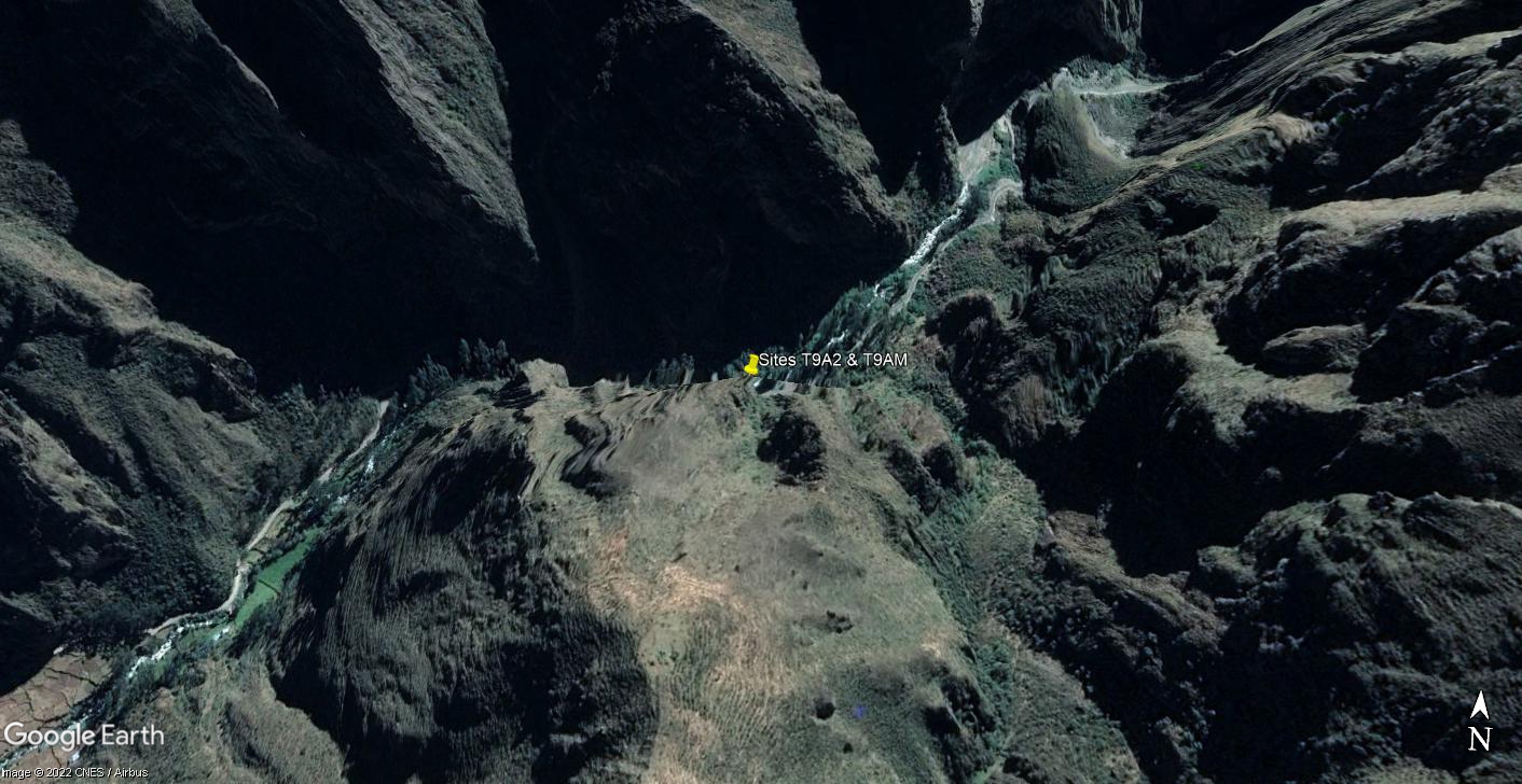 Sites RT09A2.M & RT09A2 - the location of study sites T9A2 & T9AM.
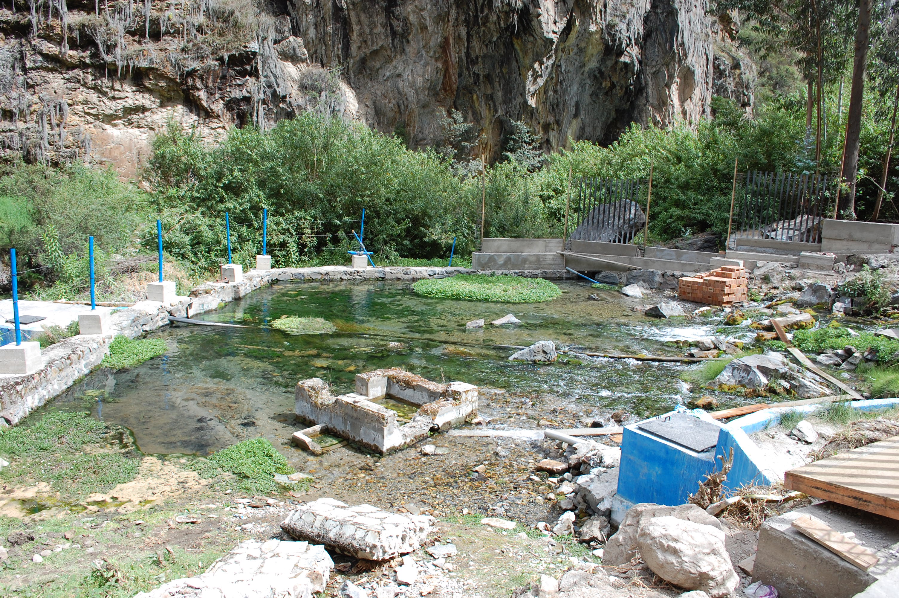 Site RT09A2.M - the study site (November 2021). (John Forrest)
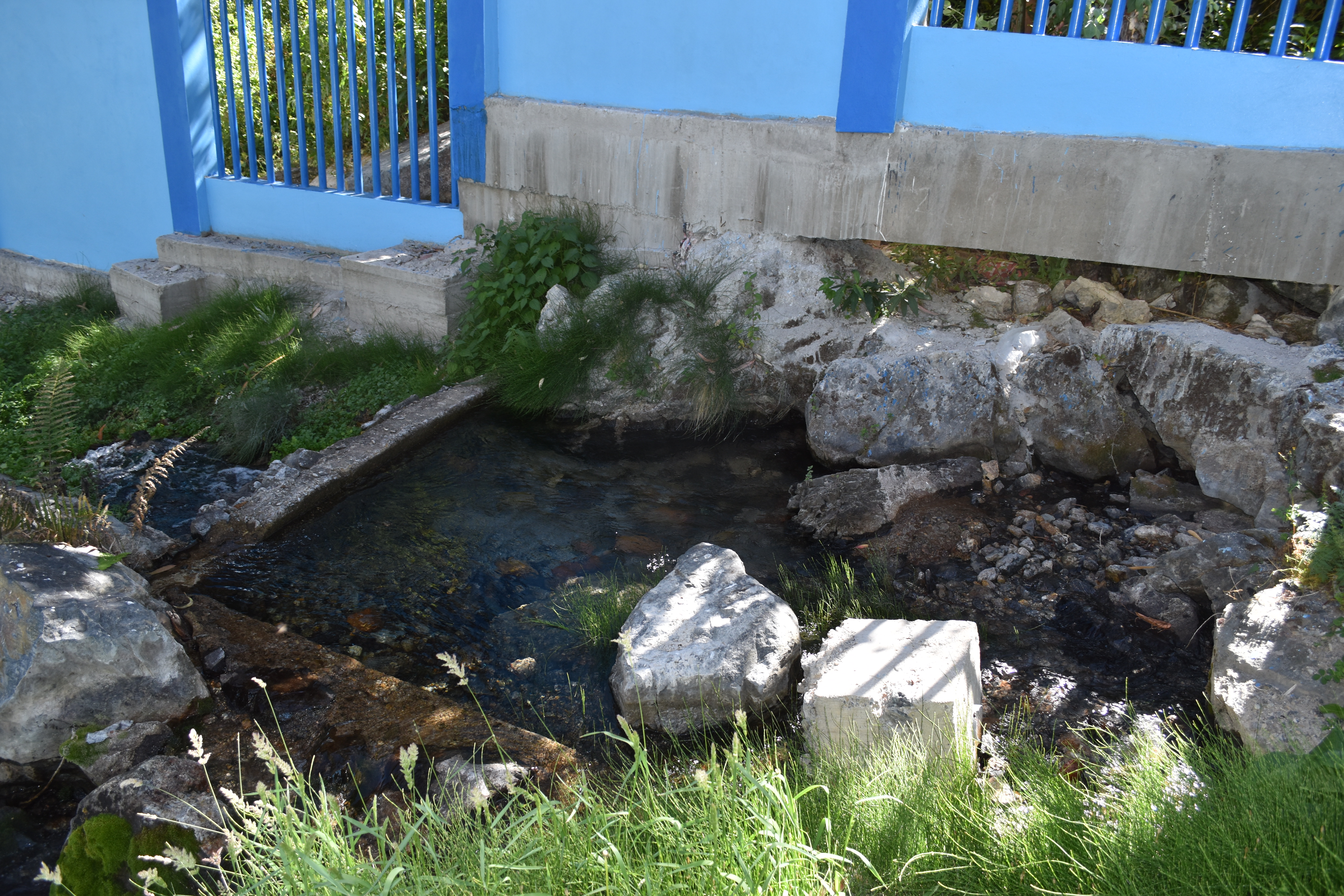 Site RT09A2.M - one of the subterranean outflows at the study site (June 2022). (John Forrest)
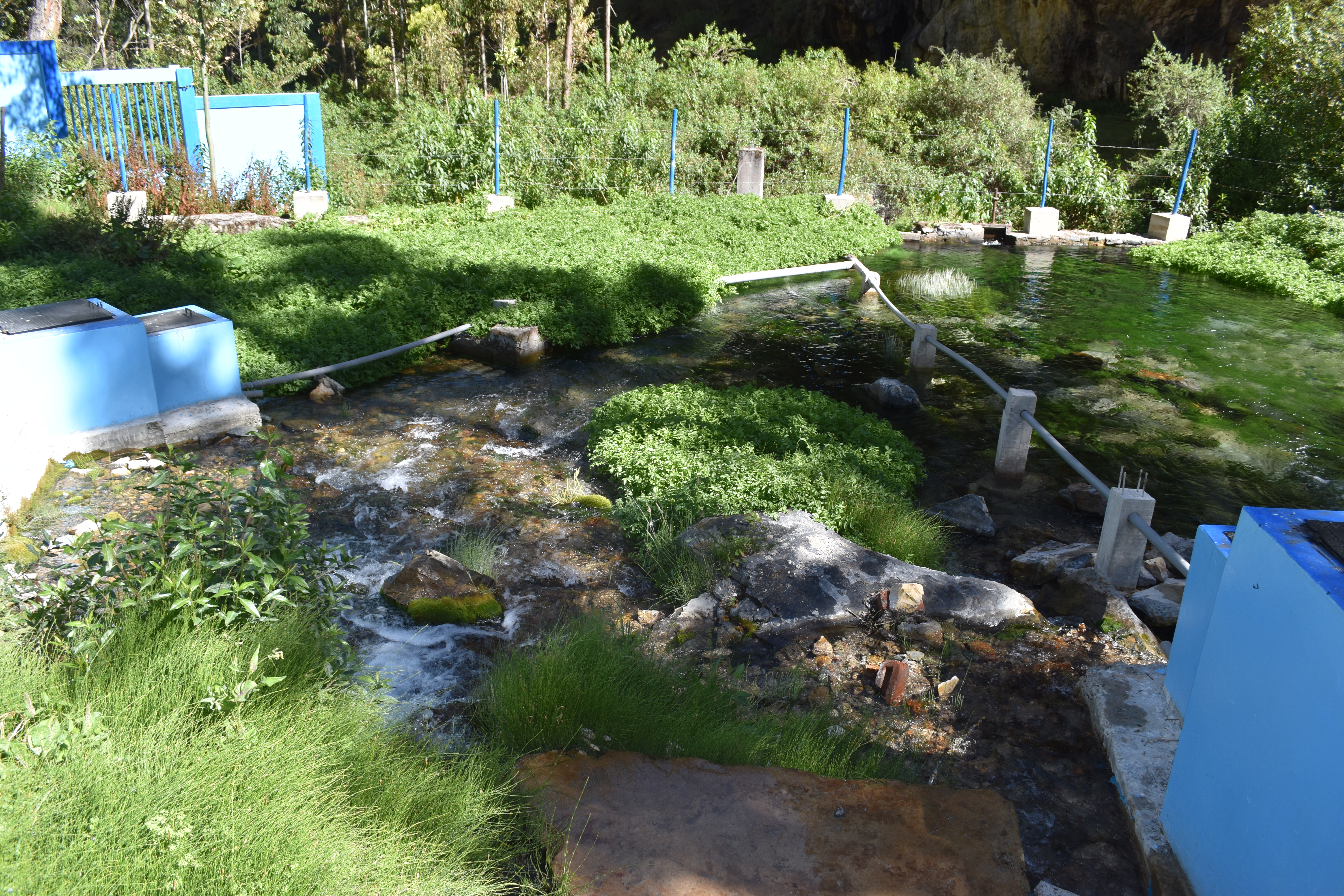
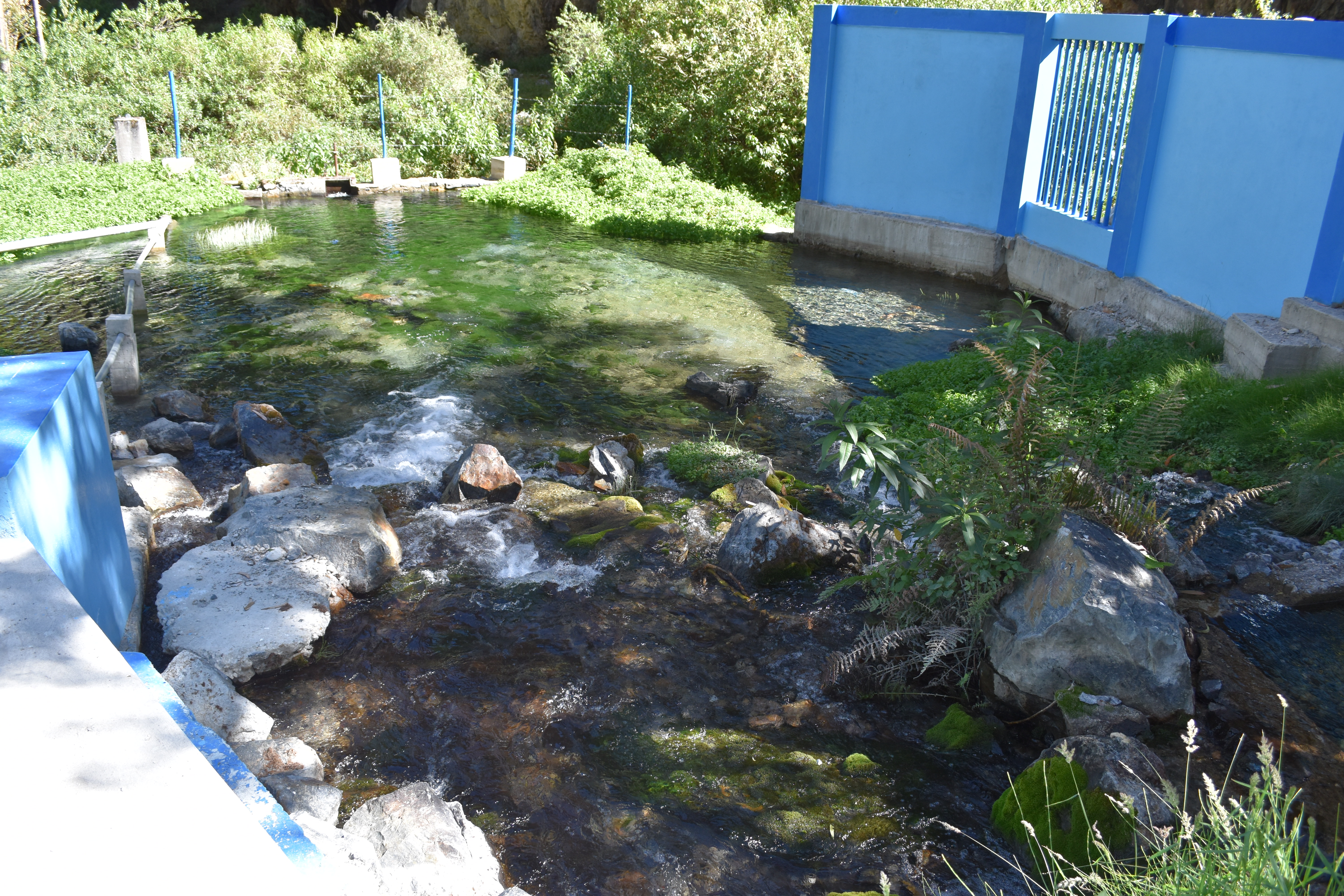 Site RT09A2.M (Exit) - view from one side of the manantial towards the manantial exit (June 2022). (John Forrest)
 Site RT09A2.M (Exit) - view from one side of the manantial towards the manantial exit (June 2022). (John Forrest)