RT08B - Middle Laraos (Below Puente Union)
Site Code: RT08B. GPS: S12°36259, W75°763129. Elevation: 3730m asl.
Water Quality Data
The following river and water quality data was collected from this site:
| RT08B | November 2019 | November 2021 |
|---|---|---|
| Season: | Austral Summer | Austral Summer |
| Date: | 21.11.19 | 16.11.21 |
| Time: | 9.00am | 13.30pm |
| Width (m) | 7.0 | 8.0 |
| Depth (Av.) (m) | 0.12 | 0.19 |
| CSA (Av.) (m²) | 0.81 | 1.52 |
| Velocity (Av.) (m/s) | 0.17 | 0.44 |
| Discharge (Av.) (m³/s) | 0.138 | 0.669 |
| Riverbed sediment | Cobbles & Boulders | Cobbles & Boulders |
| Temp. (Atmospheric) (°C) | 22 | 21 |
| Temp. (Water) (°C) | 10.61 | 11.05 |
| Atmospheric pressure (mbar) | 700 | (<600) |
| Dissolved oxygen (mg/l) | 3.45 | 5.80 |
| Dissolved oxygen (%) | 52.8 | 80.7 |
| pH | 8.33 | 8.06 |
| Conductivity (µS/cm) | 287 | 379 |
| Total Dissolved Solids (ppm) | 143 | 188 |
| ORP (mV) | 136.6 | 156.4 |
| Turbidity | Clear: | Clear: |
| Alkalinity (mg/l CaCO₃) | - | 118 (1.6N) |
| Alkalinity Field Tester (ppm/ CaCO₃) | - | - |
Data Analysis
Discharge at this point along the Rio Laraos is a combination of the discharge in the stream and the spring (mantanial) entering the river just above Puente Union. The discharge is low and in November 2021 mainly consisted of water emerging from the spring (manantial). On both occasions, the rains had not started to fall higher up in the headwaters at the end of the dry season.
At well over 3500m asl the DO readings at RT08B fall within the range to be expected. The measurements for DO, conductivity and total solids are also as expected.
Conductivity measurements are fairly low and as expected at this altitude at this point in the drainage basin above all human settlement.
pH in the range 8.0 to 8.5 is as expected.
Site Description
Sites RT08B and RT08C lie within a few metres of each other in the upper Rio Laraos at 3733m asl, above the settlement of Laraos. They are located in the temperate zone just beneath extensive polylepis groves, puna grasslands and bofedales. Above this point the valley has the features and u-shaped profile typical of once glaciated valleys. The dischrage from the manantial is likely to be fairly constant throughout the year but the indication from the size of the channel above the manantial is that significantly more water may flow in it at certain times of the year. However, the surrounding karst landscape contains dep cave systems which may also absorb significant amounts of surface water.
The bed load in the river channel is comprised of fluvio-glacial boulders, gravels, and sands. At this site, the water flow in the Rio Laraos is year-round and delivers all the water needs for the village of Laraos below. The spring is a sacred site and likewise used by local people.
There is little or no agricultural cultivation along this section of the valley. There is limited pastoralism and field rotation is employed for the production of potatoes and quinua. The riverbanks are dominated by riparian scrub and small alders. Above the uneven flood plain valley sides are arid temperate, supporting a scrub and extensive polylepis groves on the higher slopes. The low levels of agricultural activity here results from rural out-migration and depopulation.
This site displays a fauna and flora typical of temperate elevations. Chiguanco Thrush, House Wren and Hooded Siskin remain. Cream-winged and White-winged Cinclodes, Striated Earthcreeper, Peruvian Sierra Finch, Plumbeous Sierra Finch, Band-tailed and Plain-coloured Seedeaters, Black-throated Flowerpiercer are now common here. In the polylepis groves White-cheeked Cotinga and Giant Conebill are easily found and with further fieldwork other polylepis obligates may be found. Andean Parakeet, Black-winged Ground Dove, White-browed Chat Tyrant, Tufted Tit Tyrant, and Rusty-crowned Tit Spinetail are commonly observed. A more detailed inventory of avifauna will be produced for each site in subsequent reports.
In the upper parts of this sub-catchment agriculture is entirely pastoral. The road is used to access two areas of mining, the Mina Yauricocha and Mina Huancapallca, although only the latter may impact on this sub-catchment.
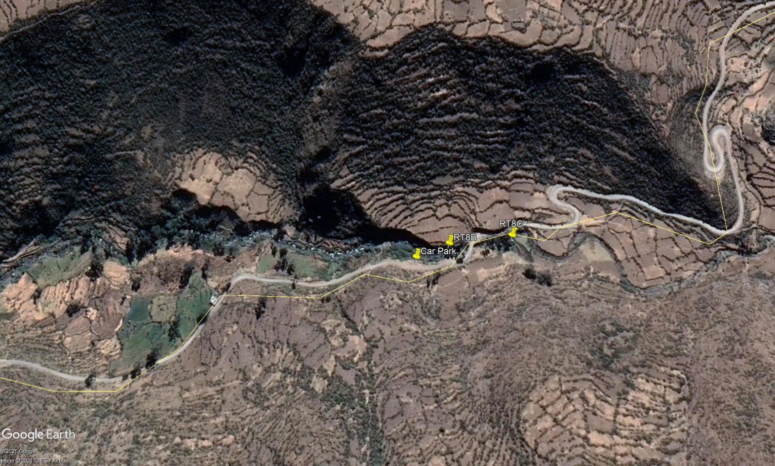 Site RT08B & RT08C - the study site locations: RT08B just below Puente Union & RT08C just above Puente Union - in the mantanial (Nov.2019) & just above the mantanial (Nov.2021). (John Forrest)
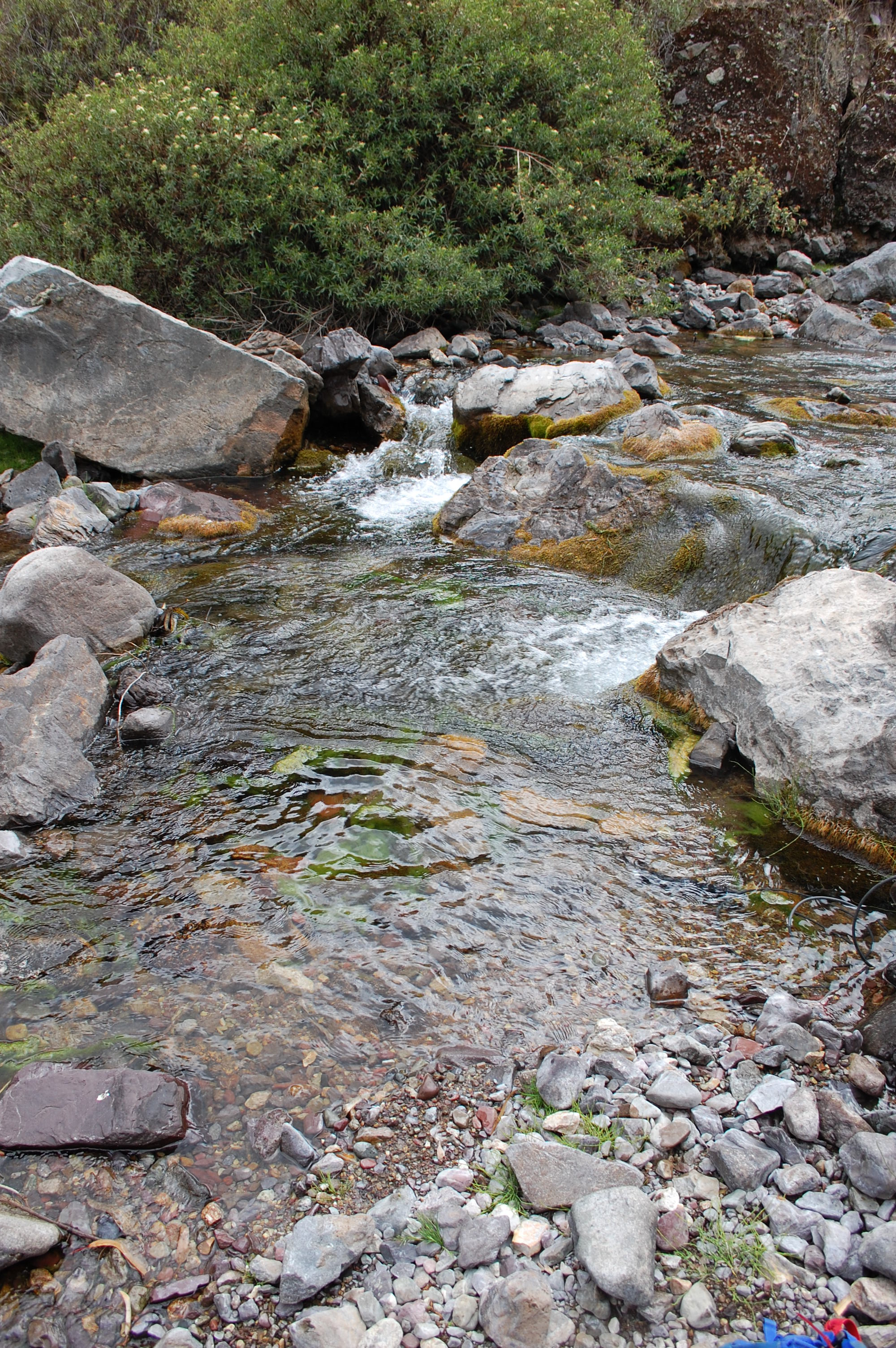 Site RT08B - the study site. (John Forrest)
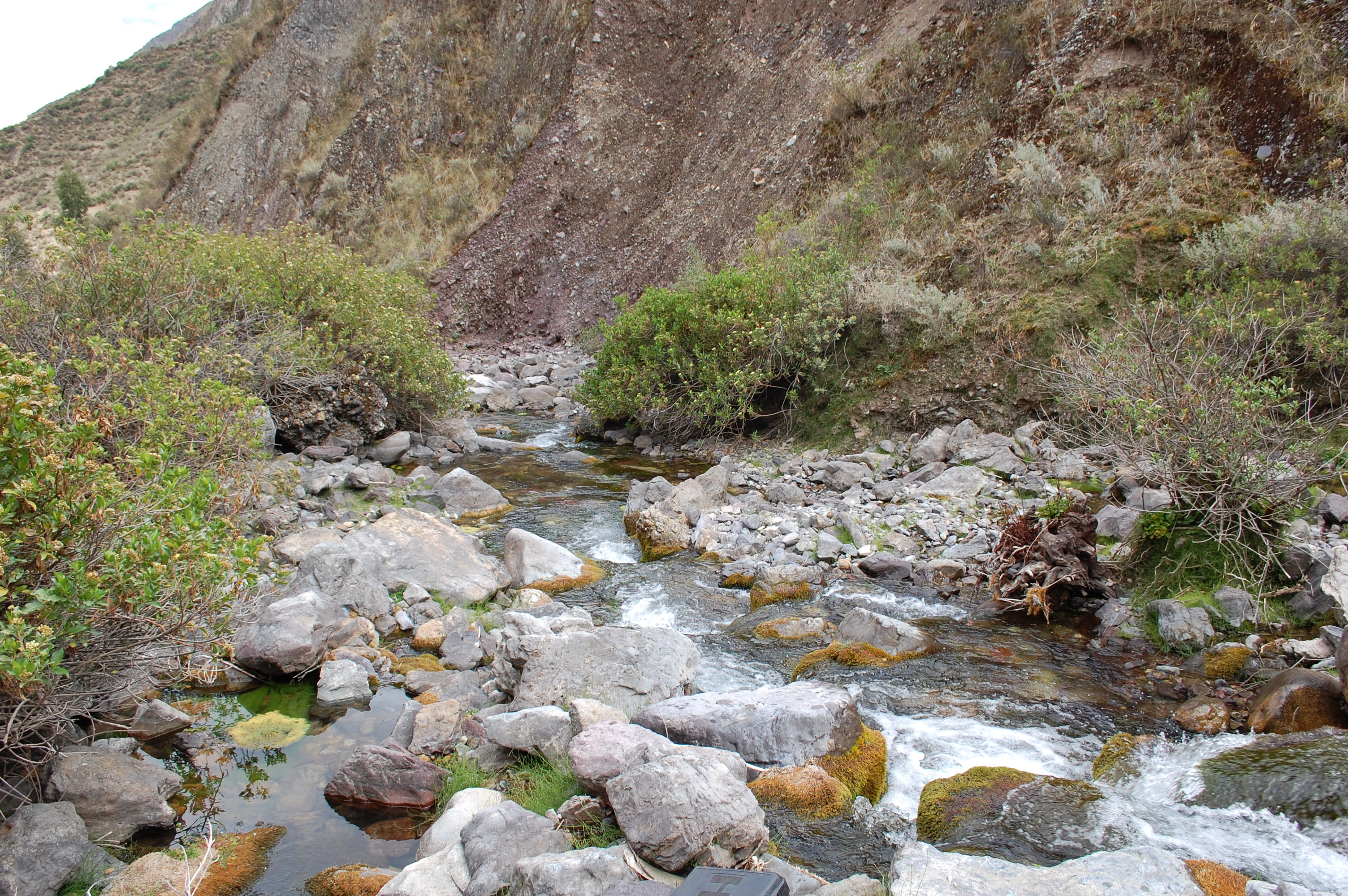 Site RT08B - View downstream from the study site. (John Forrest)
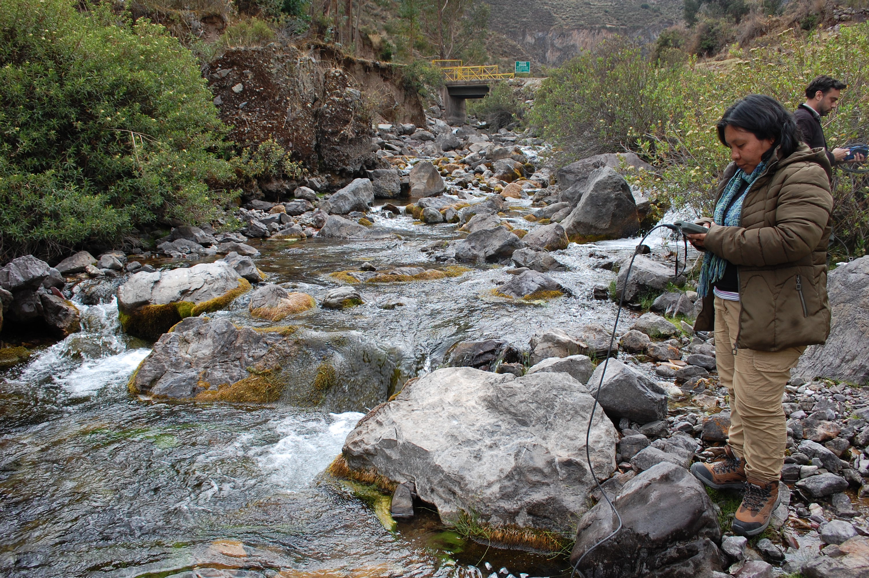 Site RT08B - View upstream from the study site. (John Forrest)